


Melrose Lane Townhouses - Knoxfield SOLD OUT
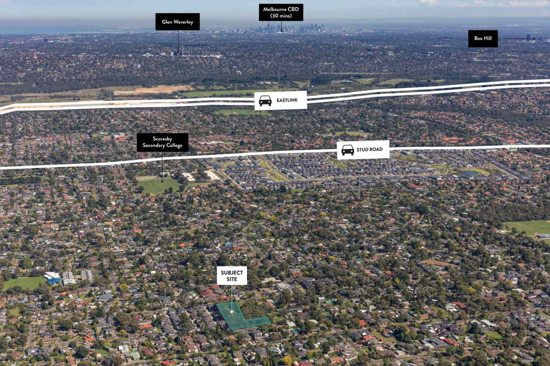
 48-52 Kathryn Road, Knoxfield VIC 3180
This information is estimated by the OpenLot research team. Let us know here to provide up-to-date information about this development.
| Total new homes | 9 |
| Area size | 0.48 hectares |
| Growth Region | Melbourne East |
| City council | Knox City Council |
| Developer | Mainline Developments |
| Project marketer | Lawfords Real Estate |
| Distance to | Melbourne CBD - 26 km east Melbourne Airport - 43 km south-east |
Townhomes:
Popular Estates near Melrose Lane Townhouses - Knoxfield


 3
3  3.5
3.5  1
1


Updates for Melrose Lane Townhouses - Knoxfield
Facebook updates:
Submit the Facebook page for Melrose Lane Townhouses - Knoxfield.


Location & Map for Melrose Lane Townhouses - Knoxfield
Visit Display Homes near Melrose Lane Townhouses - Knoxfield


Vacancy Rate in Knoxfield VIC 3180
View full vacancy rate history in Knoxfield VIC 3180 via SQM Research.
Schools near Melrose Lane Townhouses - Knoxfield
Here are 6 schools near Melrose Lane Townhouses - Knoxfield:
Prep-6 Government Primary School
Prep-6 Government Primary School
7-12 Government Secondary School
Prep-6 Government Primary School
U Catholic Special School - School Head Campus
Prep-6 Catholic Primary School
Reviews & Comments on Melrose Lane Townhouses - Knoxfield
Estate Brochure, Masterplan, Engineering Plan, Plan of Subdivision (POS), Design Guidelines
FAQs about Melrose Lane Townhouses - Knoxfield
View all estates from Mainline Developments
View all estates marketed by Lawfords Real Estate
- Carrington Primary School - 369m south-west
- Knox Park Primary School - 679m north
- Scoresby Secondary College - 1.2km west
- Kent Park Primary School - 1.3km north-east
- St Mary's College for the Deaf - 1.4km north-west
- Holy Trinity School - 1.5km north-west
Popular Estates near Melrose Lane Townhouses - Knoxfield
Latest New Home Articles for You

11/Mar/2025 | OpenLot.com.au
4 Steps to Getting the Best Building Quotes
In the latest episode of the Home Building Hub podcast, hosts Colin Bisch...
10/Mar/2025 | OpenLot.com.au
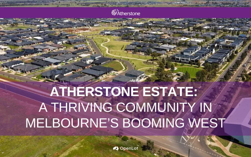
Display Homes at Atherstone Estate: A Thriving Community in Melbourne’s Booming West
Welcome to Atherstone, a vibrant and flourishing masterplanned community ...

07/Mar/2025 | OpenLot.com.au
Kaduna Park: A New Chapter in Officer South's Real Estate Story
Nestled in the scenic beauty of Officer South, Kaduna Park is a testament...
![[Feb/2025] Top Most Searched Housing Developments in Australia](https://files.openlot.com.au/p/styles/500h/s3/article/Thumbnail%20-%20Top%2030%20Most%20Searched%20Housing%20Developments%20%281%29.png.webp?itok=wtjvzwHK)
06/Mar/2025 | OpenLot.com.au
[Feb/2025] Top Most Searched Housing Developments in Australia
OpenLot provides a comprehensive overview of leading housing developments...

05/Mar/2025 | OpenLot.com.au
Display Homes at Alfredton Grove Estate: A Premier Community in Alfredton's Growing West
Alfredton Grove has become one of the most desirable residential communit...

04/Mar/2025 | OpenLot.com.au
Display Homes at Ooranya: Beveredige's Perfect Blend of Country Living and Modern Convenience
Nestled in the charming town of Beveridge, Ooranya is a community designe...

03/Mar/2025 | OpenLot.com.au
The Rise of Regional Living: Why More Australians are Moving Beyond Major Cities
In recent years, Australia has witnessed a significant shift in populatio...

28/Feb/2025 | OpenLot.com.au
2025 Property Investment Strategies: How to Maximise ROI
As Australia’s real estate market evolves, property investors are seeking...

27/Feb/2025 | OpenLot.com.au
Display Homes at Everley: The Heart of Sunbury’s Newest Community
Everley proudly stands at the centre of Sunbury, offering an unparalleled...