Yaringa Armstrong Creek Estate - Mount Duneed
Vacant land House and land  371 Torquay Road, Mount Duneed VIC 3217
The information provided in relation to this development has been obtained from publicly available sources and has not been verified or in any way endorsed by the developer. OpenLot.com.au has not been authorised by the developer to market this land estate on behalf of the developer or the vendors or any other third party.
If you're the developer or authorised agent, contact us now to activate your project.
This information is estimated by the OpenLot research team. Let us know here to provide up-to-date information about this development.
| Total new homes | 210 |
| Area size | 12.23 hectares |
| Growth Region | Greater Geelong Growth Areas |
| City council | City Of Greater Geelong |
| Developer | N/A |
| Creative agency | Arthur St Digital |
| Distance to | Geelong CBD - 8 km south Melbourne CBD - 71 km south-west |
Land for Sale, House and Land Packages:
Popular Estates near Yaringa Armstrong Creek Estate - Mount Duneed
Updates for Yaringa Armstrong Creek Estate - Mount Duneed
Location & Map for Yaringa Armstrong Creek Estate - Mount Duneed
Visit Display Homes near Yaringa Armstrong Creek Estate - Mount Duneed
Land Price Trend in Mount Duneed VIC 3217
- In Apr - Jun 24, the median price for vacant land in Mount Duneed VIC 3217 was $354,900. *
- From Oct - Dec 17 to Apr - Jun 24, the median price for vacant land in Mount Duneed VIC 3217 has increased 56.07%. *
- From 2010 to 2023, the median price for vacant land in Mount Duneed VIC 3217 has increased 2.65%. *
Vacancy Rate in Mount Duneed VIC 3217
View full vacancy rate history in Mount Duneed VIC 3217 via SQM Research.
Schools near Yaringa Armstrong Creek Estate - Mount Duneed
Here are 6 schools near Yaringa Armstrong Creek Estate - Mount Duneed:
7-12 Government Secondary School
Prep-6 Government Primary School - School Head Campus
Prep-6 Government Primary School
Prep-6 Catholic Primary School
Prep-12 Independent Combined School - School Head Campus
Prep-6 Government Primary School
Suburb Planning Review in Mount Duneed VIC 3217
Mount Duneed is approximately 46.2 square kilometres within the City of Greater Geelong and Surf Coast Shire Council, a largely rural location to the south-west of Geelong Centre. Mount Duneed contains the western half of the Armstrong Creek Urban Growth Boundary and logical expansion of the Mount Duneed township. The suburb is located 91 kilometres south-west of Melbourne CB and 15 kilometres from Geelong CBD.
The northern portion of Mount Duneed became recognised as part of the Armstrong Creek Growth Area when the suburb of Armstrong Creek was gazetted in February 2012. This decision incorporated the region into a southern extension to the urban growth boundary of the metropolitan area of Geelong, Victoria.
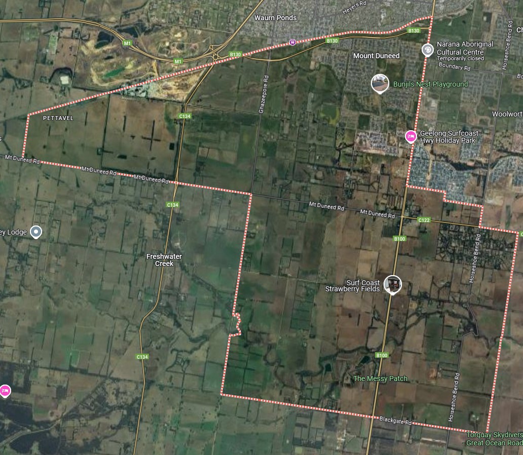
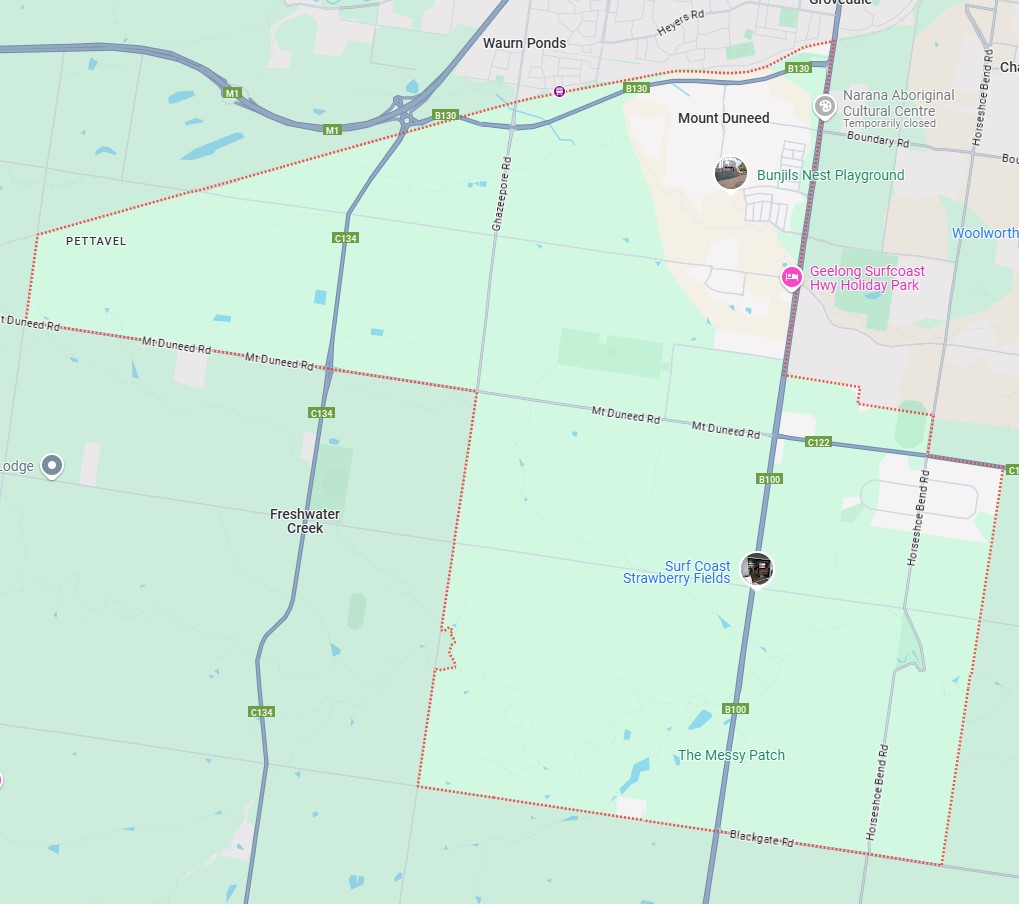
The suburb boundary is located along the rail corridor to the North, with Ghazeepore Road, Pettavel Road and Mt Duneed Road making up the western boundary. Blackgate Road provides for the southern boundary, with property boundaries and Surf Coast Highway providing the eastern boundary.
Mt Duneed Road, Lower Duneed Road, Whites Road, Dickins Road and McCanns Road provide local road access (east to west), along with Surf Coast Road and Ghazeepore Road providing local road access (North to South) throughout Mount Duneed linking to the Geelong Ring Road interchange and Princes Highway found to past the north boundary.
The suburb of Mount Duneed is a large established suburb, providing a dense residential area to the north and rural residential to the east, The housing is made up of small-large property sizes. The suburb is still mainly rural land, with lakes, dams and inter-connected waterway corridors throughout. Mount Duneed is slowly redeveloping, with new housing estates in the north expanding from the original.
Regional Growth Plans - Victorian Government
Regional growth plans guide land use and development across regional Victoria, offering detailed frameworks for key regional centres. Covering all regions, these plans, alongside Plan Melbourne, form strategic land use plans for the state. Developed collaboratively with local governments, state agencies, and stakeholders, they incorporate community input.
The Victoria in Future 2012 documents outlines that the G21 region is experiencing steady growth in population, housing development, and economic activity. With a current population exceeding 294,000, it is projected to grow by at least 1.6% annually until 2026, reaching over 400,000 by 2031.
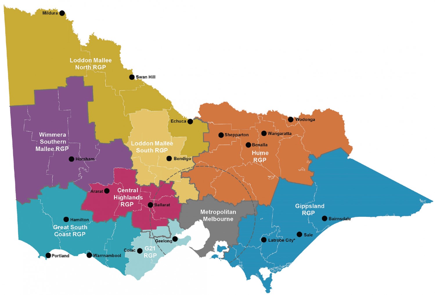
In 2011, the Victorian Government launched the $17.2 million Regional Centres of the Future program to support councils, communities, and authorities in preparing for regional growth. The G21 Regional Growth Plan is one of eight state-wide plans aimed at coordinating responses to population growth and regional change over the next 30 years.
The 2011 budget allocated $12.3 million to implement these plans and support the Rural Council Planning Flying Squad, assisting councils with major projects and planning. Victoria’s population is projected to grow by three million between 2011 and 2041, with 20–25% of this growth occurring in regional areas, more than doubling previous growth rates. To manage this, the state aims to become a "state of cities," promoting lifestyle options and job distribution. The G21 Regional area is projected to have a population of 500,000 by 2050.
Key features of the plans include:
- Preserving and enhancing environmental, cultural, and economic resources.
- Delivering strategic information and mapping for councils.
- Providing a framework to manage population growth and secure long-term land supply.
These plans ensure immediate benefits while fostering sustainable development for rural and regional councils.
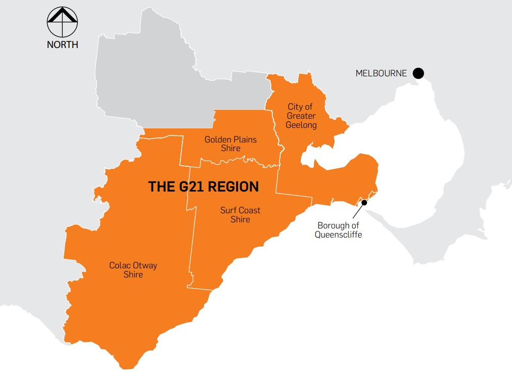
G21 Region Growth Plan
Mount Duneed forms part of the G21 regional growth plan that outlines regional land use and development for the City of Greater Geelong, Colac Otway Shire, Surf Coast Shire, Borough of Queenscliffe, and southern Golden Plains Shire. The plan was endorsed by the five G21 – Geelong Region Alliance Councils and launched in April 2013 by the Minister for Planning.
Key Features:
- Broad Land Use Direction: Focuses on managing regional growth challenges, including infrastructure, housing, environmental protection, and sustainable transportation.
- Amendment VC106: Incorporated objectives and strategies of eight regional growth plans into the State Planning Policy Framework (clauses 11.06 - 11.13).
- Nine Guiding Principles: Address regional linkages, growth vulnerabilities, environmental risks, and leveraging competitive advantages.
- Integration with Other Plans: Aligns with Plan Melbourne, other regional growth plans, and strategies like the Corangamite Regional Catchment Strategy.
Challenges and Opportunities:
- Growth Management: Addresses climate variability, housing diversity, and reduced car dependence.
- Risk Mitigation: Considers natural risks like flooding, erosion, and fire.
- Strategic Assets: Highlights the region's economic, environmental, and lifestyle strengths.
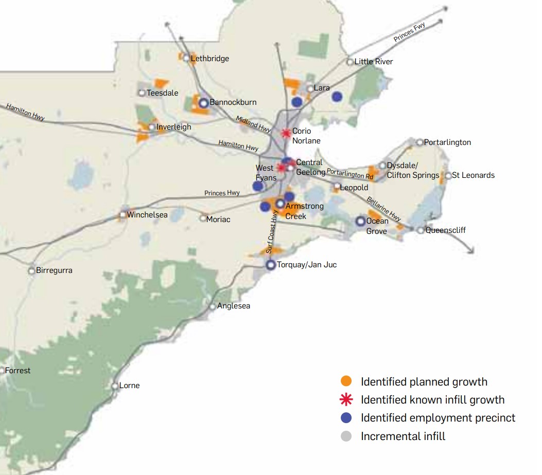
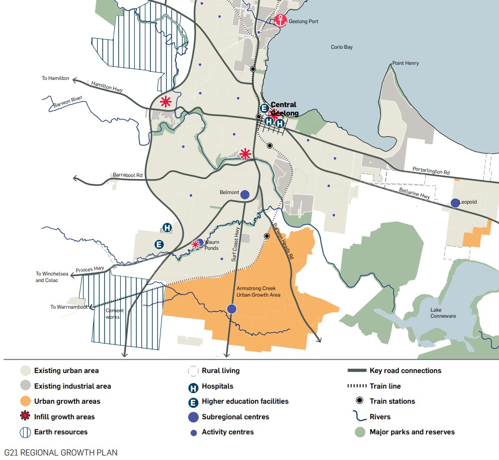
G21 Region – Identified Growth Area
Armstrong Creek Growth Area is identified as growth area through local planning processes with extensive community engagement which have been designated for significant growth. This area has been identified as a Priority 1 short term planned growth allowing development within existing residential zoned land and will accommodate most new residents and jobs while supporting surrounding communities and productive farming activities. The area will also have extra planning completed for transit links between the growth area and Torquay.
The G21 has a Region Alliance that unites government, business, and community organisations across five municipalities. It leads the G21 Geelong Region Plan, a strategic framework that addresses future challenges in environment, settlement, land use, and the economy through to 2050.
The alliance includes hundreds of members, including councils, businesses, and over 300 volunteer community leaders. Its funding primarily comes from municipal councils, member contributions, and occasional grants. G21 plays a crucial role in driving sustainable growth and development across the region.
G21 Geelong Region Plan
The G21 Geelong Region Plan is a strategic framework and vision for the region through to 2050, addressing challenges in environment, settlement, land use, community cohesion, and the economy. Developed between 2006-07, it reflects input from hundreds of stakeholders, including local municipalities, state government, peak bodies, and community and business groups.
The plan uses robust research from regional, state, and national sources, alongside commissioned studies and extensive consultations. It was a pioneering approach in Australia, creating opportunities to deliver priority projects for the region's future productivity, livability, and sustainability. The document highlights the top 10 priority projects, chosen for their economic, environmental, and social significance, as well as their feasibility.
Armstrong Creek – Urban Growth Plan
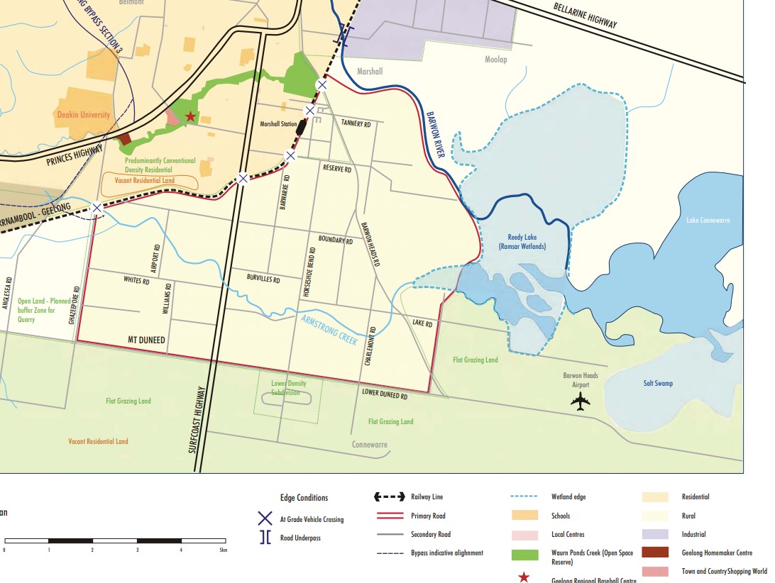
The Armstrong Creek Urban Growth Plan (UGP) is a strategic document that guides sustainable urban development in the Armstrong Creek area. Adopted by the City of Greater Geelong and incorporated into the Greater Geelong Planning Scheme, the UGP outlines long-term planning directions, including the boundary for urban growth and locations for various development types. It also highlights areas of ecological, cultural, or aesthetic significance. The UGP was developed through consultations with stakeholders like government agencies, local councils, community groups, and landowners.
Adopted in 2008, the UGP is expected to remain operational for many years, as full development may take up to 25 years. The UGP has been updated through Planning Scheme Amendments C206, C207, and C240, which included Precinct Structure Plans for various areas within Armstrong Creek. Further amendments will be made to keep the UGP current as development progresses in other precincts.
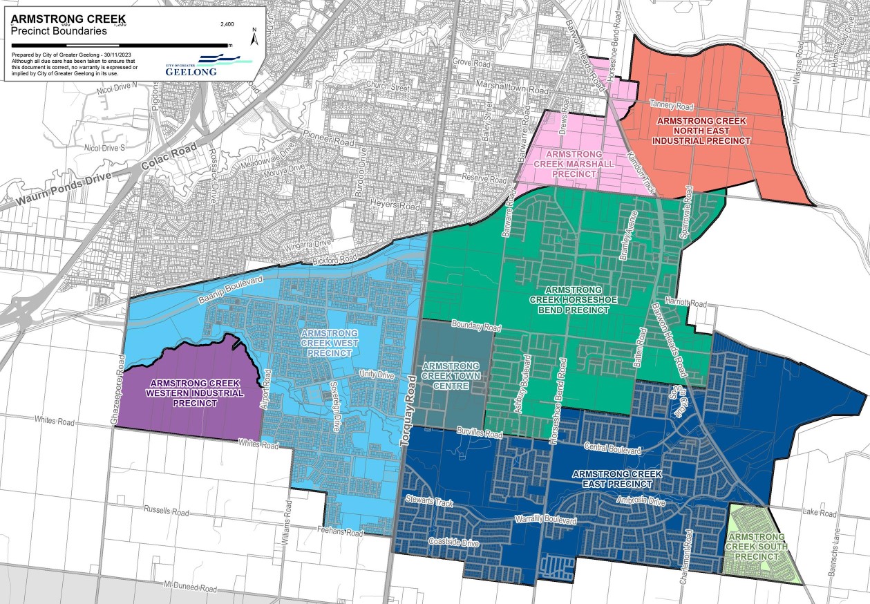
The Urban Growth Area has been divided into 6 Precincts of different land uses, activities and housing. Each precinct will be master-planned individually through Precinct Structure Plans (PSPs). PSPs are incorporated into the Planning Scheme through a standard amendment process. Once a PSP is approved, permits can be issued for land subdivision.
- East Precinct
- Horseshoe Bend Precinct
- Marshall Precinct
- North East Industrial Precinct
- Town Centre Precinct
- West Precinct
PSP Relevant to Mount Duneed:
- Western Industrial Precinct
- South Precinct
Greater Geelong Council Planning Scheme (2024).
The council is responsible for providing housing, facilities, infrastructure, and services for Geelong's growing population. By 2036, the city is expected to add 152,000 people, requiring over 73,400 new homes. These will be delivered through greenfield developments in areas like Armstrong Creek and Northern and Western Geelong Growth Areas, focusing on sustainable, well-planned communities, and through infill developments in areas with access to infrastructure and services.
The city aims to maintain Geelong’s unique character while promoting well-designed, high-quality housing that fits into existing neighbourhoods and enhances liveability. Growth areas are supported by zoning, precinct structure plans, and essential infrastructure such as schools, parks, sports facilities and transport links.
West Precinct of Mount Duneed
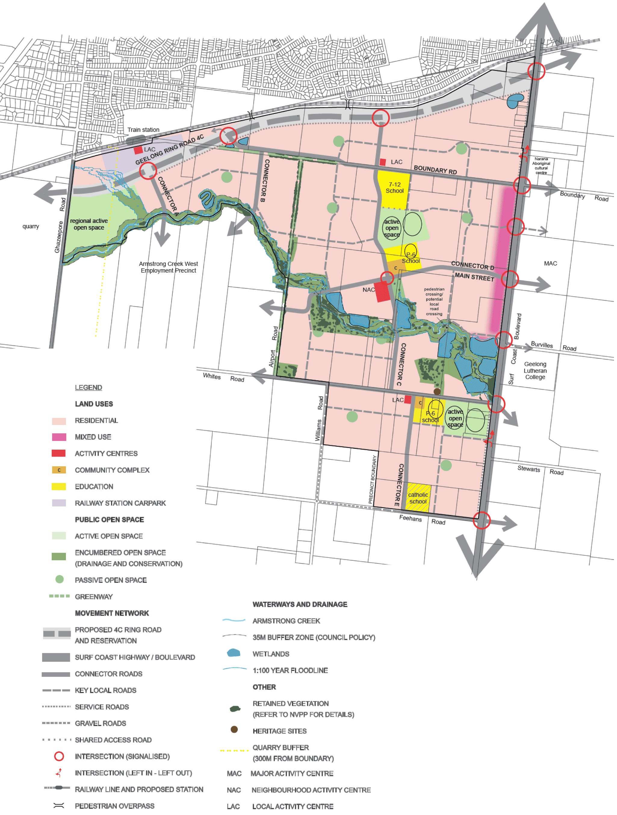
Since 2012, amendments to the planning scheme have been made to support the future urban structure outlined in the incorporated Armstrong Creek West Precinct Structure Plan. A community designed to accommodate approximately 14,000 residents. This high-level framework was translated into action with the creation of a comprehensive master-planned community on behalf of Villawood Properties.
Spanning 175 hectares, the masterplan evolved under our guidance to deliver 2,841 homes for the Geelong region. The development also featured a thoughtfully designed club facility, a neighbourhood activity centre in collaboration with CHC, and a range of community amenities, including parks and other recreational spaces, ensuring a well-rounded, sustainable community.
West Industrial Precinct of Mount Duneed
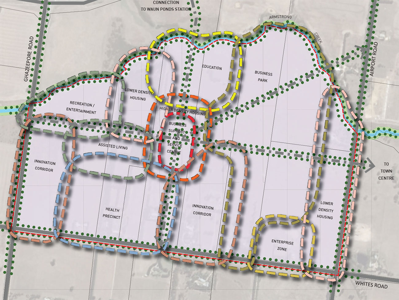
Adopted by Council in December 2023, the South-West Geelong Employment Land Review examines employment land needs and opportunities in south-west Geelong, focusing on the Boral quarry site (Waurn Ponds) and the Western Industrial Precinct within the Armstrong Creek Growth Area. Prepared by HillPDA consultants for the City, the review outlines key recommendations:
- Designate the Boral site and Western Industrial Precinct as a single "investigation precinct."
- Develop approximately 170 hectares of net employment land within the precinct.
- Target activation of additional employment land by 2027.
- Set an aspirational employment density of 60 jobs per hectare across the precinct.
- Focus development on local and sub-regional needs, offering industrial lot sizes from 250 sqm to over 5 hectares.
- Prioritize market demand sectors, including warehousing, large-format retail, trade supplies, advanced manufacturing, and sustainability-driven industries.
- Reserve surplus land for alternative uses only if employment land delivery is feasible and timely.
- Require further detailed planning, such as a Precinct Structure Plan, for implementation.
Mount Duneed Suburb Summary
Reviews & Comments on Yaringa Armstrong Creek Estate - Mount Duneed
Estate Brochure, Masterplan, Engineering Plan, Plan of Subdivision (POS), Design Guidelines
FAQs about Yaringa Armstrong Creek Estate - Mount Duneed
- Grovedale College - 778m north-west
- Grovedale West Primary School - 947m north-west
- Mirripoa Primary School - 1.0km south
- Nazareth School - 1.5km north
- Geelong Lutheran College - 1.7km south
- Mandama Primary School - 1.8km north
Popular Estates near Yaringa Armstrong Creek Estate - Mount Duneed
Latest New Home Articles for You

13/Mar/2025 | OpenLot.com.au
Home Building Hub Offers Expert Tips for Visiting Display Homes
The latest episode of "Home Building Hub," hosted by industry experts Col...
12/Mar/2025 | OpenLot.com.au
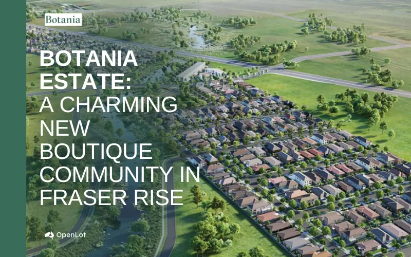
Display Homes at Botania Estate: A Charming New Boutique Community in Fraser Rise
Welcome to Botania Estate in Fraser Rise, where the charm of a boutique c...

11/Mar/2025 | OpenLot.com.au
4 Steps to Getting the Best Building Quotes
In the latest episode of the Home Building Hub podcast, hosts Colin Bisch...
10/Mar/2025 | OpenLot.com.au
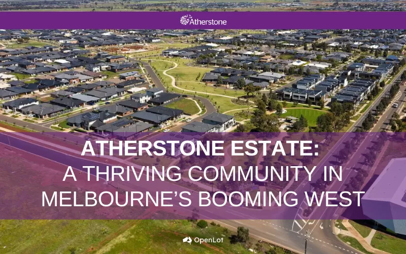
Display Homes at Atherstone Estate: A Thriving Community in Melbourne’s Booming West
Welcome to Atherstone, a vibrant and flourishing masterplanned community ...
07/Mar/2025 | OpenLot.com.au
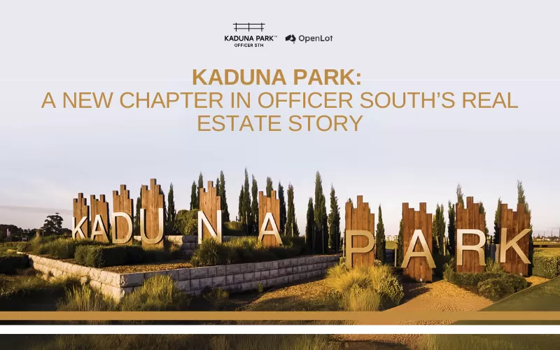
Kaduna Park: A New Chapter in Officer South's Real Estate Story
Nestled in the scenic beauty of Officer South, Kaduna Park is a testament...
![[Feb/2025] Top Most Searched Housing Developments in Australia](https://files.openlot.com.au/p/styles/500h/s3/article/Thumbnail%20-%20Top%2030%20Most%20Searched%20Housing%20Developments%20%281%29.png.webp?itok=wtjvzwHK)
06/Mar/2025 | OpenLot.com.au
[Feb/2025] Top Most Searched Housing Developments in Australia
OpenLot provides a comprehensive overview of leading housing developments...

05/Mar/2025 | OpenLot.com.au
Display Homes at Alfredton Grove Estate: A Premier Community in Alfredton's Growing West
Alfredton Grove has become one of the most desirable residential communit...

04/Mar/2025 | OpenLot.com.au
Display Homes at Ooranya: Beveredige's Perfect Blend of Country Living and Modern Convenience
Nestled in the charming town of Beveridge, Ooranya is a community designe...

03/Mar/2025 | OpenLot.com.au
The Rise of Regional Living: Why More Australians are Moving Beyond Major Cities
In recent years, Australia has witnessed a significant shift in populatio...


 4
4  2
2  2
2


