


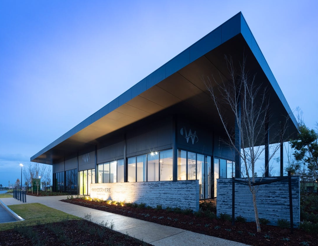
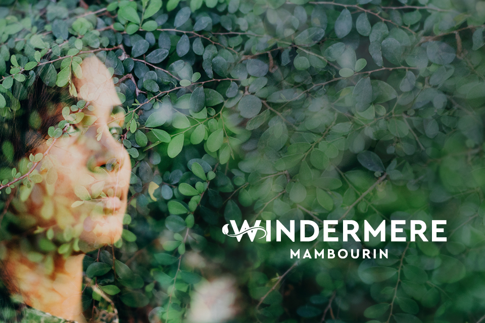
Windermere Estate - Mambourin
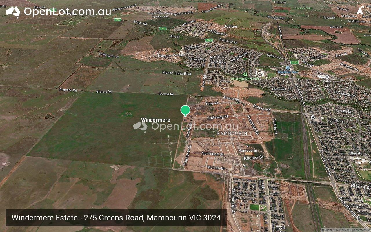
 275 Greens Road, Mambourin VIC 3024
- Imagine life in a new, smarter community designed to enrich every part of your being, where an inspired learning experience will enrich minds, young and old.
- Offering residents the future choice of three government schools and one private school, as well as tertiary opportunities with the Werribee-based campuses of Deakin and Victoria Universities, Windermere will stand out as a well-educated community.
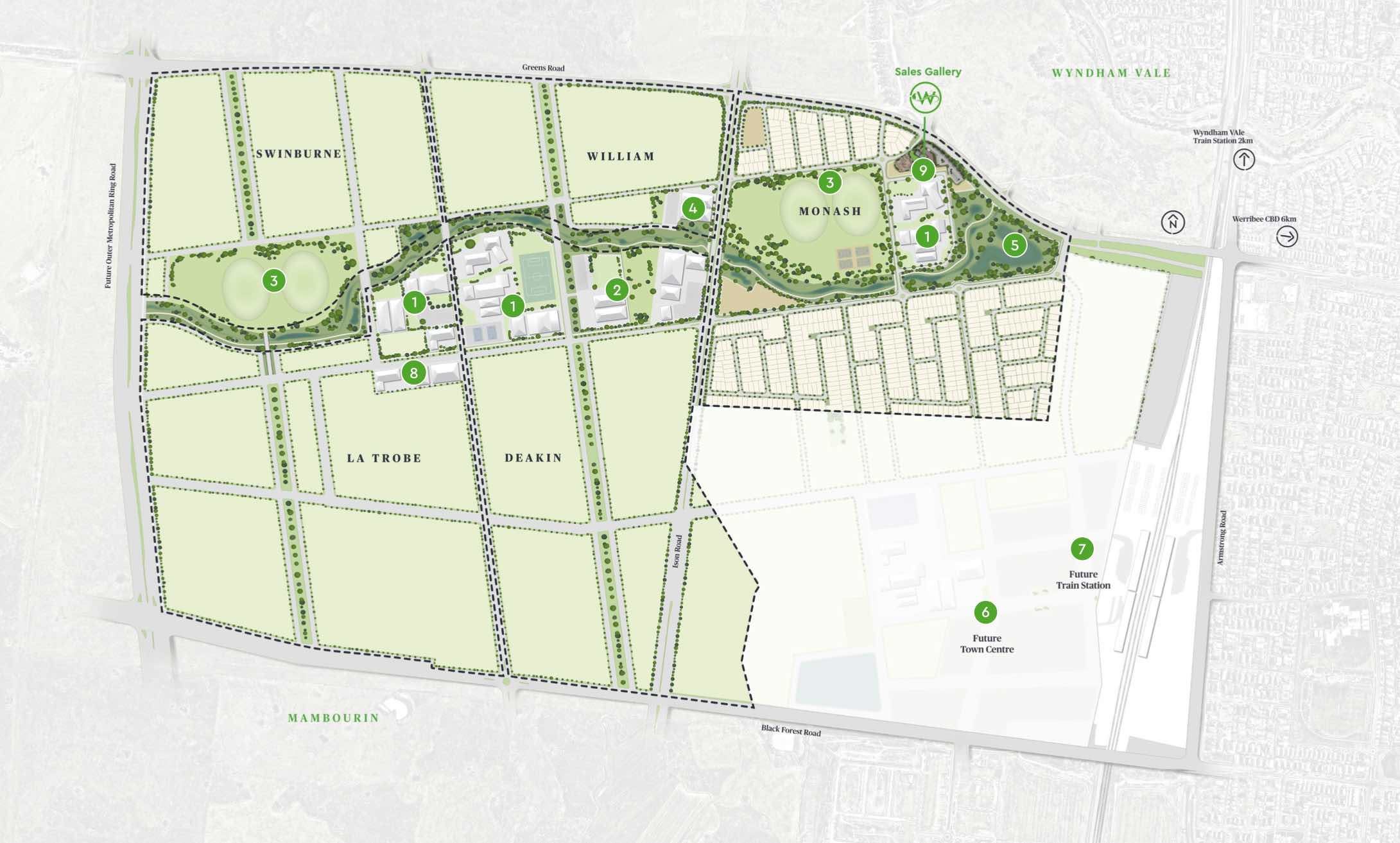
- With approximately 50 hectares of sports ovals, parklands, and recreation areas, plus a wetlands and creek corridor, this connected community is focused on wellbeing that will rejuvenate the soul.
- The Windermere community is destined to set a new standard for premium masterplanned living, located in Melbourne’s newest residential suburb – Mambourin.
- Windermere’s village hub, with space for a supermarket and a boutique range of speciality and convenience shopping, will provide for residents’ needs and wants, while a planned community centre will bring locals of all ages together to connect in an inviting environment.
- The nearby Wyndham Vale train station means that Windermere is directly connected to the Melbourne CBD, and its business, shopping and entertainment offerings.
This information is estimated by the OpenLot research team. Let us know here to provide up-to-date information about this development.
| Total new homes | 4,800 |
| Area size | 363.00 hectares |
| Growth Region | Melbourne West Growth Corridor |
| City council | Wyndham City Council |
| Developer | Risland Australia |
| Project marketer | Oliver Hume Real Estate Group |
| Creative agency | Traffic Brand Agency, Nimbl |
| Other names | The Elysian Collection |
| Distance to | Melbourne Airport - 33 km south-west Melbourne CBD - 34 km west |
Land for Sale, House and Land Packages:
23 Display Homes in Windermere Estate - Mambourin
 4
4 2
2 2
2 2
2Popular Estates near Windermere Estate - Mambourin


Updates for Windermere Estate - Mambourin
Facebook updates:
Related news:
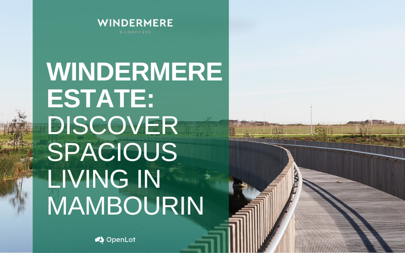
Welcome to Windermere, where spacious living meets natural beauty. Nestled in Mambourin, this community offers a perfect balance of modern conveniences and boundless green spaces. Here, every day presents rich opportunities for a well-rounded life, set against a backdrop of nature. Windermere is more than just a place to live—it’s a place to grow, connect, and thrive.
Chinese real estate giant Country Garden has sold out the first staged release of 43 lots at its massive Windermere estate in Melbourne's west.

Missing articles? Send us a link here.
Location & Map for Windermere Estate - Mambourin
Land Price Trend in Mambourin VIC 3024
- In Apr - Jun 24, the median price for vacant land in Mambourin VIC 3024 was $340,000. *
- From Jan - Mar 20 to Apr - Jun 24, the median price for vacant land in Mambourin VIC 3024 has increased 14.29%. *
- From 2020 to 2023, the median price for vacant land in Mambourin VIC 3024 has increased 17.29%. *
Vacancy Rate in Mambourin VIC 3024
View full vacancy rate history in Mambourin VIC 3024 via SQM Research.
Schools near Windermere Estate - Mambourin
Here are 6 schools near Windermere Estate - Mambourin:
Prep-12 Government Combined School
Prep-6 Catholic Primary School
Prep-6 Government Primary School
Prep-6 Government Primary School
Prep-6 Catholic Primary School
Prep-6 Government Primary School
Suburb Planning Review in Mambourin VIC 3024
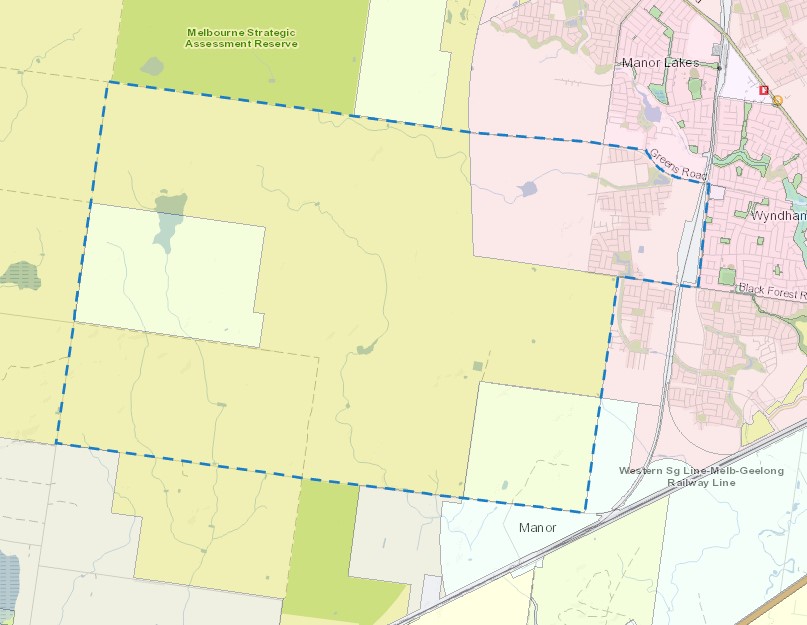
Mambourin is approximately 248 square kilometres located within the City of Wyndham forming part of the Victorian west growth corridor area, located 38 kilometres south-west of Melbourne, 45 kilometres from Geelong. The suburb is a result of two large master planned community projects in the area, in proximity to the existing Regional Rail Link between Werribee and Wyndham Vale. The existing suburb was originally primarily grazing land holdings and the residents relied on adjoining urban residential suburbs for services and retail convenience.
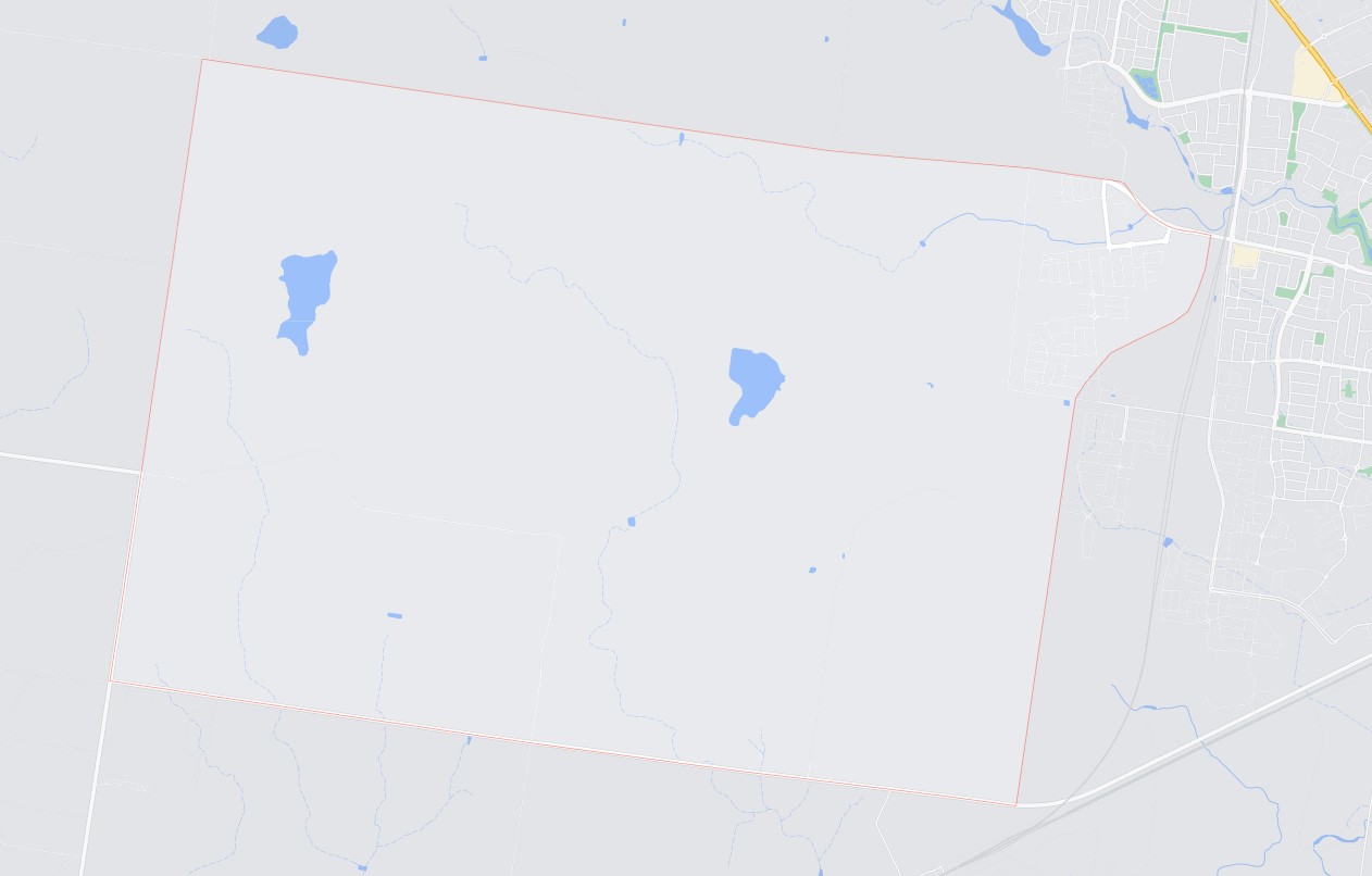
The suburb is bounded by Argoona Road and Greens Road in the north, Edgers Road to the west, Bulvan Road to the south and property boundaries to the east. The suburb is bare, with pockets of trees found near dry dams, a handful of dwellings and sheds. Dry river beds traverse the site and an existing quarry is positioned in the western portion of the site.
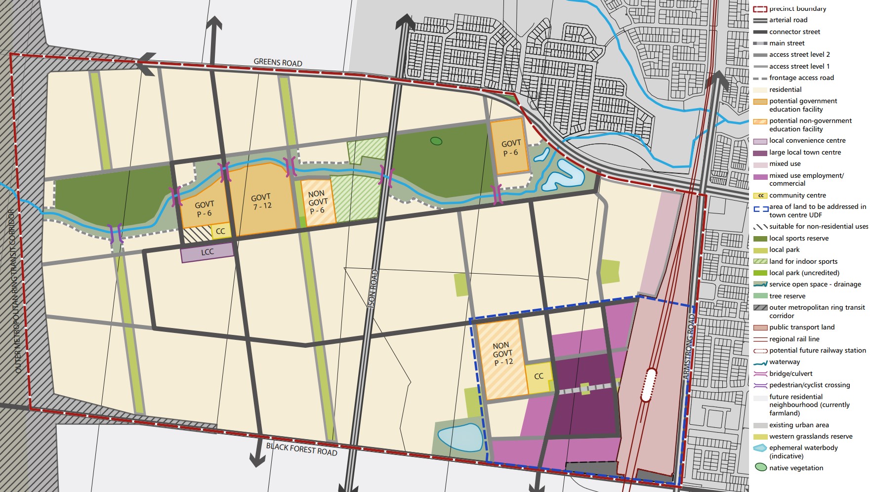
The only portion of the site that will be considered for the new urban redevelopment, is the area in the north-east corner (marked in red). A future Precinct has also been prepared for the south of Black Forest Road.
The Black Forest Road North Precinct Structure Plan (PSP) was prepared by Victorian Planning Authority (VPA) in consultation with the Wyndham City Council and approved by the Minister for Planning. The PSP was officially gazetted on 11 February 2016 under Amendment C170 of the Wyndham Planning Scheme. The PSP covers only the north-east portion of the site, with the balance land subject to future Precinct Structure Plans.
The Vision of Mambourin
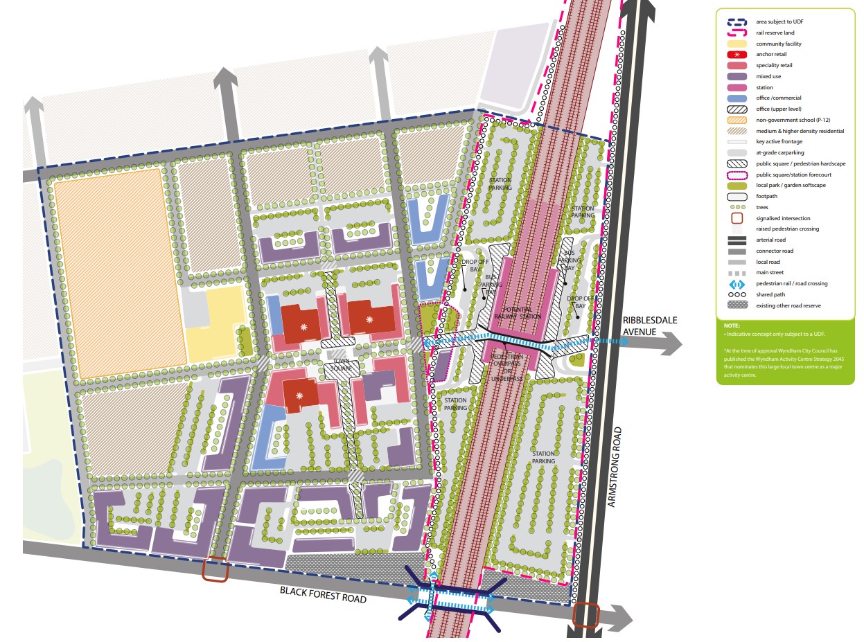
“Black Forest Road North will be a community where a distinct urban form, characterised by a strong grid of high quality streets, is complemented by an extensive and innovative park network focused on the main east-west waterway and key north-south streets. It will also contain attractive and integrated town centres and significant educational and community facilities.
A town centre integrated with a railway station precinct, together with extensive parkland along an existing ephemeral waterway, will provide the principal character elements. The town centre will be an active and vibrant place providing services, facilities and local amenity to the surrounding residential catchment. Due to the centre’s proximity to the railway station, bus routes and the potential future population beyond the boundaries of the PSP area, the town centre will have scope for additional growth in the longer term.
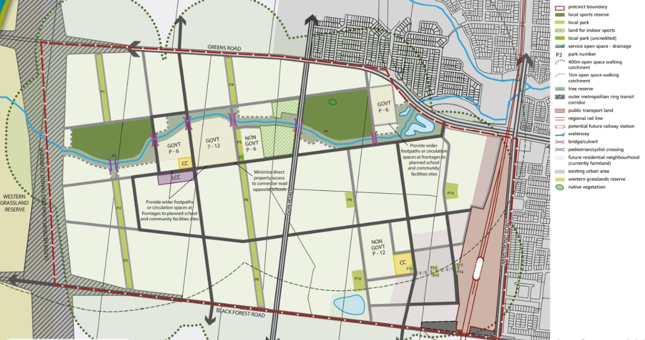
The open space network has been created through a grid of formal and informal green spaces. Meandering west to east across the precinct, the waterway corridor provides a naturally landscaped link between schools and formal open spaces. Traversing these corridors and running northsouth are two linear parks. These unique green spines extend the width of the precinct and will provide a range of recreation opportunities through footpaths, cycling tracks, play equipment, picnic areas and informal sports infrastructure. Additional pocket parks will be scattered throughout the precinct to complete an accessible open space structure”.
Transportation in Mambourin
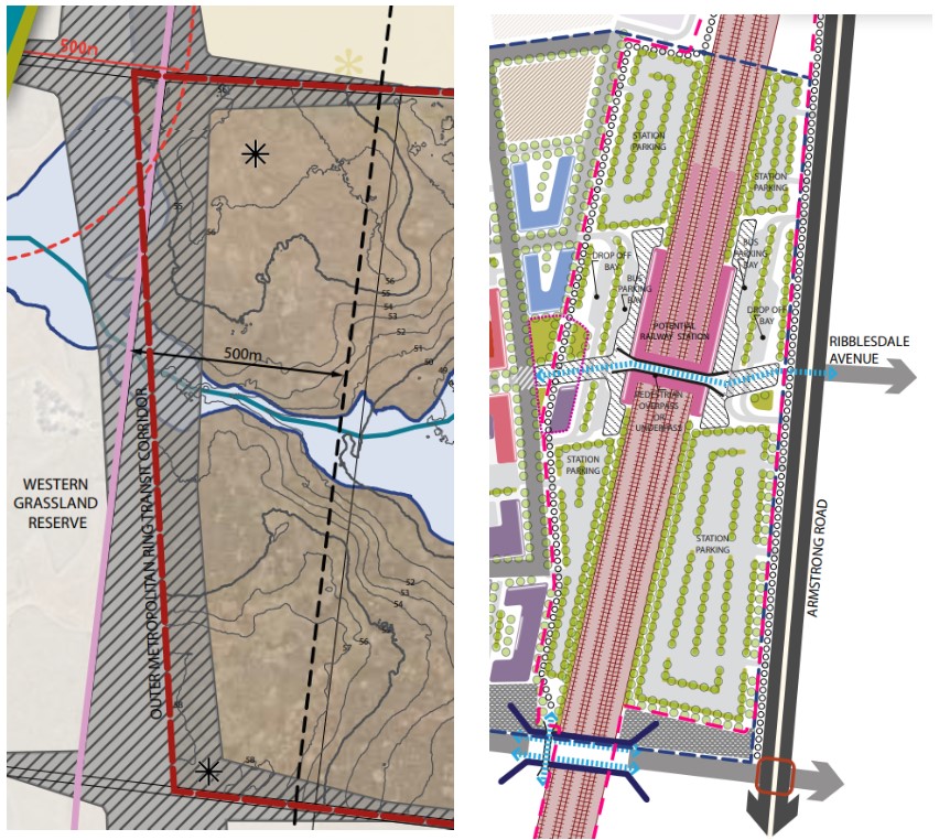
An Outer Metropolitan Ring Transit Corridor has been proposed along the western boundary of the Black Forest Road North Precinct Structure Plan and a Future Railway Station and Line along the eastern boundary. A 500m development setback has also been applied to the gas transmission line that traverses the site.
Mambourin will be well connected to public passenger transport, with a future train station to be located just outside the suburb boundary and the passenger train service connects to Melbourne, via the Sunshine Station transport node connection.
The suburb will include a network of shared paths linking the local parks and a new road network.
Greens Road and Bulban Road provide access to the Princes Freeway, providing a direct connection to Melbourne CBD or Geelong in south-west Victoria.
Local Town Centre of Mambourin
The Black Forest Road North PSP required an urban design framework plan to be prepared to guide the development of the large local town centre to the satisfaction of the Council and Victorian Planning Authority and Public Transport Victoria due to the new train station. The proposed layout was provided to the public for comment as well as a 1-10+ year staging of how the town centre will transform, taking in key considerations of high density residential, retail, civic and interim uses until fully developed.
Benefits of Mambourin
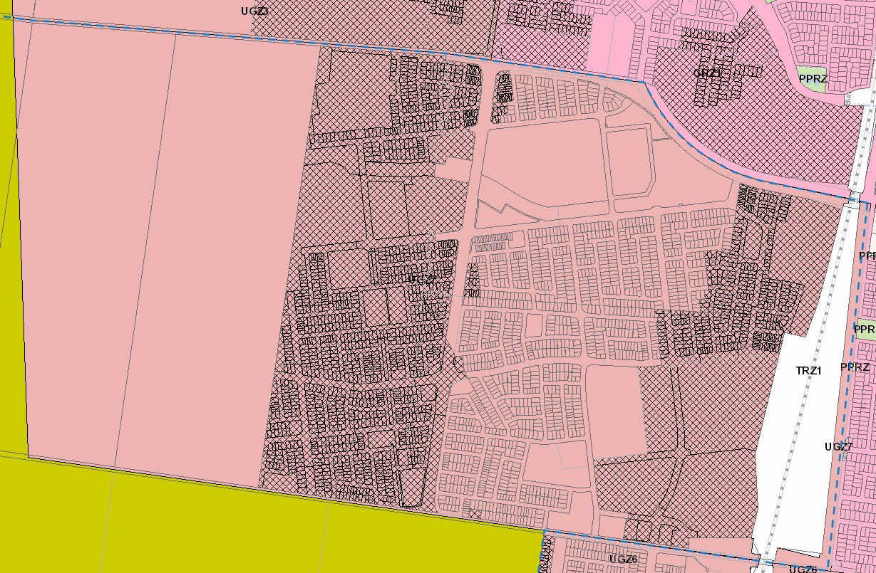
The PSP also supports new schools, higher density of residential development, retail, and office, in a mixed use town centre with employment opportunities. The new residential community will enhance and protect the existing natural features, parks, and sports and recreation areas. The existing zoning will be amended to provide for Rural Conservation and Urban Growth Zones, providing a series of greenfield sites in proximity to natural water corridors and reserves.
Windermere Residential Community
Country Garden Australia has begun to establish a large residential community within the growth suburb of Mambourin, in accordance with the Black Forest Road North Precinct PSP. The new master planned community is named ‘Windermere’ and provides a variety of residential allotments, types of dwellings, schools, parks and a local road network. The redevelopment has protected and rejuvenated the creek corridor to support the provision of amenities and facilities for the residential dwellings intended for the redevelopment of the Urban Growth Zone.
.jpg)
Mambourin Residential Community
Property developer Frasers Property has begun to establish a large residential community over the Mambourin suburb, in accordance with the Black Forest Road North Precinct PSP. The new master planned community is named after the suburb ‘Mambourin’ and provides the town centre, school, shopping centre, parkland and a mixed use centre in proximity to the potential new train station.
.jpg)
Mambourin Suburb Summary
Reviews & Comments on Windermere Estate - Mambourin
Estate Brochure, Masterplan, Engineering Plan, Plan of Subdivision (POS), Design Guidelines
FAQs about Windermere Estate - Mambourin
View all estates from Risland Australia
View all estates marketed by Oliver Hume Real Estate Group
- Manor Lakes P-12 College - 1.9km north-east
- Our Lady of the Southern Cross - 2.0km north-east
- Wyndham Vale Primary School - 2.2km south-east
- Ngarri Primary School - 2.3km north
- St Joseph's Catholic Primary School - 2.7km south-east
- Lollypop Creek Primary School - 3.3km south-east
Popular Estates near Windermere Estate - Mambourin
Latest New Home Articles for You

05/Mar/2025 | OpenLot.com.au
Display Homes at Alfredton Grove Estate: A Premier Community in Alfredton's Growing West
Alfredton Grove has become one of the most desirable residential communit...
04/Mar/2025 | OpenLot.com.au
Display Homes at Ooranya: Beveredige's Perfect Blend of Country Living and Modern Convenience
Nestled in the charming town of Beveridge, Ooranya is a community designe...

03/Mar/2025 | OpenLot.com.au
The Rise of Regional Living: Why More Australians are Moving Beyond Major Cities
In recent years, Australia has witnessed a significant shift in populatio...
28/Feb/2025 | OpenLot.com.au
2025 Property Investment Strategies: How to Maximise ROI
As Australia’s real estate market evolves, property investors are seeking...

27/Feb/2025 | OpenLot.com.au
Display Homes at Everley: The Heart of Sunbury’s Newest Community
Everley proudly stands at the centre of Sunbury, offering an unparalleled...

25/Feb/2025 | OpenLot.com.au
Western Australia’s Most Popular Land Estates for January 2025: Top Picks Across Growth Areas
Western Australia’s property market continues to show robust growth, with...

24/Feb/2025 | OpenLot.com.au
South Australia’s Most Popular Land Estates for January 2025: Top Picks Across Growth Areas
South Australia’s property market is gaining momentum, with growth areas ...

23/Feb/2025 | OpenLot.com.au
Exploring the Impact of Technology on Home Buying: A Comprehensive Overview
The latest episode of the "Home Building Hub" podcast delved into this to...

22/Feb/2025 | OpenLot.com.au
Display Homes at Cloverton: Kalkallo Perfect Balance of City and Nature
If you're seeking a harmonious balance between vibrant city life and sere...