
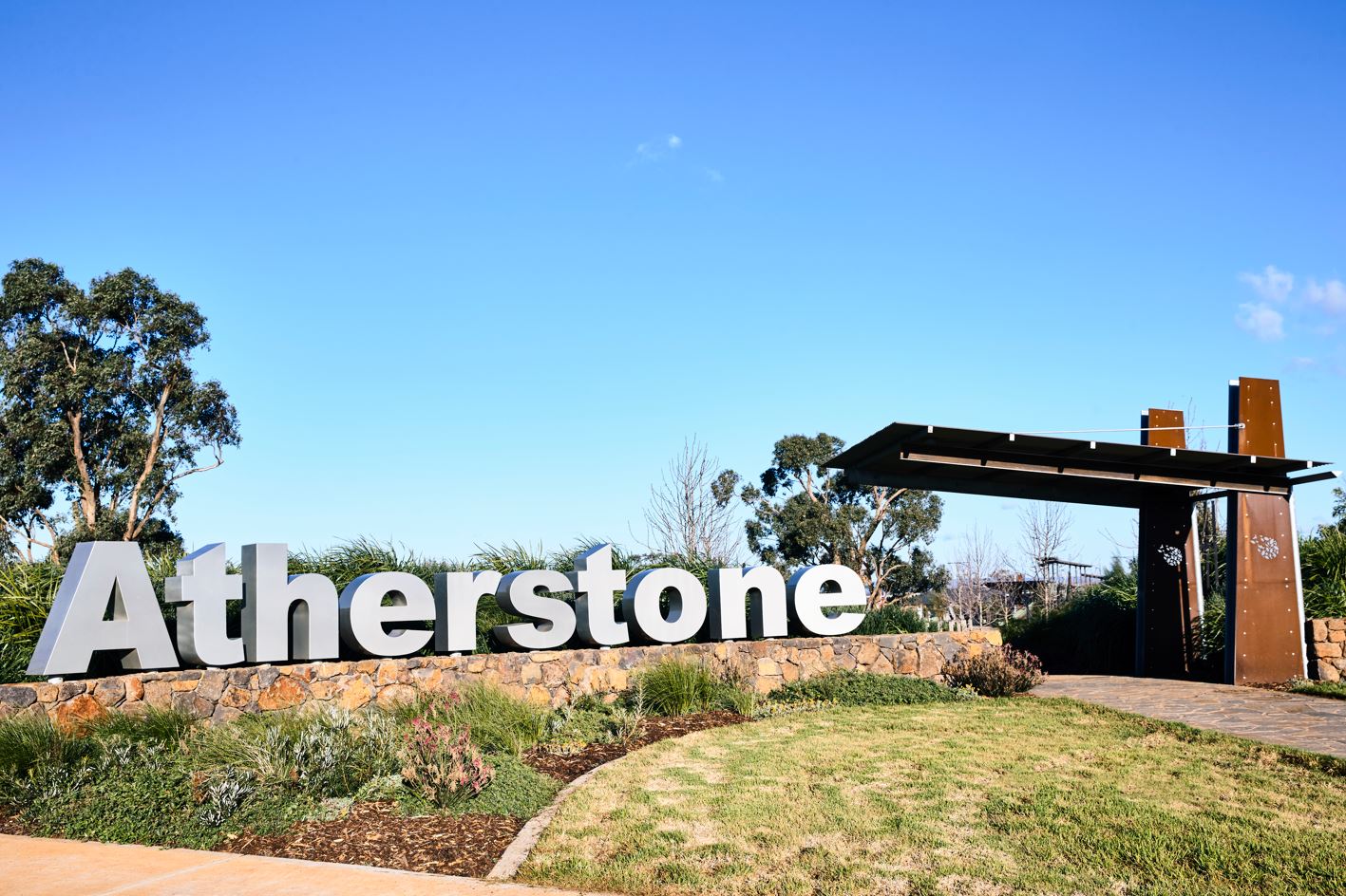
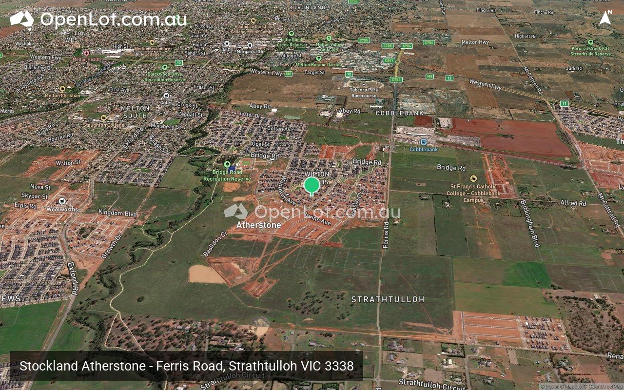
Stockland Atherstone - Strathtulloh 1 AVAILABLE
 Ferris Road, Strathtulloh VIC 3338
[LIMITED OFFER] Stockland Open Doors Sale now on! Save up to $40k~
- Open the door to more with Stockland Atherstone in Strathtulloh. For a limited time, enjoy up to $20k~ off land lots and house & land packages with the Stockland Open Doors Sale. Unlock your future today!
- 44km West of Melbourne CBD
- 10+ Education options already open on your doorstep from early learning through to high school
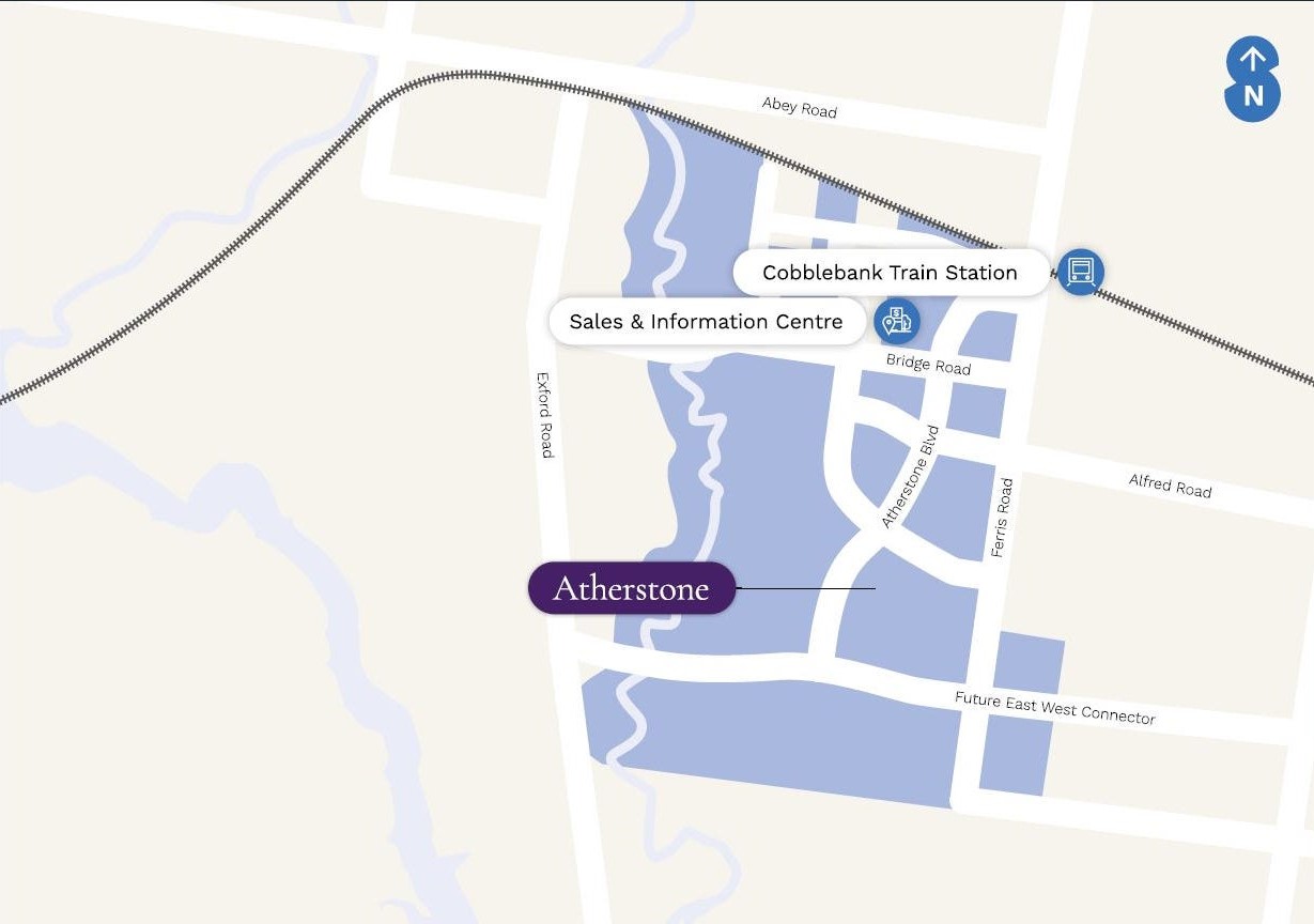
- 750m to Strathtulloh Train Station, putting the CBD less than 40 mins away
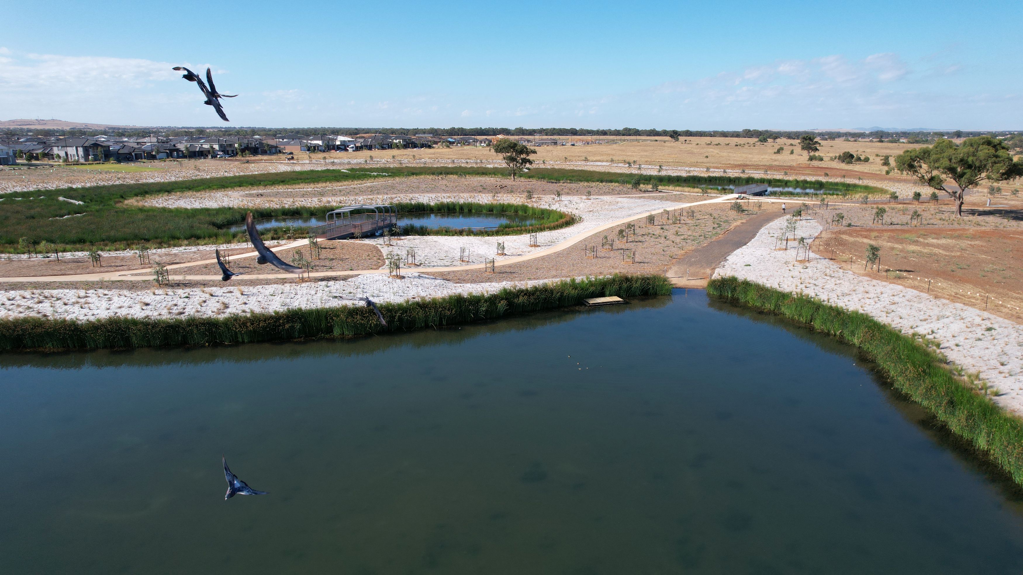
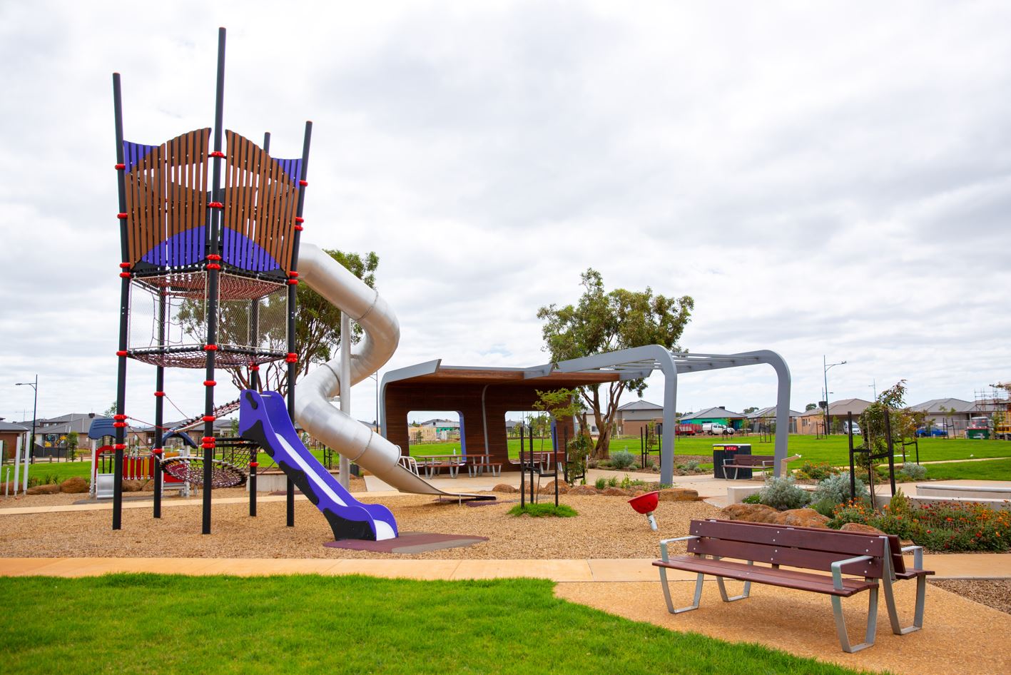
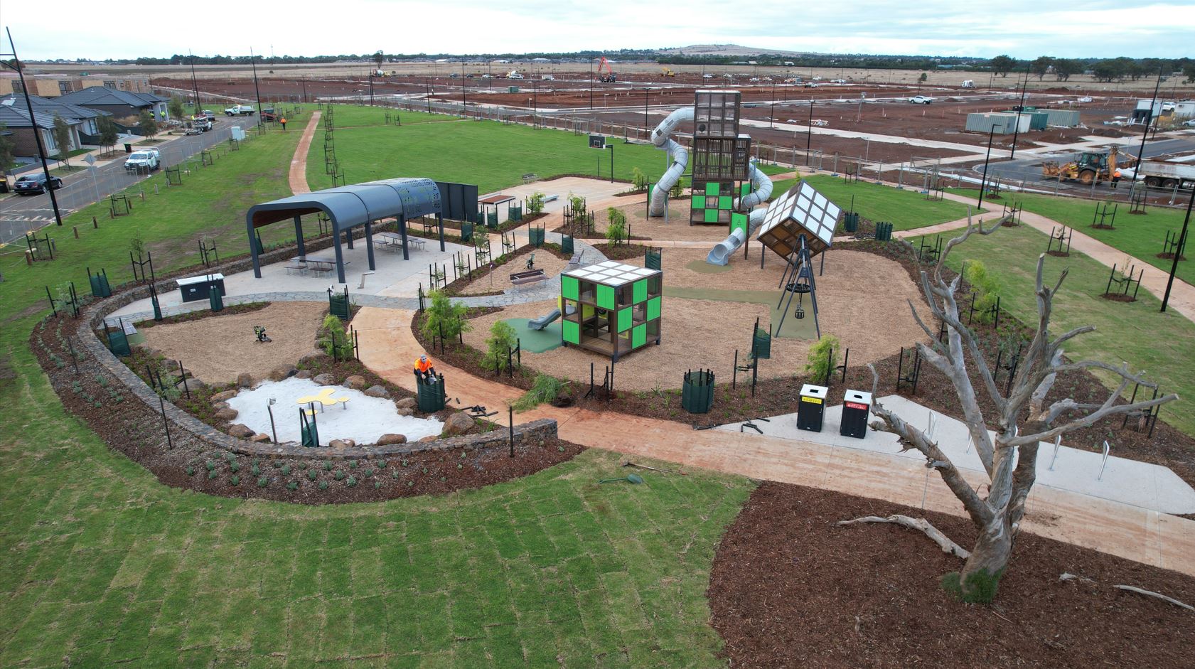
- ¼ of the community is dedicated to green open space with multiple parks ready for play
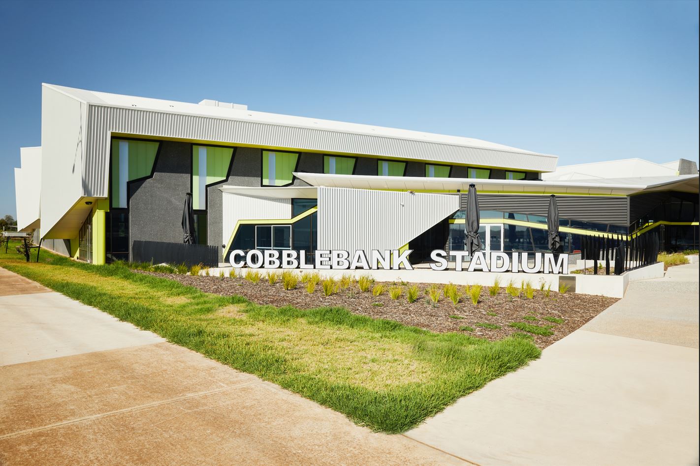
- Cobblebank Village, with a Coles, is now open
- Future Cobblebank CBD will be conveniently located across the road
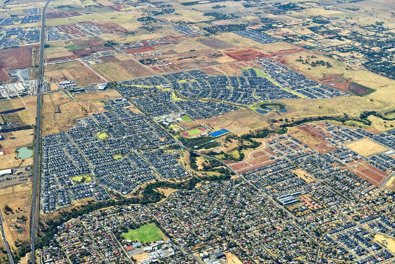
- Atherstone will eventually be home to 15,000 residents
- ~T&Cs apply.* Price correct as at 24.01.2025. Offer may vary community by community. Ends 31 March 2025. See website for details. https://www.stockland.com.au/residential/vic/sale-terms
- ^All details (including any prices), images and statements are based on the intention of, and information available to, Stockland as at the date of this email and may change due to future circumstances. This email is not legally binding on Stockland. Stockland does not give any warranty in relation to any information contained in this email. Stockland does not accept any liability for loss or damage arising as a result of any reliance on this email or its contents. Images are are subject to change. Stockland is only responsible for the sale of the land. Price does not include stamp duty, registration fees or any incidental fees.
This information is estimated by the OpenLot research team. Let us know here to provide up-to-date information about this development.
| Total new homes | 4,200 |
| Area size | 481.00 hectares |
| Growth Region | Melbourne West Growth Corridor |
| City council | Melton City Council |
| Developer | Stockland |
| Other names | Wilton Fields, Park Edge, Middle Park, Stone Ridge, Settlers Creek |
| Distance to | Melbourne Airport - 23 km west Melbourne CBD - 34 km west |
Land for Sale, House and Land Packages:
Land Lots in Stockland Atherstone - Strathtulloh

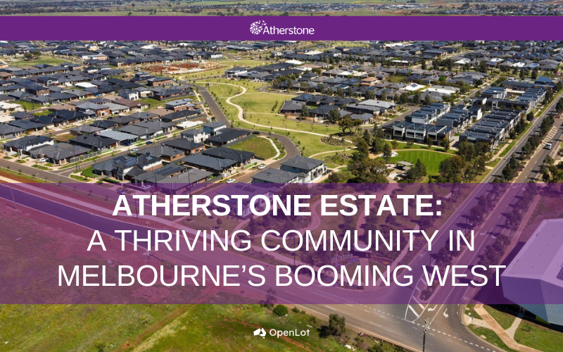
Get more out of life at Atherstone. On the doorstep of the emerging Cobblebank CBD, just 40km west of Melbourne, is a thriving community designed to provide comfort, connection and convenience. Create a lifestyle you love amongst 120 hectares of open space, connected by tree-lined streets and walkways. Living here, you can enjoy the best of both worlds – urban convenience in a serene environment from the day you move in.
Reach out today to ensure you're among the first to receive updates about our releases.
Feel free to contact our sales by calling 13 52 63.
Updates for Stockland Atherstone - Strathtulloh
Facebook updates:
Related news:
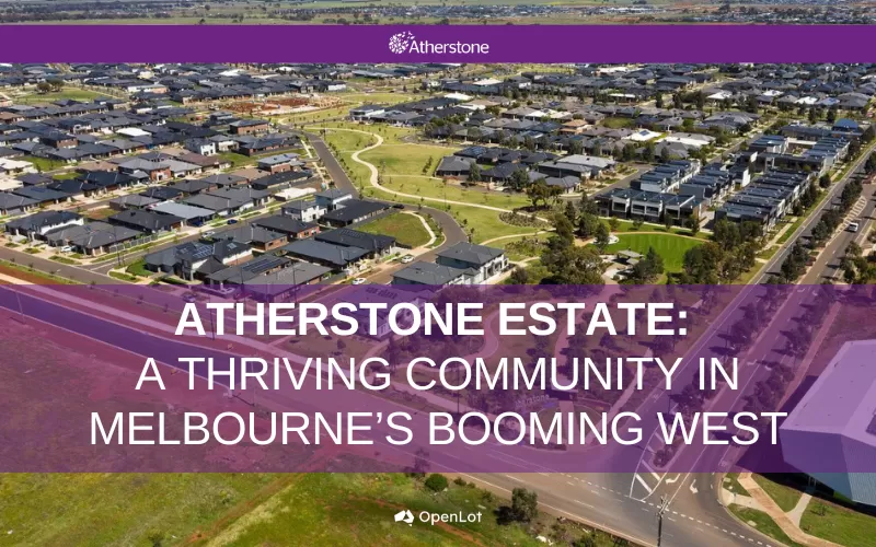
Welcome to Atherstone, a vibrant and flourishing masterplanned community created by Lendlease, situated right on the doorstep of the emerging Cobblebank CBD in Melbourne’s booming west. Atherstone is a tight-knit neighbourhood designed with families in mind, offering an ideal blend of modern conveniences and community charm. Everything your family needs is close at hand, with more exciting developments still to come.
Report on Council's partnership with Lend Lease to deliver this new community.
Stockland Managing Director and Chief Executive Officer, Tarun Gupta, said the acquisition represents a step change in the reshaping Stockland's portfolio

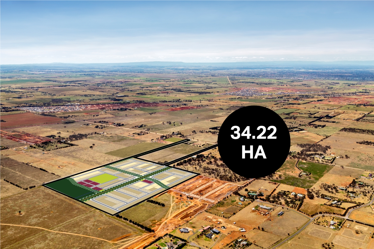
The 34.22 hectare site is centrally located in the Melton Growth Corridor, 30kms west of Melbourne’s CBD and is covered by the approved Toolern PSP.
"Be dreamers. Be proud. Be home-owners."
Under round one of the Smart Cities and Suburbs Program, the Australian government will provide 52 projects across the nation with AU$28.5 million in shared funding.

Missing articles? Send us a link here.
Location & Map for Stockland Atherstone - Strathtulloh
Visit Display Homes near Stockland Atherstone - Strathtulloh


Land Price Trend in Strathtulloh VIC 3338
- In Apr - Jun 24, the median price for vacant land in Strathtulloh VIC 3338 was $300,000. *
- From Oct - Dec 17 to Apr - Jun 24, the median price for vacant land in Strathtulloh VIC 3338 has increased 75.64%. *
- From 2011 to 2023, the median price for vacant land in Strathtulloh VIC 3338 has increased 92.22%. *
Vacancy Rate in Strathtulloh VIC 3338
View full vacancy rate history in Strathtulloh VIC 3338 via SQM Research.
Schools near Stockland Atherstone - Strathtulloh
Here are 6 schools near Stockland Atherstone - Strathtulloh:
Prep-6 Government Primary School
Prep-6 Catholic Primary School
Prep-6 Government Primary School
Prep-6 Catholic Primary School
7-12 Government Secondary School
Prep-12 Independent Combined School
Suburb Planning Review in Strathtulloh VIC 3338
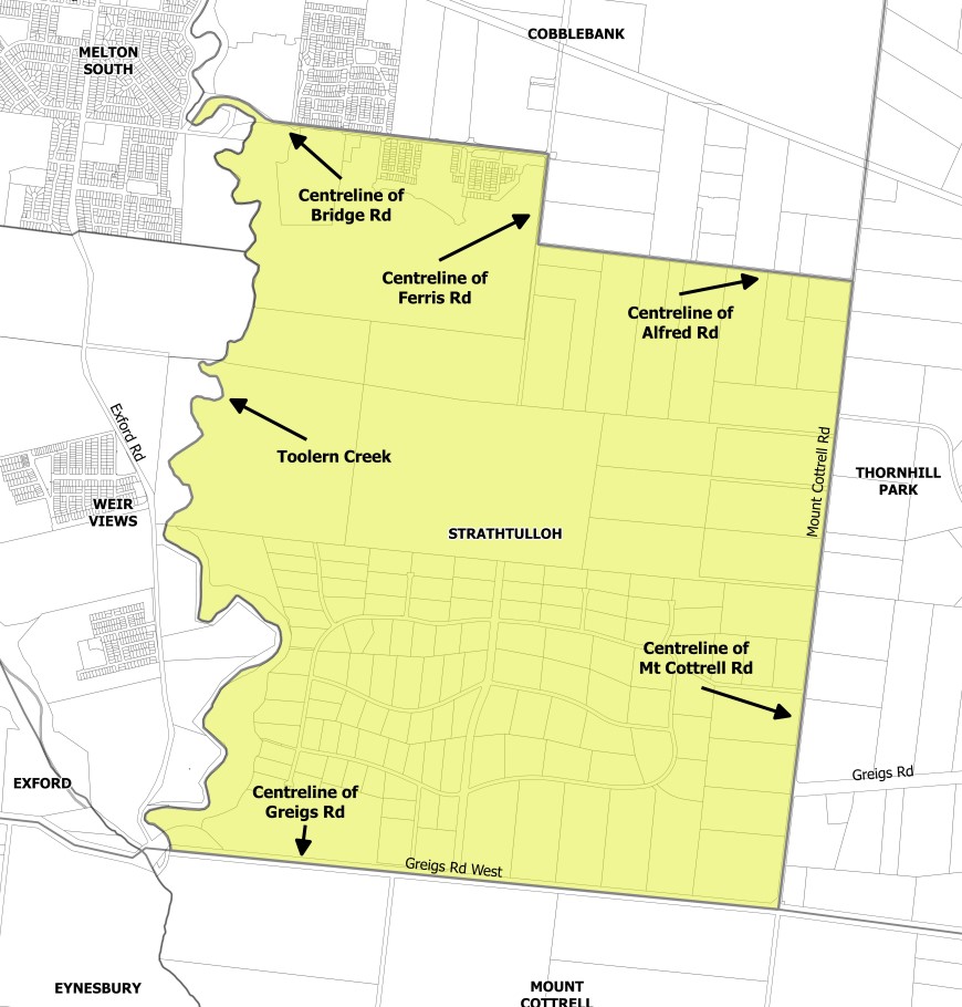
Strathtulloh is with the City of Melton located 40 kilometres west of Melbourne and named after a heritage-listed property located on Greigs Road. Strathtulloh is approximately 1,093 ha, which is bounded by Mount Cottrell Road to the west, Toolern Creek natural waterway corridor to the east, Alfred Road, Ferris Road and Bridge Road to the north and Greigs Road West to the south.
Strathtulloh was gazetted by the Office of Geographic Names on 9 February 2017 under the direction of the Victorian State Government, following a proposal for 11 new suburbs by the City of Melton. The new suburbs have strict density changes to ensure density does not exceed 20,000 residents, ensure vibrant community neighbourhood hubs, provide affordable housing and maintain the geographic characteristics.
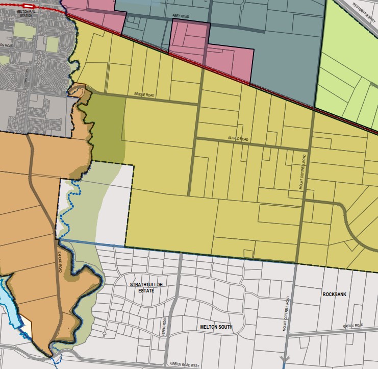
The suburb is made up of two parts (northern and southern), as listed below:
- The northern area is set to be redeveloped under the Toolern Precinct Structure Plan which will provide schools, parks and new residential dwellings with an increased density; and
- The southern area known as ‘Strathtulloh Estate’ is a low/semi-rural density area with agriculture surrounded by bushland which will remain undeveloped
.jpg)
Strathtulloh contains zones that maintain the development intentions of the planning scheme. The Green Wedge Zone (GWZ) is found in the southern portion of the area, the Public Park / Recreation Zone (PPRZ) and Rural Conservation Zone (RCZ) are both located along the western boundary and adjoins the Toolern Creek Park corridor.
The Toolern Precinct Structure Plan includes the Urban Growth Zone (UGZ) located in the northern area of Strathtulloh and enables Melton Shire Council to provide a range of physical and social infrastructure as part of the development of the area, with further infrastructure to be provided by the redevelopment of the new suburb.
The Toolern Precinct Structure Plan (PSP) provides recreation and residential infrastructure necessary to support the long-term strategic planning direction for a more sustainable growth area. The new growth area of Cobblebank-Strathtulloh is expected to provide for over 35,000 people by 2051.
The Toolern PSP was prepared by Victorian Planning Authority (VPA) in consultation with the City of Milton and was approved by the Minister for Planning in October 2010. The decision was officially gazetted in November 2011 under Amendment CO84 (Part 1) to the Milton Planning Scheme. The Toolern Precinct Structure Plan was later amended in December 2015 under amendment C161.
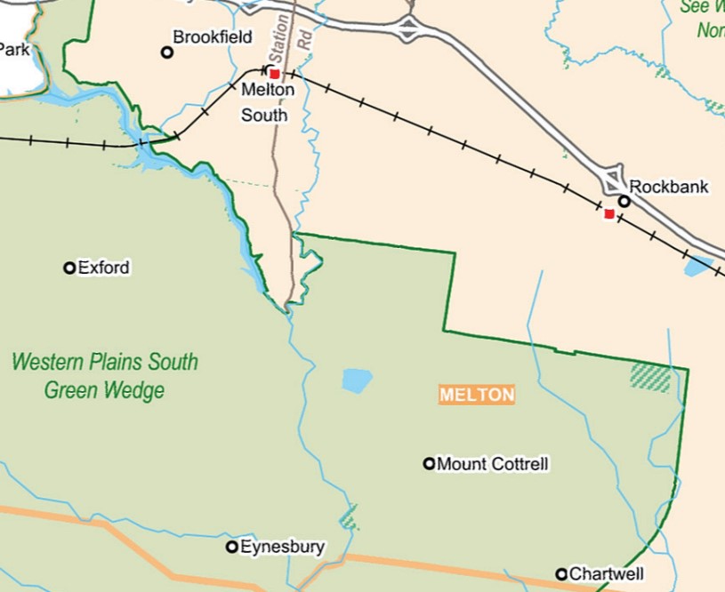
Green Wedge
Strathtulloh is within the northern portion of the Western Plains South Green Wedge, which refers to a non-urban land that surrounds the Urban Growth Boundary of Melbourne and was put in place by the Victorian Government in 2002. The city of Melton is preparing a management plan with other surrounding council areas to provide a framework to support sustainable development, land use and management.
- Provide opportunities for agricultural uses, such as market gardening, viticulture, aquaculture, farm forestry and broadacre farming
- Preserve rural and scenic landscapes
- Preserve renewable and non-renewable resources and natural areas (such as water catchments)
- Providing and safeguarding sites for infrastructure that supports urban areas, and
- Provide opportunities for tourism and recreation.
The southern area will be controlled by a management plan for the Western Plains South Green Wedge (WPSGW) that is being prepared and until such time the planning principles of the prepared background report will guide future development. The report can be found here.
Benefits of Strathtulloh
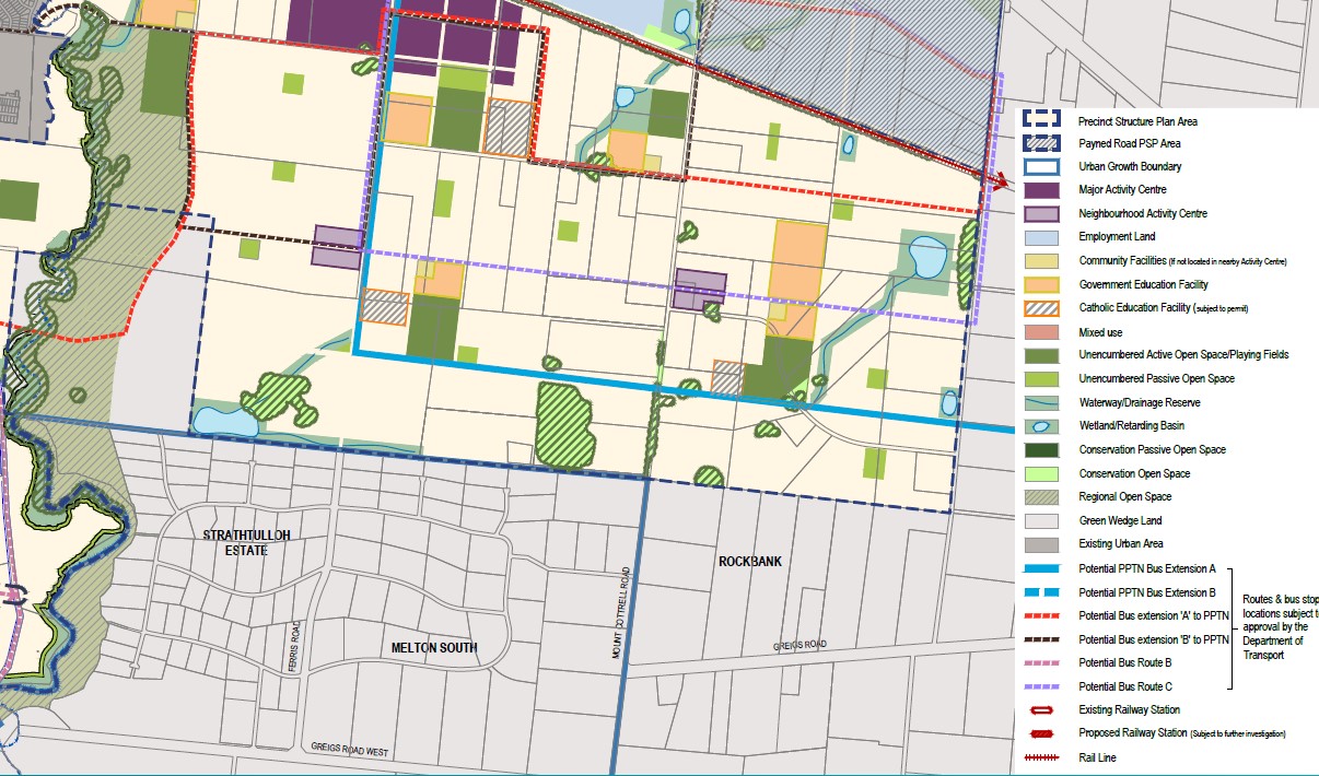
The amendment to the Melton Planning Scheme provides suburb urban structure and redevelopment density direction within the existing Urban Growth Zone (UGZ). The Toolern PSP provides the planning framework to facilitate the new residential community, new schools, sports and recreation areas for future development.
The protection of the open space, parkland and Toolern Creek corridor will be controlled by the existing Public Park / Recreation Zone (PPRZ) and Rural Conservation Zone (RCZ). The existing zoning allows for a series of linear public parklands that can be enjoyed by all future residents.
The envisaged school, sports fields and parks are strategically located within the northern portion of the suburb experiencing urban redevelopment. The future neighbourhood activity centre and surrounding suburbs provide areas that provide social, retail, employment and community infrastructure, with the largest located on Bridge Road adjacent to the northern boundary of Strathtulloh.
Transportation in Strathtulloh
Strathtulloh will be connected to public passenger transport, with Melton train station and Toolner Train Station located in adjacent suburbs north of Strathtulloh. Both stations provide passenger train service to Melbourne CBD.
A shared pathway connects local parks, adjacent suburbs and residential areas in Strathtulloh. A road network is envisaged to connect the large rural residential lots with the approved and proposed residential subdivisions to facilitate vehicle access to the surrounding growth areas. Access to Ferris Road to the north will provide a direct connection to the Melton Highway/ Western Freeway interchange providing access to Melbourne CBD or western Victoria.
Atherstone Residential Community
Property developer Lendlease has begun to establish a large residential community over the Cobblebank and Strathtulloh suburbs, in accordance with the Toolern PSP. The new master planned community is named ‘Atherstone’ and provides a variety of residential allotments, types of dwellings, parks and a local road network. The redevelopment has announced that future stages of development will be released. The redevelopment has protected the Public Park / Recreation Zone (PPRZ) and Rural Conservation Zone (RCZ) and facilitated the intended redevelopment of the Urban Growth Zone (UGZ).
.jpg)
Strathtulloh Suburb Summary
References
City of Milton – Strathtulloh Map
City of Milton – C122 Draft Planning Scheme Amendment
2019—2020 Federal Government Budget Submission
Western Plains South Green Wedge – Background Report
Western Plains South Green Wedge - Map
Victoria Planning Authority – Toolern PSP
Atherstone Master planned Community
Reviews & Comments on Stockland Atherstone - Strathtulloh
Estate Brochure, Masterplan, Engineering Plan, Plan of Subdivision (POS), Design Guidelines
FAQs about Stockland Atherstone - Strathtulloh
View all estates from Stockland
- Strathtulloh Primary School - 645m north
- St Lawrence of Brindisi Catholic Primary School - 2.1km south-west
- Melton South Primary School - 2.1km north-west
- St Anthony's School - 2.2km north-west
- Staughton College - 2.6km north-west
- Al Iman College - 2.9km north-west
Popular Estates near Stockland Atherstone - Strathtulloh


 4
4  2
2  2
2


Latest New Home Articles for You

13/Mar/2025 | OpenLot.com.au
Home Building Hub Offers Expert Tips for Visiting Display Homes
The latest episode of "Home Building Hub," hosted by industry experts Col...
12/Mar/2025 | OpenLot.com.au
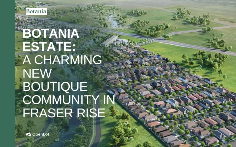
Display Homes at Botania Estate: A Charming New Boutique Community in Fraser Rise
Welcome to Botania Estate in Fraser Rise, where the charm of a boutique c...

11/Mar/2025 | OpenLot.com.au
4 Steps to Getting the Best Building Quotes
In the latest episode of the Home Building Hub podcast, hosts Colin Bisch...
10/Mar/2025 | OpenLot.com.au
Display Homes at Atherstone Estate: A Thriving Community in Melbourne’s Booming West
Welcome to Atherstone, a vibrant and flourishing masterplanned community ...
07/Mar/2025 | OpenLot.com.au
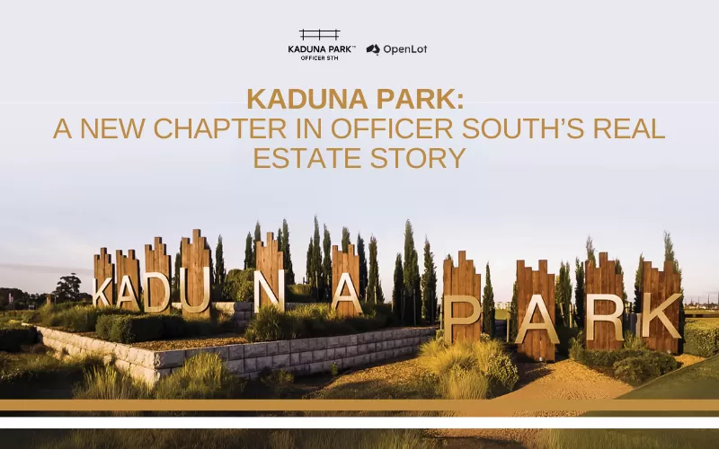
Kaduna Park: A New Chapter in Officer South's Real Estate Story
Nestled in the scenic beauty of Officer South, Kaduna Park is a testament...
![[Feb/2025] Top Most Searched Housing Developments in Australia](https://files.openlot.com.au/p/styles/500h/s3/article/Thumbnail%20-%20Top%2030%20Most%20Searched%20Housing%20Developments%20%281%29.png.webp?itok=wtjvzwHK)
06/Mar/2025 | OpenLot.com.au
[Feb/2025] Top Most Searched Housing Developments in Australia
OpenLot provides a comprehensive overview of leading housing developments...

05/Mar/2025 | OpenLot.com.au
Display Homes at Alfredton Grove Estate: A Premier Community in Alfredton's Growing West
Alfredton Grove has become one of the most desirable residential communit...
04/Mar/2025 | OpenLot.com.au
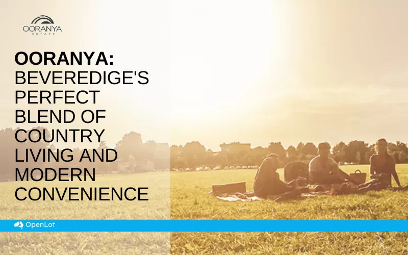
Display Homes at Ooranya: Beveredige's Perfect Blend of Country Living and Modern Convenience
Nestled in the charming town of Beveridge, Ooranya is a community designe...

03/Mar/2025 | OpenLot.com.au
The Rise of Regional Living: Why More Australians are Moving Beyond Major Cities
In recent years, Australia has witnessed a significant shift in populatio...