Prep-6 Government Primary School
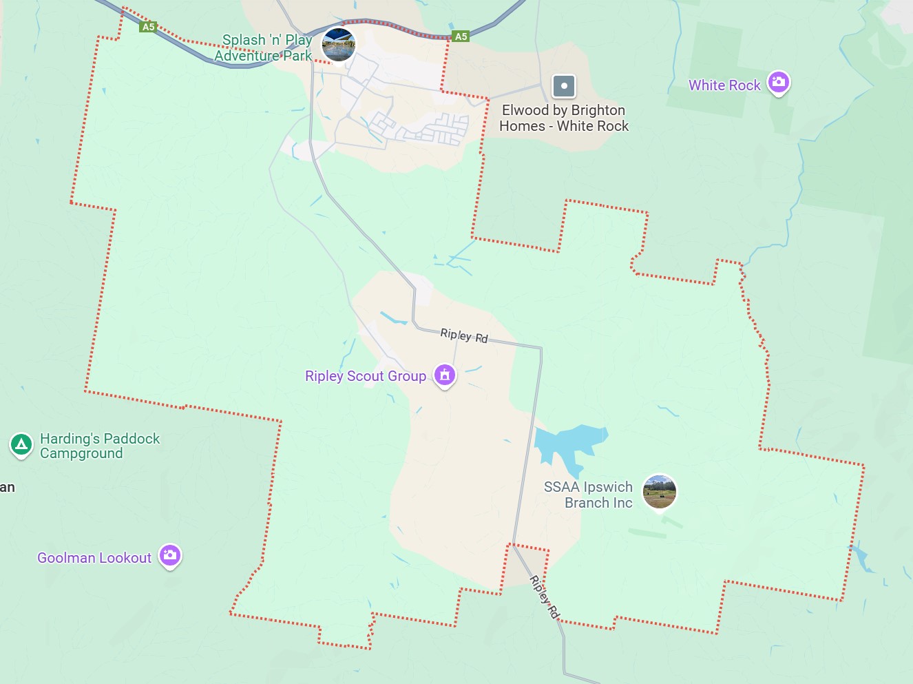
South Ripley is approximately 50.5 square kilometres within the City of Ipswich, a largely rural location positioned in the northern foothills of the Flinders Peak Group, in the Bundamba Creek water catchment and formed part of the range of hills located on the south of Ipswich. The suburb is located 11.8 kilometres south-east of Ipswich Centre and 45 kilometres from Brisbane CBD.
South Ripley is part of the Ripley Valley Priority Development Area (PDA), located in South East Queensland's rapidly expanding western growth corridor. This region is projected to support a population of 4.4 million by 2031, with plans underway to accommodate 120,000 residents across 50,000 homes. Key transport infrastructure includes the Centenary Highway and a planned extension of the Springfield rail line, ensuring excellent connectivity for the growing community.
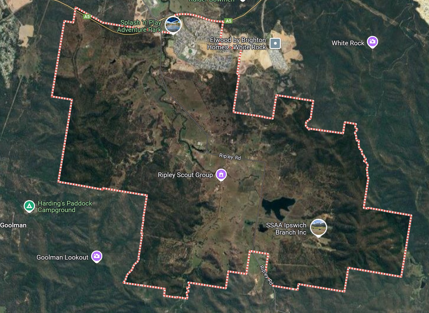
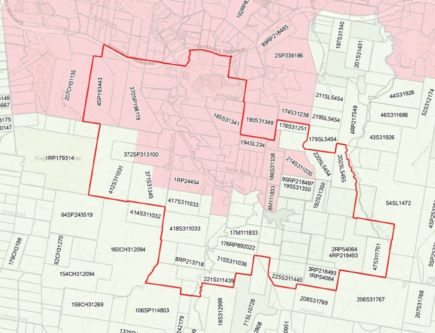
The suburb boundary is located along Centenary Highway and property boundaries to the north. The Woogaroo Creek and property boundaries make up the eastern boundary. Property boundaries make up the southern and western vegetated boundary.
Ripley Road and Watsons Road provide local road access (north to south) between the large hills of the suburb, connecting to the local road network found throughout South Ripley. Barrams Road and Providence Parade run through South Ripley's northern urban area and connects to White Rock along the north-east boundary. The Centenary Highway interchange allows connections to the northern direction but also provides direct access for anyone travelling through the region across to the Ripley Town Centre.
South Ripley combines rural charm with modern living, offering a diverse landscape of natural waterways, recreational spaces, and growing residential areas. Bundamba Creek flows through the suburb, connecting features like Daly's Lagoon and scattered dams, while large hills frame the area’s scenic beauty.
The suburb is home to a P-12 school, recreation fields, parks, an outdoor gym, a dog park, and a water park. While South Ripley does not provide retail or business hubs, its urban living and outdoor spaces are complemented by proximity to national parks. Urban development is rapidly expanding in the northern and central regions, bringing new opportunities to this growing community.
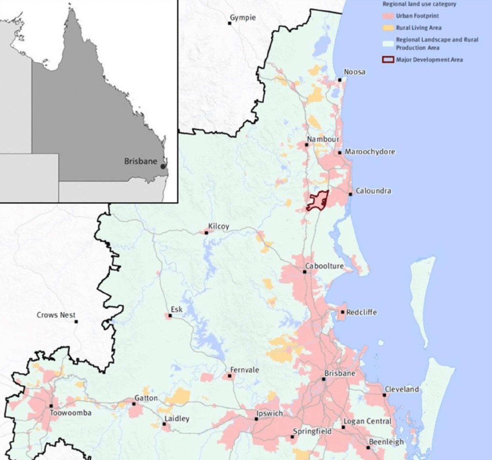
SEQ Regional Plan 2009–2031
The South East Queensland Regional Plan 2017, also known as ShapingSEQ is a regional plan for South East Queensland (SEQ), Australia and includes Ipswich City Council (urban extent only).
It is a long-term strategic plan that guides land use and development in the region. Developed by the Queensland Government, ShapingSEQ is intended to support sustainable growth and development while protecting the region's natural and cultural heritage. The plan includes policies and guidelines on land use, infrastructure, transport, environment, and economic development.
The plan identifies priority growth areas and development corridors, and sets targets for population growth and housing supply in the region. It also includes strategies for managing urban sprawl, protecting natural resources and biodiversity, and addressing climate change impacts.
The plan also lays out the vision for the region in 2041 which includes a liveable, sustainable, and prosperous region, with a focus on protecting the environment and encouraging sustainable development, as well as improving connectivity and accessibility throughout the region. ShapingSEQ provides a regional framework for growth management and sets the planning direction for sustainable growth, global economic competitiveness, and high-quality living by:
Identifying a long-term sustainable pattern of development which focuses more on growth in existing urban areas
Harnessing regional economic strengths and clusters to compete globally
Ensuring land use and infrastructure planning are integrated
Valuing and protecting the natural environment, productive land, resources, landscapes, and cultural heritage
Promoting more choice of housing and lifestyle options
Locating people and jobs closer together, and moving people and goods more efficiently and reliably
Promoting vibrant, fair, healthy, and affordable living and housing to meet all the community's needs
Valuing design and embracing the climate to create high-quality living environments
Maximising the use of existing infrastructure and planning for smarter solutions for new infrastructure
Supporting strong rural communities and economic diversification.
Regional Growth Management Strategy 2042
The Growth Management Strategy 2042 provides a roadmap for sustainable growth in the region over the next 20 years, aligned with the 'Our Well-Planned Places' goal of the Corporate Plan 2022-2027. It outlines strategic priorities, policies, and actions for short, medium, and long-term outcomes, with a focus on monitoring progress. As one of six central council strategies, it ensures an integrated approach to planning, responding to the South East Queensland Regional Plan 2017. It builds on past achievements, addresses gaps, and responds to housing challenges while preserving local character. Neighbourhood planning and employment opportunities are emphasized, with collaboration being key to its success.
South East Queensland City Deal – Implementation Plan
The Australian Government, Queensland Government, and Council of Mayors (SEQ) are already delivering for local communities throughout South East Queensland. They are focused on commitments that meet four strategic outcomes: accelerating future jobs across SEQ; a faster, more connected SEQ region; a more liveable SEQ; and creating thriving communities for SEQ.
The SEQ City Deal agreement was signed on 21 March 2022 by the Australian Government, Queensland Government and Council of Mayors (SEQ). The accompanying deal document sets out the vision, objectives, and commitments.
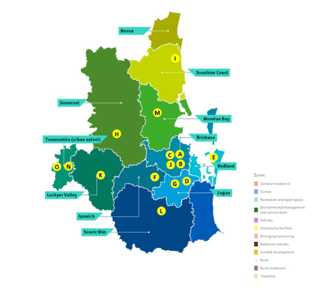
The SEQ City Deal Implementation Plan was released in July 2023 and provides details about how the Deal will be delivered, commitment milestones and funding arrangements. The document identifies the Ipswich City Council area as F (Public Transport Corridor Upgrade).
Sekisui House – South Ripley Development
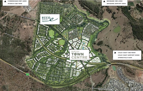
Ripley Valley, part of South East Queensland’s western growth corridor is projected to reach 4.4 million by 2031. Planned to house 120,000 residents in 50,000 homes, Ripley Valley is one of the largest greenfield developments in the area. Key transport links include the Centenary Highway and a future extension of the Springfield rail line, ensuring seamless connectivity.
At the heart of Ripley Valley is Ecco Ripley, a master-planned community by Sekisui House north of South Rpley. It has a Town Centre that will span 194 hectares, offering civic and commercial spaces alongside 4,000 homes for over 10,000 people.
Development is already underway, marking Ripley Valley as a cornerstone of Queensland’s future growth.
Ipswich Council Planning Scheme (2024)
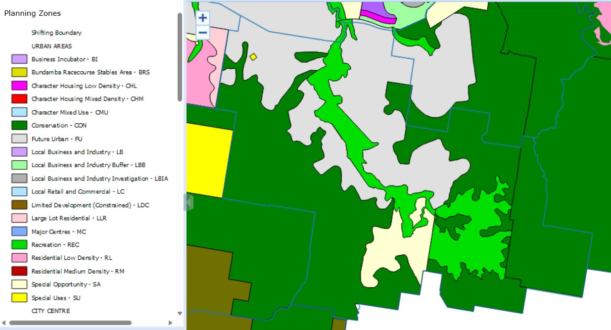
The council is responsible for ensuring adequate housing, facilities, infrastructure, and services for new residents and businesses. The city of Ipswich is experiencing rapid growth, with a current population of around 247,000 expected to reach 535,000 by 2046. To address this growth, the Council has developed the Ipswich Plan 2024, a comprehensive planning scheme for the next two decades.
The draft Ipswich Plan 2024 was available for public review from May 15 to July 16, 2023. The council is now in the process of reviewing and considering all submissions received during this period and will compile a report on the consultation.
Revisions to the plan may occur based on feedback and changes in circumstances, such as drafting errors or new planning information. Upon completion of the review process, the plan will be submitted to the state government for final approval, aiming to replace the current 2006 Ipswich Planning Scheme.
We anticipate that the Ipswich Plan 2024 will come into effect in early 2024, contingent on approval from both the state government and the Council.
Youtube - New Ipswich Planning Scheme: Ipswich Plan 2024 (youtube.com)
South Ripley Suburb Summary
References
Ipswich City Planning Scheme
South East Queensland City Deal – Implementation Plan
Providence – Stockland
Ecco Ripley - Sekisui House