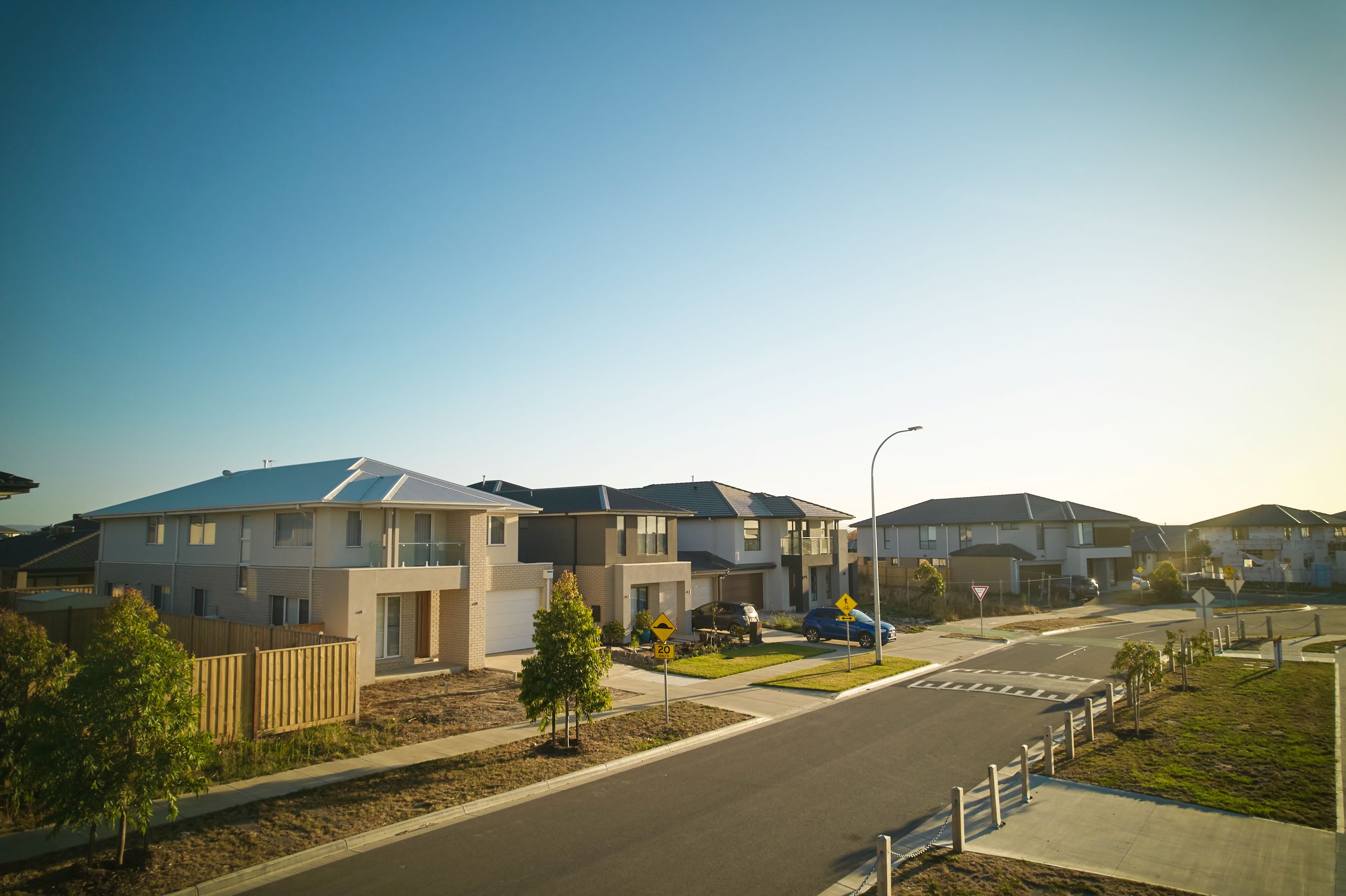
Riverfield Estate - Clyde 3 AVAILABLE
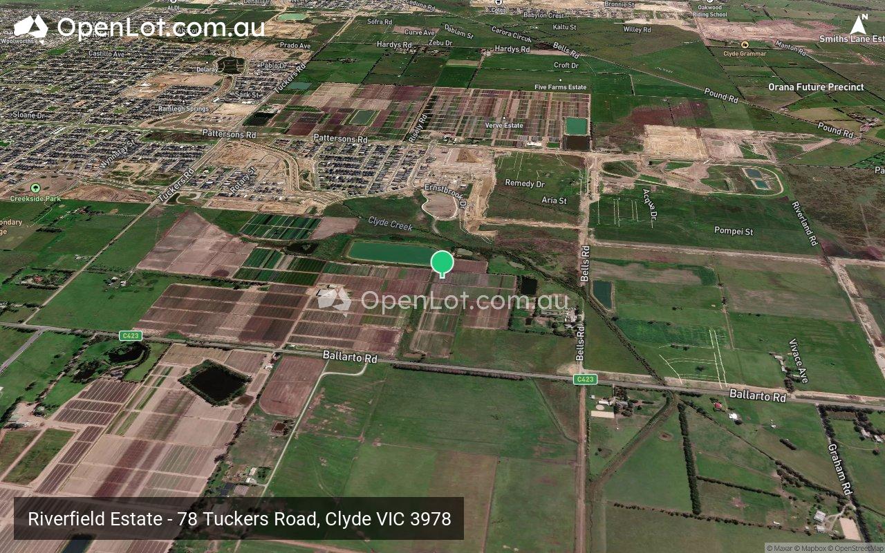
 78 Tuckers Road, Clyde VIC 3978
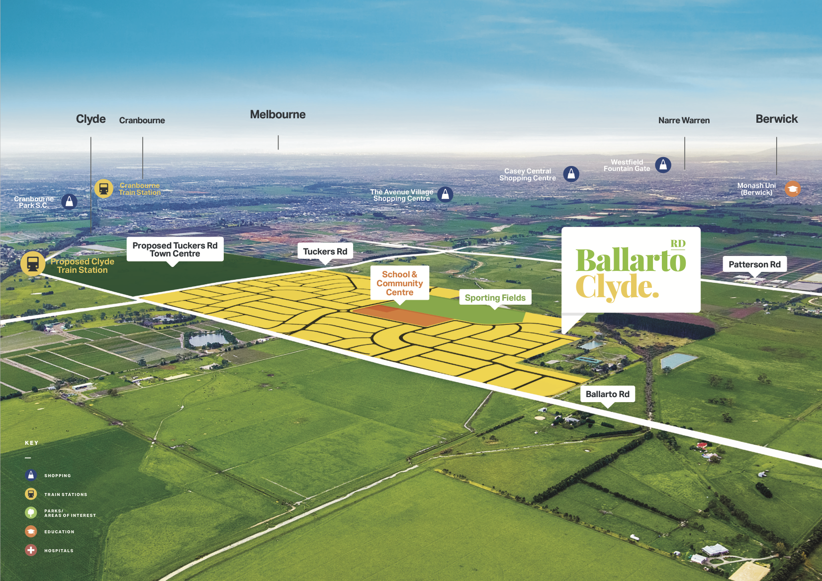
[NEW RELEASE] Clyde's most sought after address! Land Now Selling from just $340k.
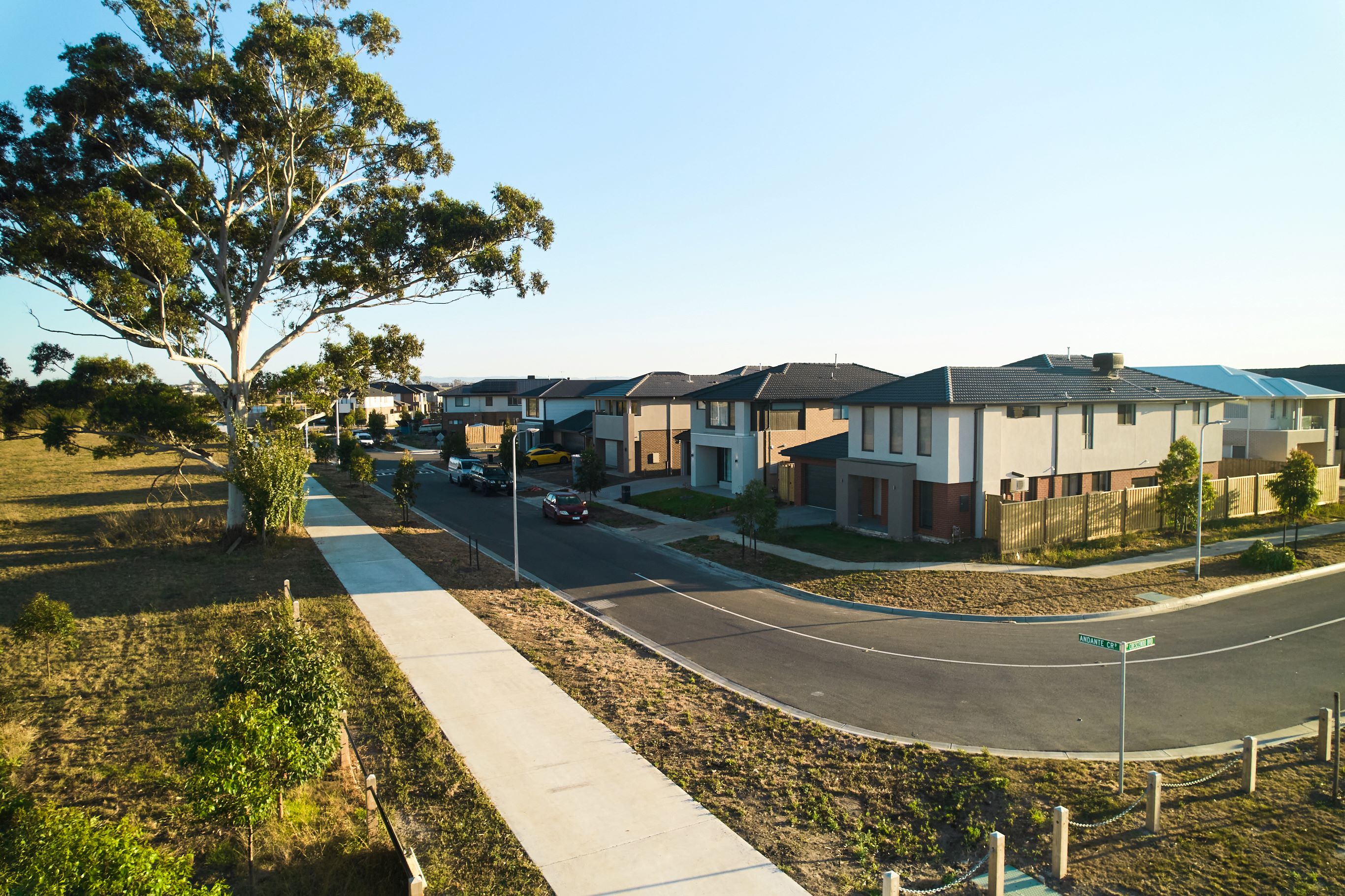
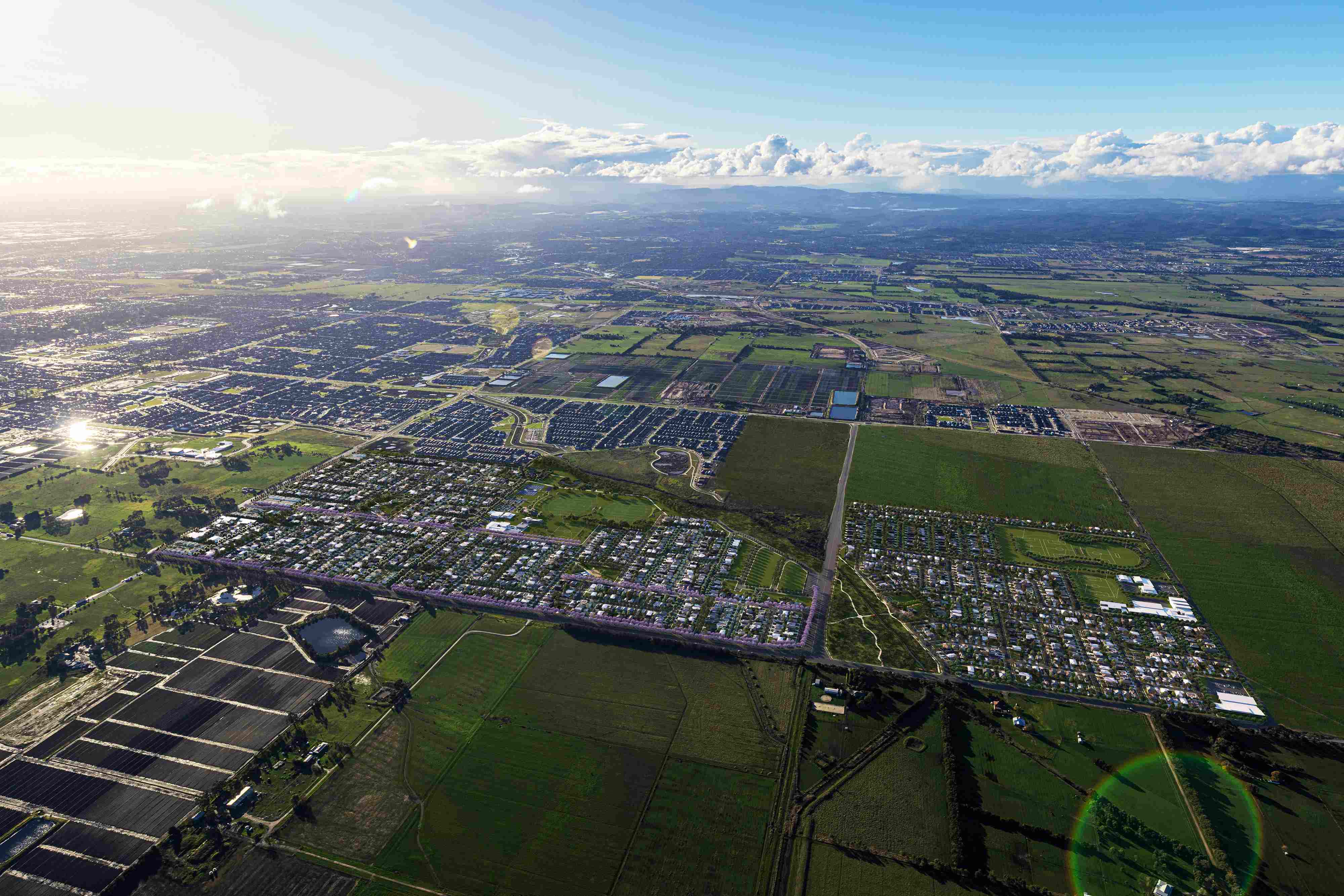
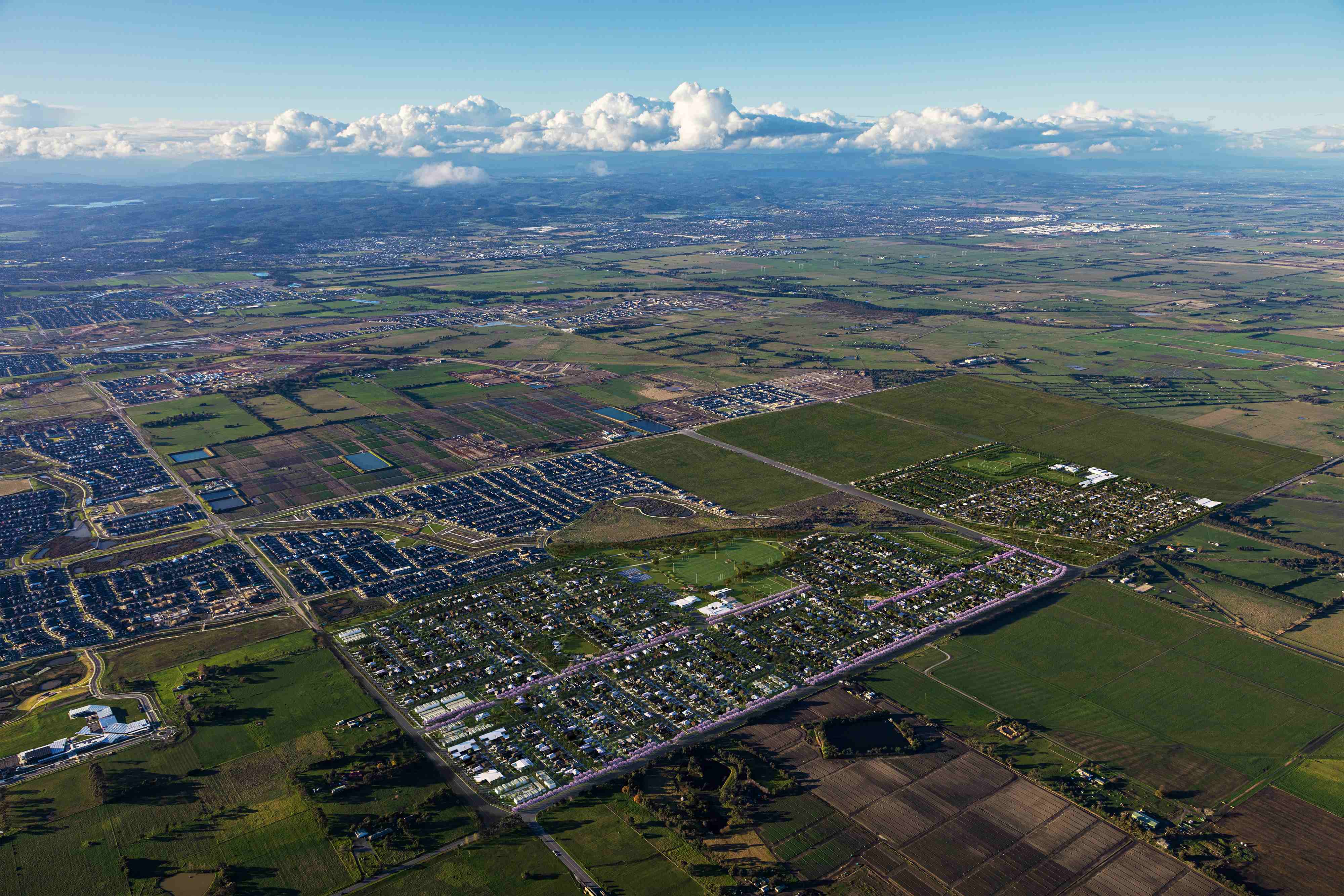
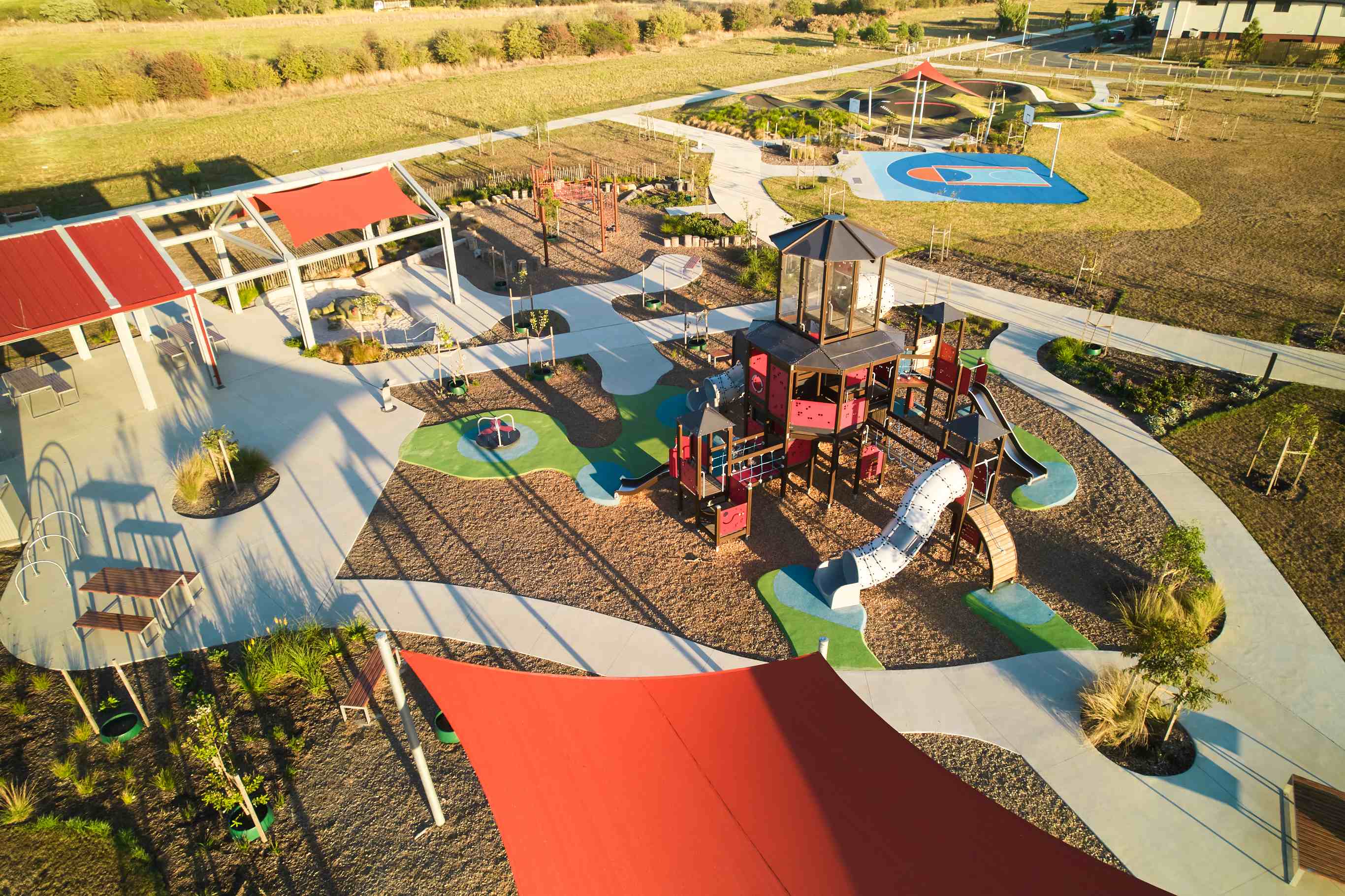
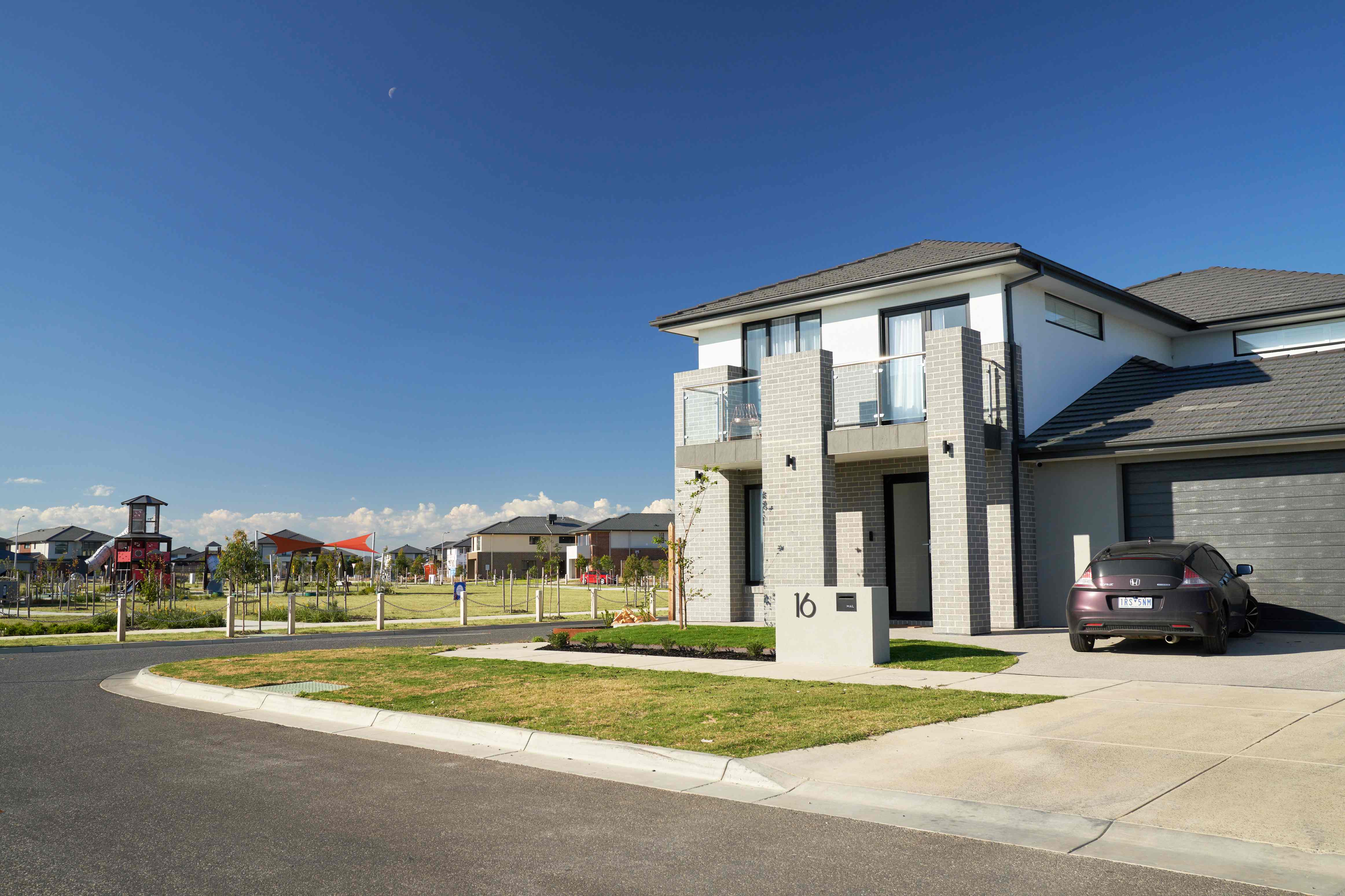
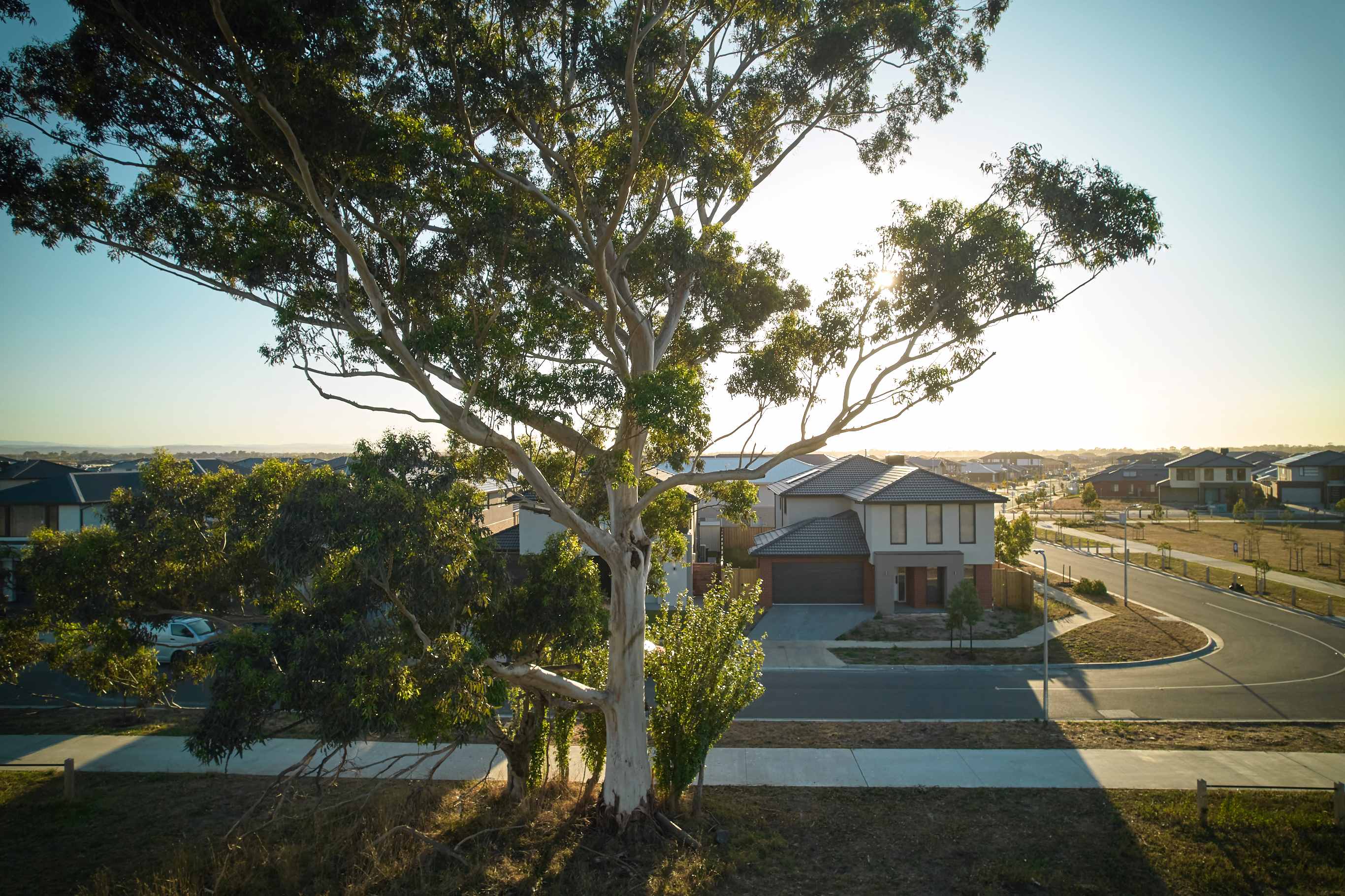
- Ready for a better lifestyle? At Riverfield, the sky’s the limit. Surrounded by lush parks, peaceful creeks and natural beauty, you'll enjoy the serenity of wide open spaces every day.
- With an abundance of established and upcoming amenities on all sides, everything you need is right at your doorstep.
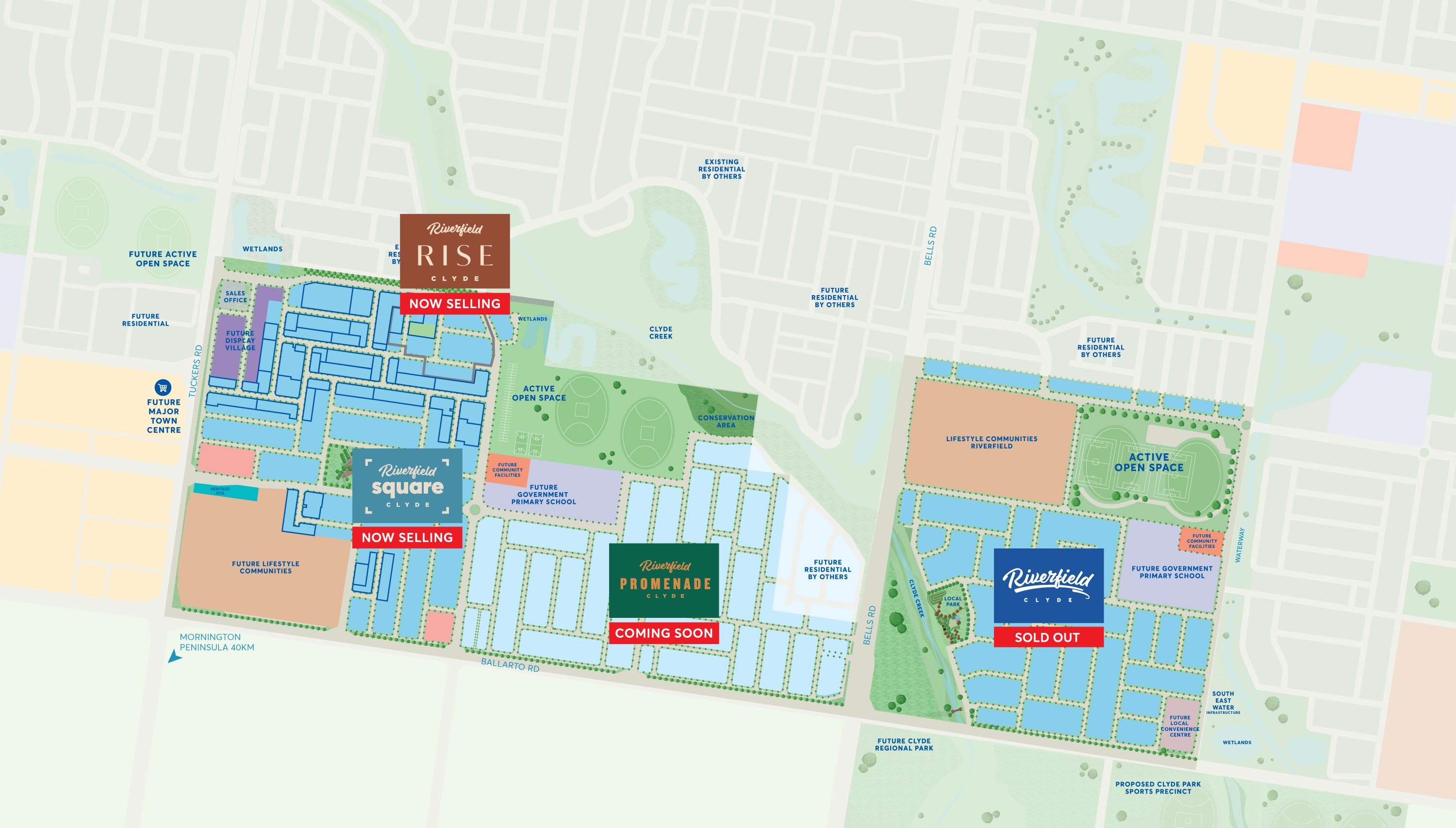
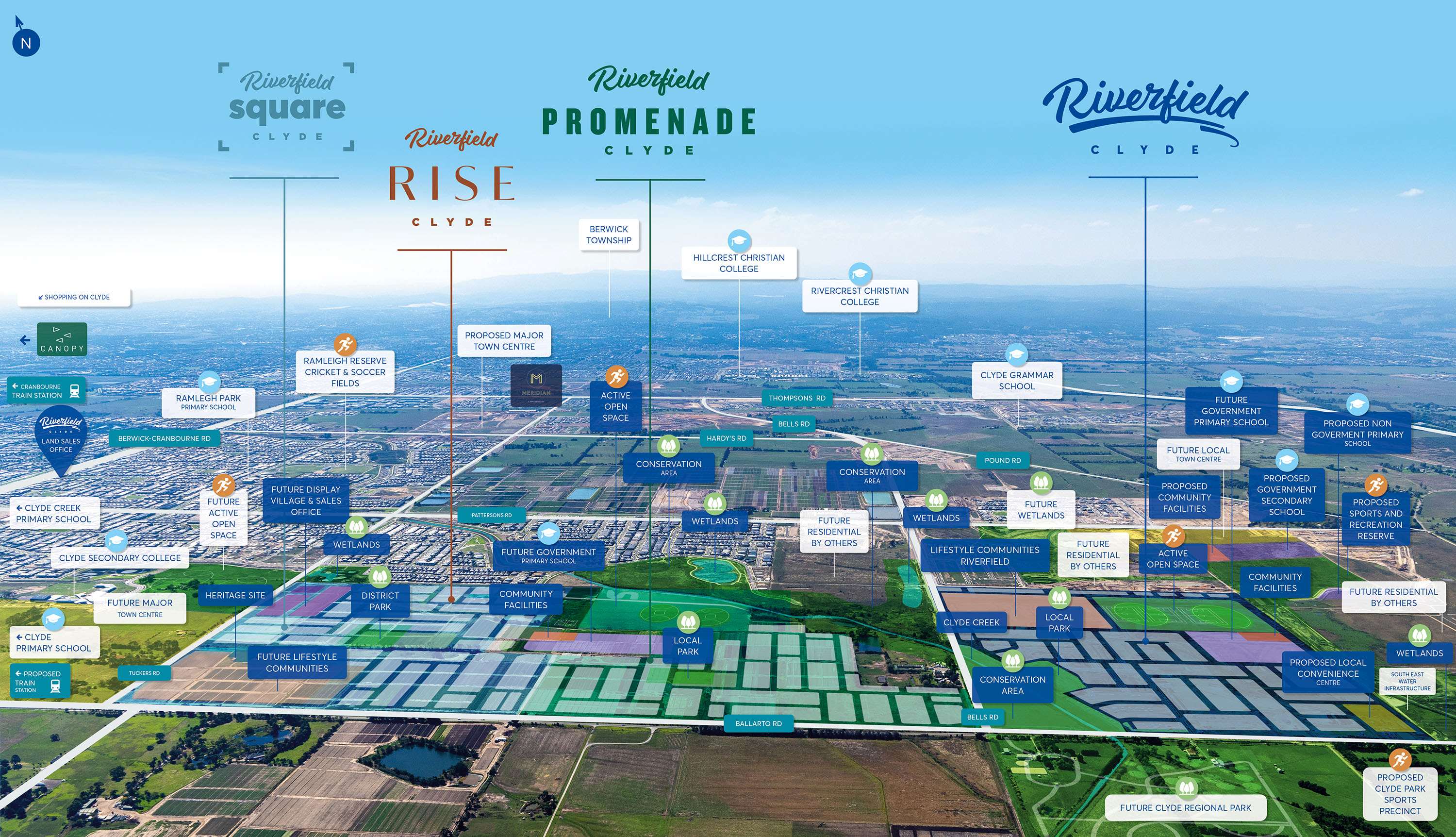
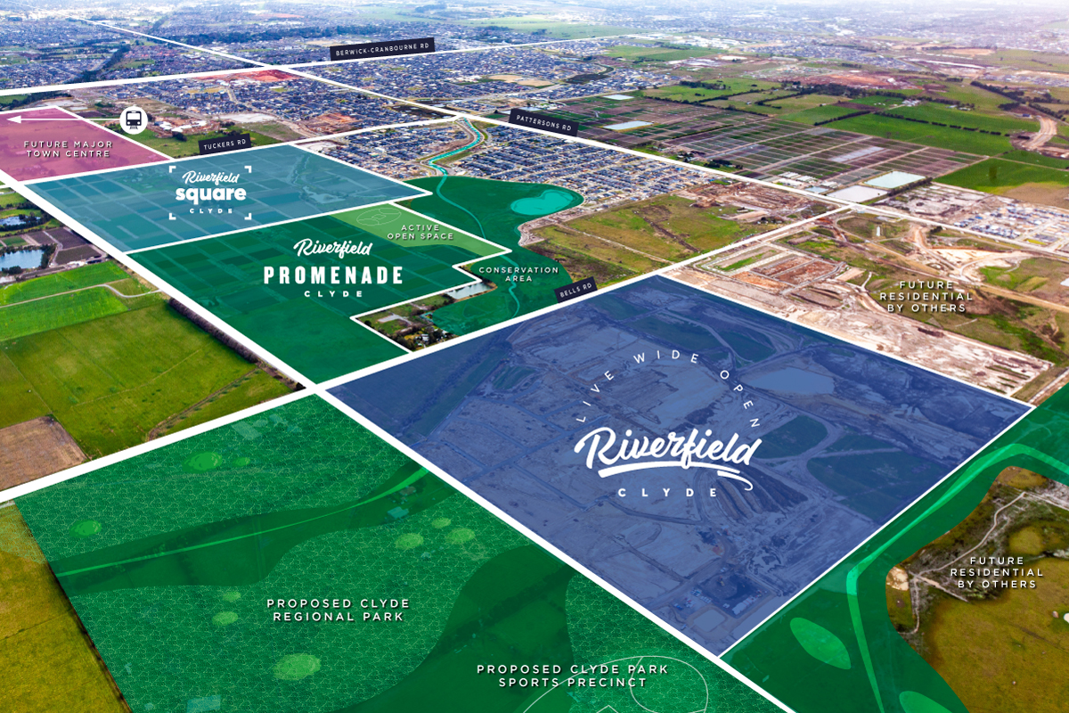
- Encompassing four incredible precincts, Riverfield has been thoughtfully designed to accommodate every stage of life.
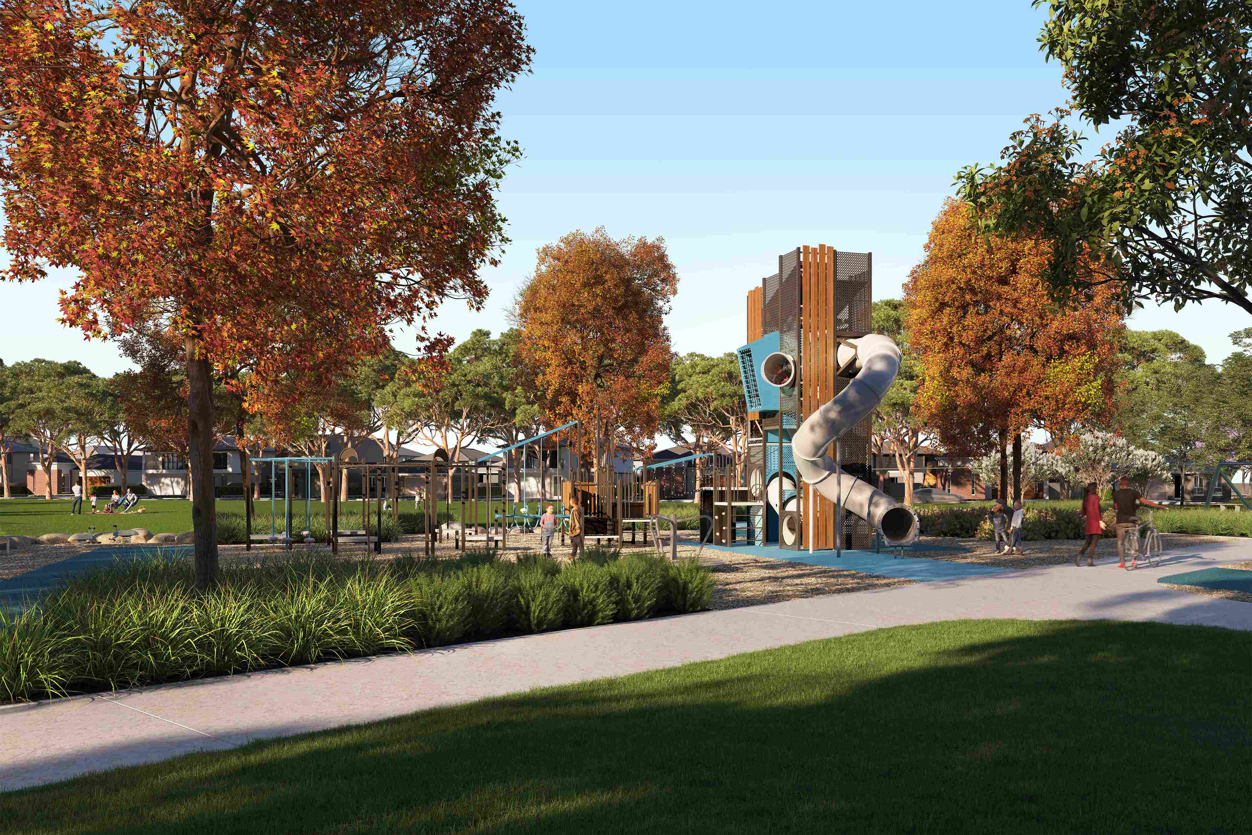
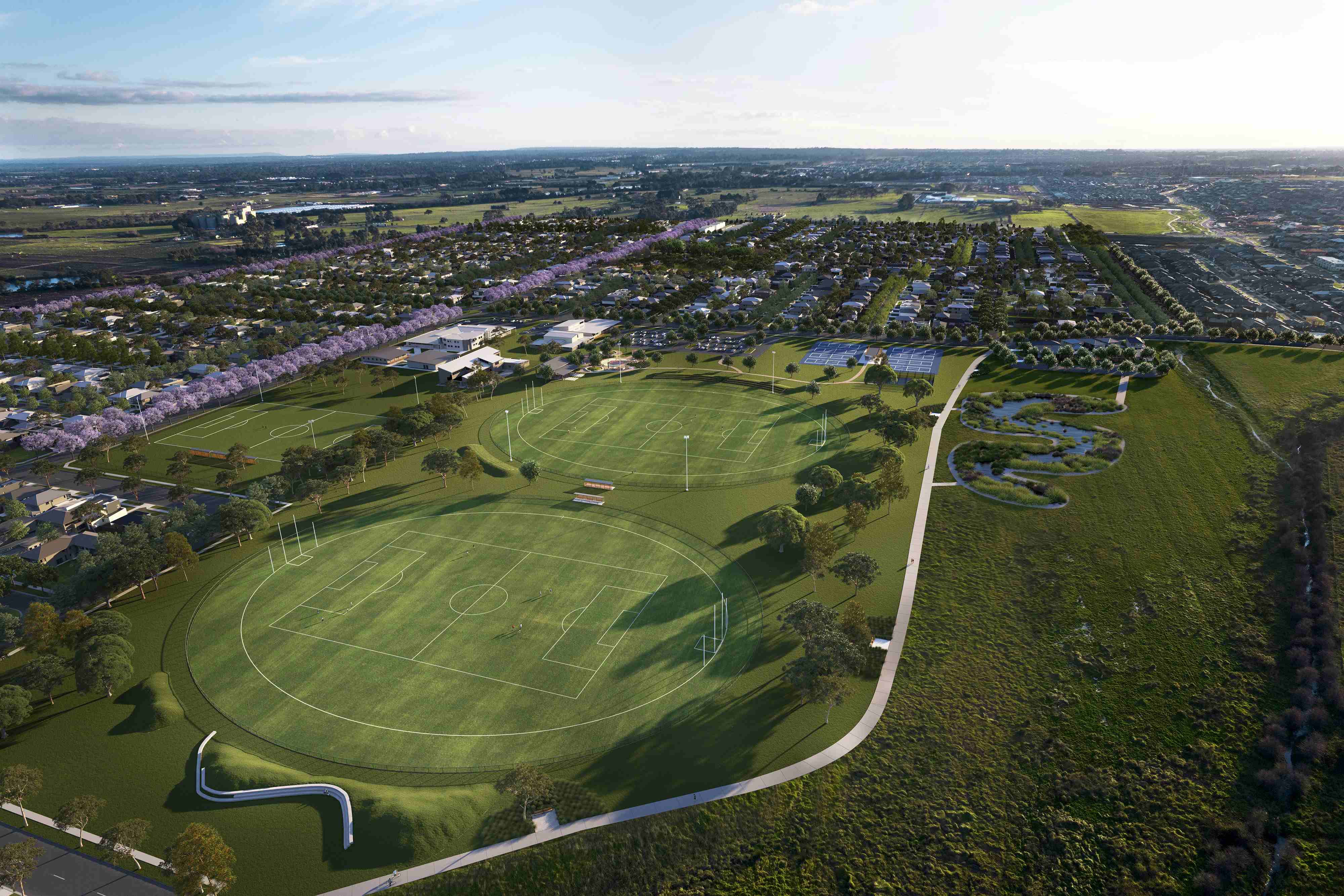
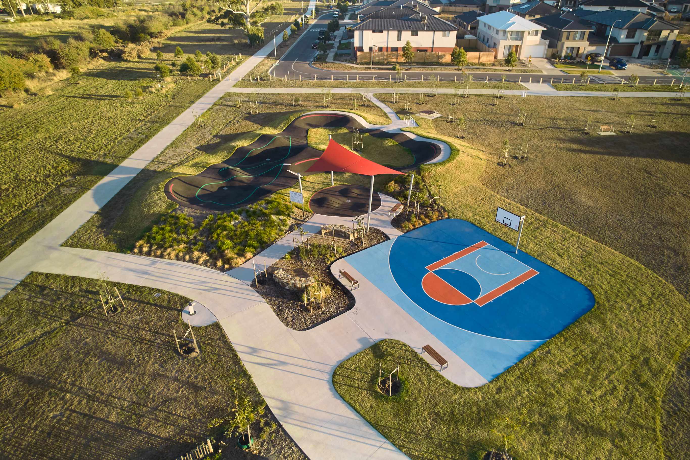
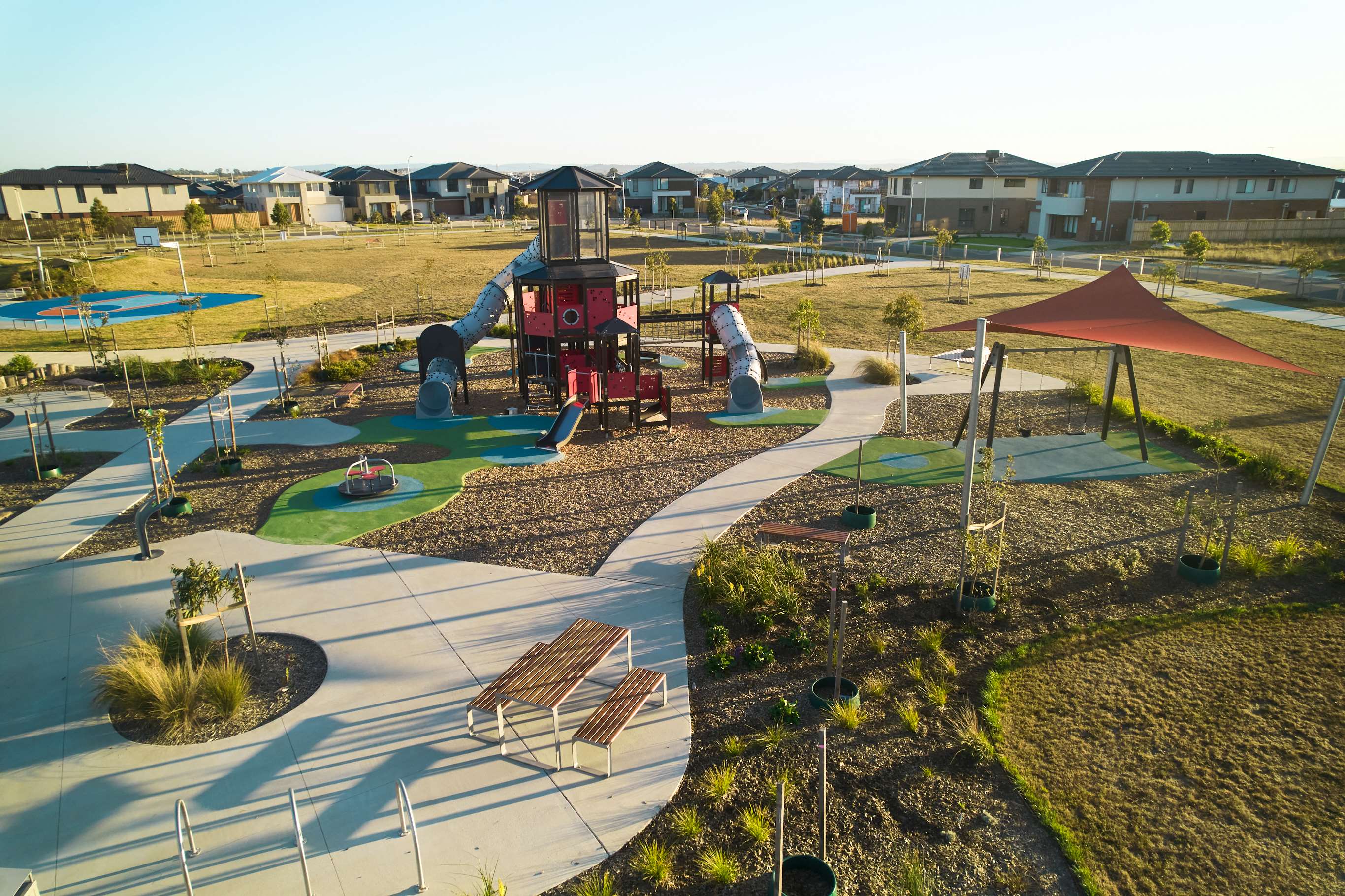
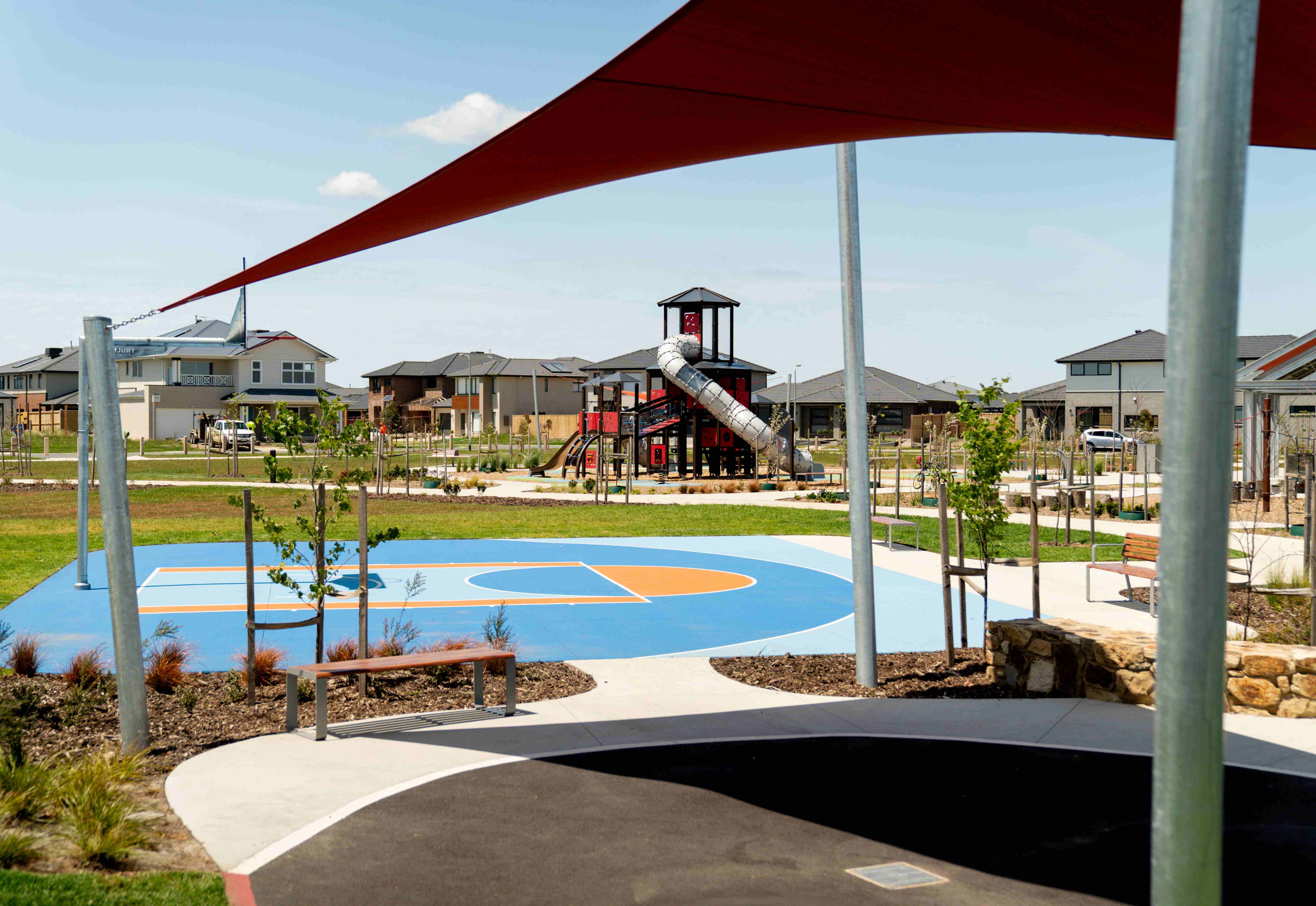
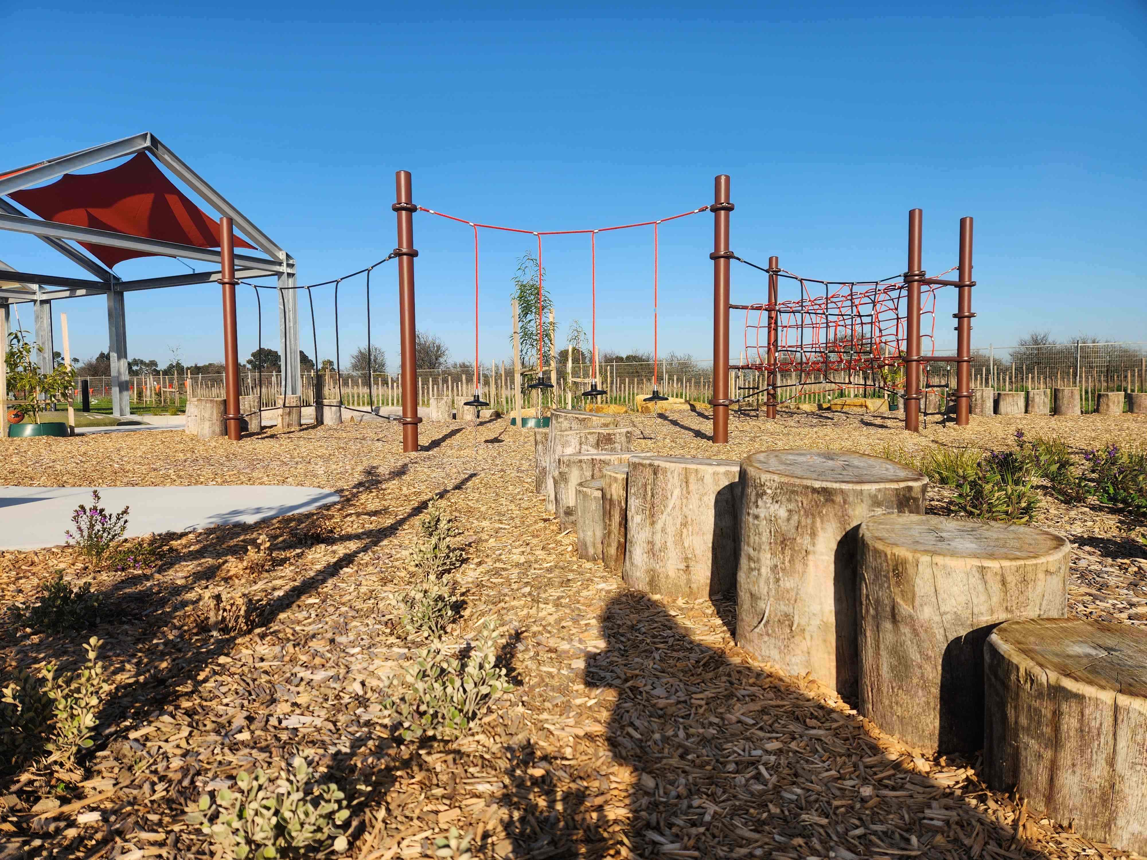
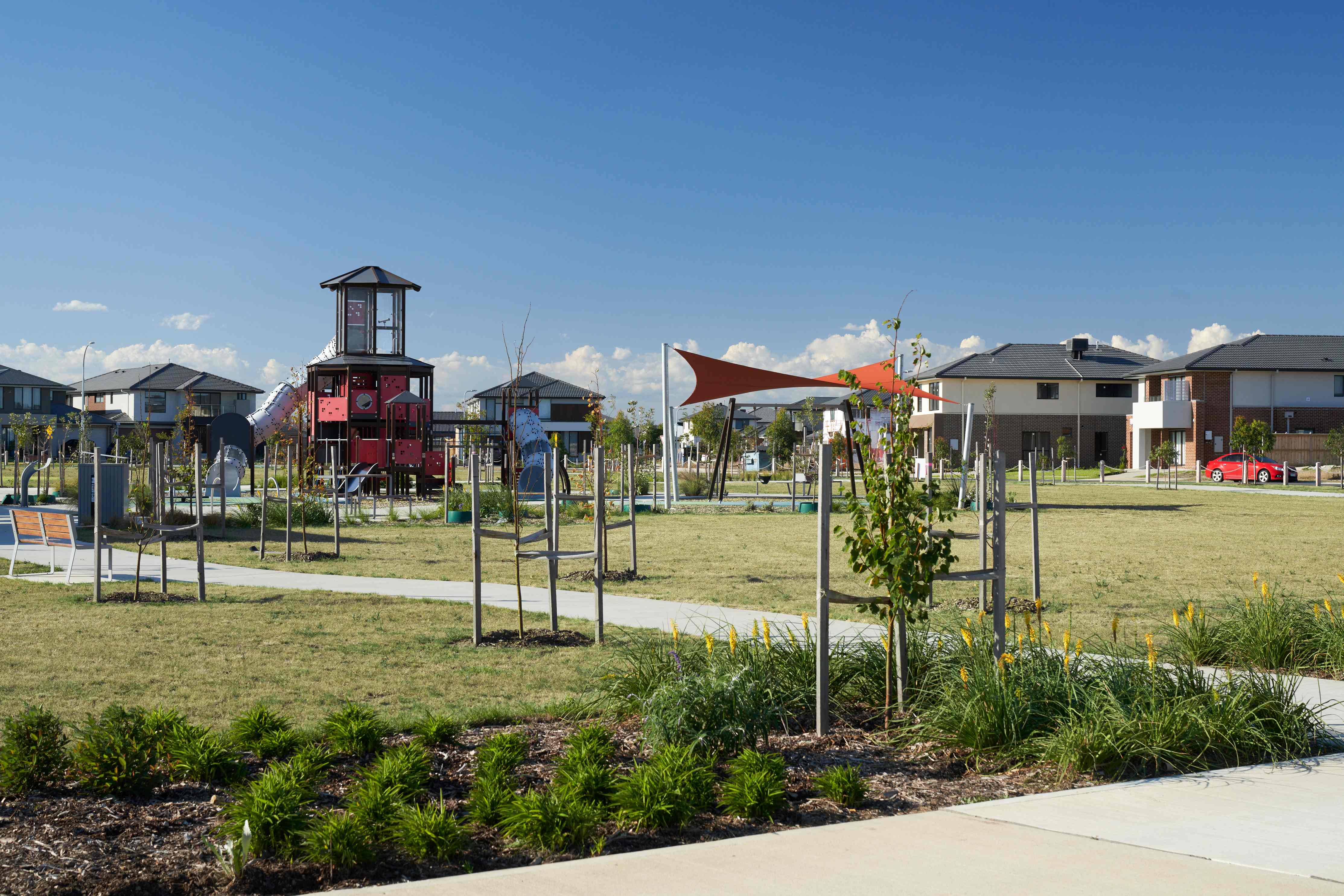
- Enjoy 28 hectares of beautifully landscaped open space, parks and reserves. One park has been delivered, and there's plenty more to come!
- With two schools planned - one due to open in 2026 - and Clyde Secondary College just around the corner, education options are plentiful.
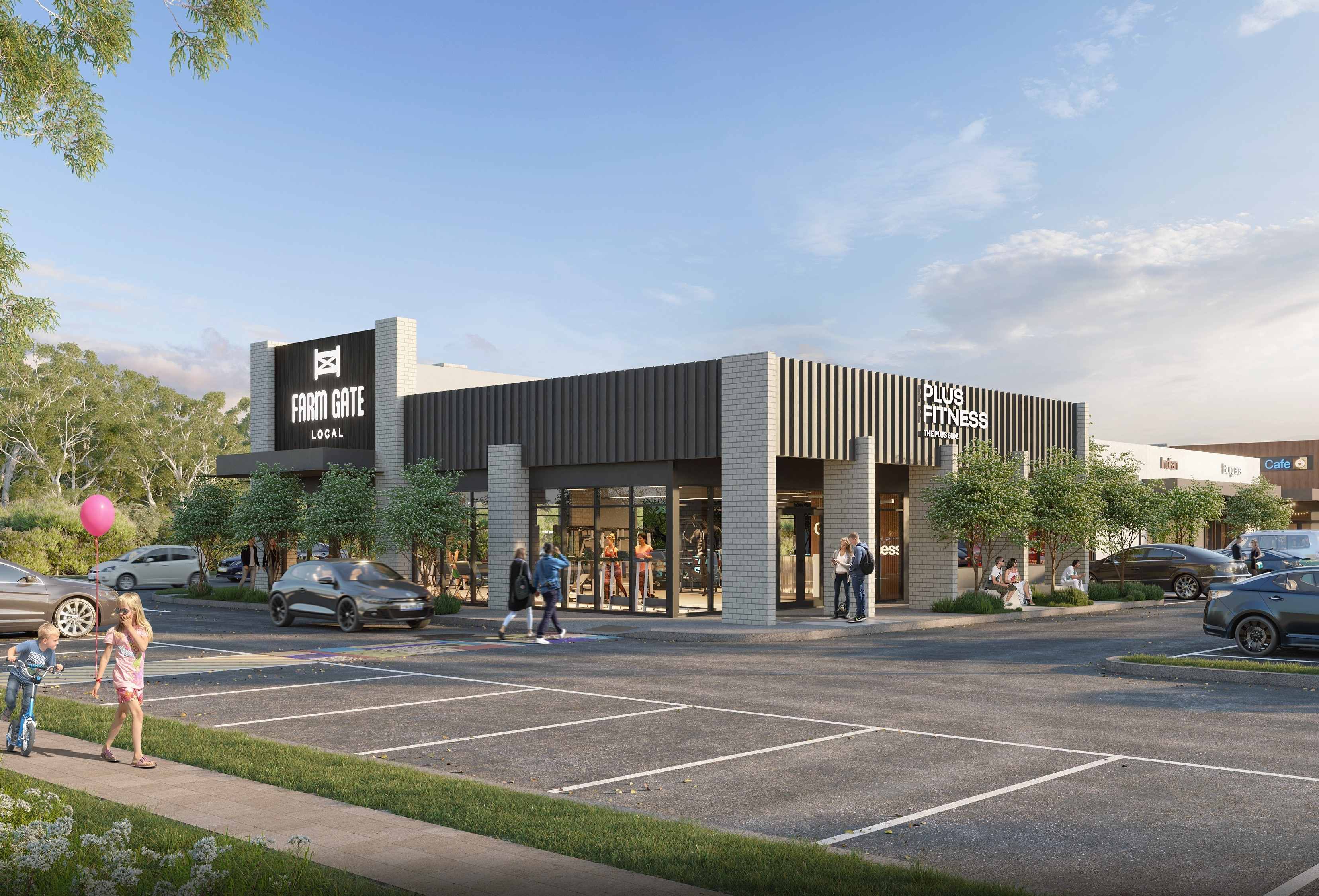
- The future Major Town Centre will be a vibrant hub for our residents, offering everything from grocery stores to food and beverage outlets and everything in between. With Berwick and Cranbourne close by, there are plenty of places to explore.
- Stay active at the proposed Clyde Sports Precinct and future Clyde Regional Park, or enjoy a more leisurely pace on the various interwoven bike paths and walking trails within our neighborhood.
- Discover the natural surrounds of Clyde Creek, the future Conservation Area and the future Wetlands, each offering a serene oasis just beyond your own backyard.
- Thoughtfully designed to accommodate every stage of life, it’s Clyde’s best new community - where space and convenience come together.
- A fantastic selection of Land Lots and House and Land Packages are Now Selling at Riverfield.
- Visit our Sales Office at 1 Dowling Way, Clyde, or contact our friendly sales team to learn more and take your first step toward joining our ever-evolving community today. We are open Saturday-Wednesday, 11am-5pm.
This information is estimated by the OpenLot research team. Let us know here to provide up-to-date information about this development.
| Total new homes | 2,300 |
| Area size | 182.75 hectares |
| Growth Region | Melbourne South East Growth Corridor |
| City council | Casey City Council |
| Developer | Brown Property Group |
| Creative agency | Sense Creative Agency |
| Other names | Riverfield Square, Riverfield Promenade, Riverfield Rise |
| Distance to | Melbourne CBD - 49 km south-east |
Land for Sale, House and Land Packages:
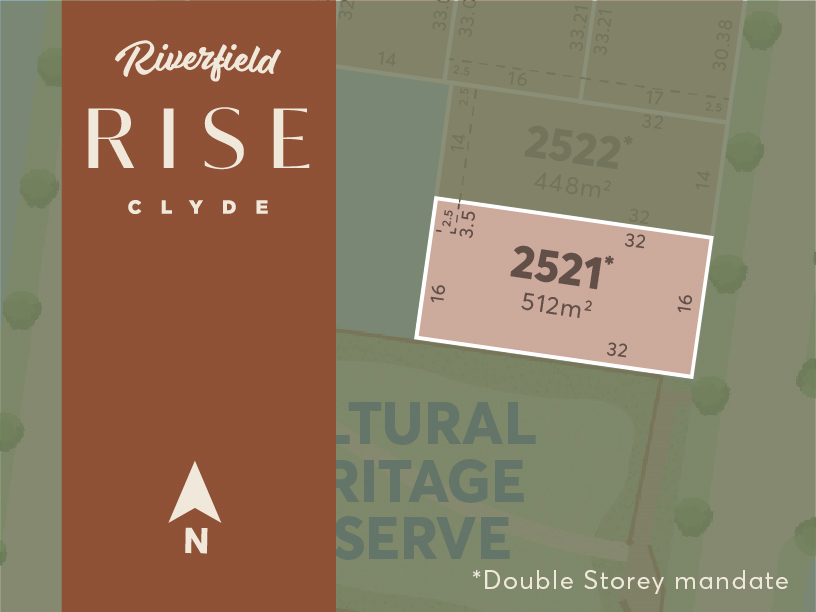
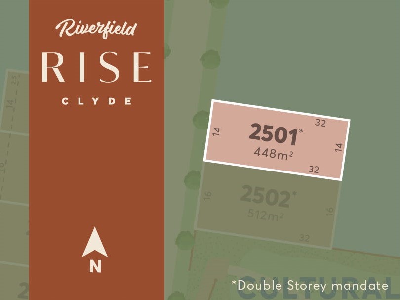
3 Land Lots in Riverfield Estate - Clyde
Walk along wide, tree-lined boulevards to your local park, to the exquisite native wetlands, or to the Heritage Reserve Lookout where you can admire all that Riverfield Rise has to offer.
Share breakfast with friends at the nearby future Major Town Centre, while the kids attend the future Government Primary School, Kindergarten, or Clyde Secondary College just down the road.
Comprising a limited release of just six exclusive homesites ranging from 448m2 to 562m2, the Monroe release is a rare opportunity to elevate your lifestyle. And, with a landscape incentive of up to $10,000*
For more information please visit our Land Sales and Information Centre located at 1 Dowling Way, Clyde North, VIC, 3978. We are open 7 days a week, from 11:00am – 5:00pm

Position near the upcoming display village, Lot 2163 if the perfect sized block for anyone looking to build a generous single or double storey home.
With titles forecasted February 2025 this lot wont last long!
Approx West Facing.
Deposit is 5% of the purchase price.
For more information please visit our Land Sales and Information Centre located at 1 Dowling Way, Clyde North, VIC, 3978. We are open 7 days a week, from 11:00am – 5:00pm
Interactive Masterplan for Riverfield Estate - Clyde
Popular Estates near Riverfield Estate - Clyde


 4
4  3
3  2
2


Updates for Riverfield Estate - Clyde
Facebook updates:
Related news:
Former Carlton great Fraser Brown paid almost $250m for a site in Melbourneâs south-east and Stockland has bought a large site in the cityâs west.

RPM Real Estate Group have listed for sale one of Melbourne’s most significant land development opportunities for 2016 in Clyde.
The next exciting phase of our community has arrived, with the introduction of two new precincts: Riverfield Square and Riverfield Promenade!
Missing articles? Send us a link here.
Location & Map for Riverfield Estate - Clyde
Visit Display Homes near Riverfield Estate - Clyde


Land Price Trend in Clyde VIC 3978
- In Apr - Jun 24, the median price for vacant land in Clyde VIC 3978 was $331,800. *
- From Oct - Dec 17 to Apr - Jun 24, the median price for vacant land in Clyde VIC 3978 has increased 7.03%. *
- From 2010 to 2023, the median price for vacant land in Clyde VIC 3978 has increased 72.09%. *
Schools near Riverfield Estate - Clyde
Here are 6 schools near Riverfield Estate - Clyde:
7-8 Government Secondary School
U, Prep-6 Government Primary School - School Head Campus
Prep-6 Government Primary School
Prep-6 Government Primary School
Prep-3 Independent Primary School
Prep-6 Catholic Primary School
Suburb Planning Review in Clyde VIC 3978
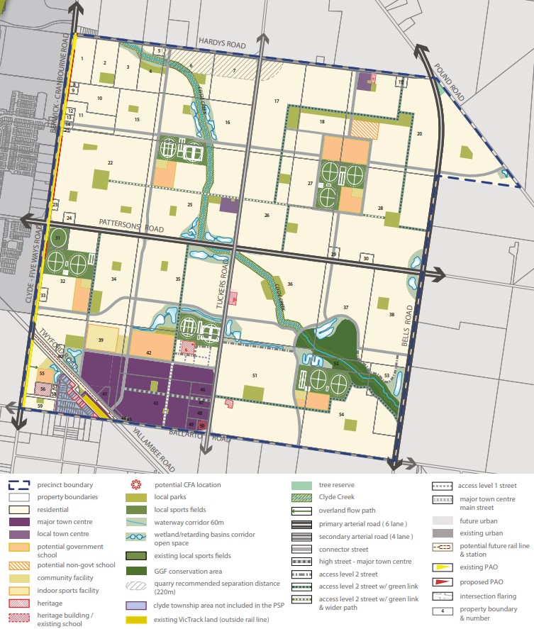
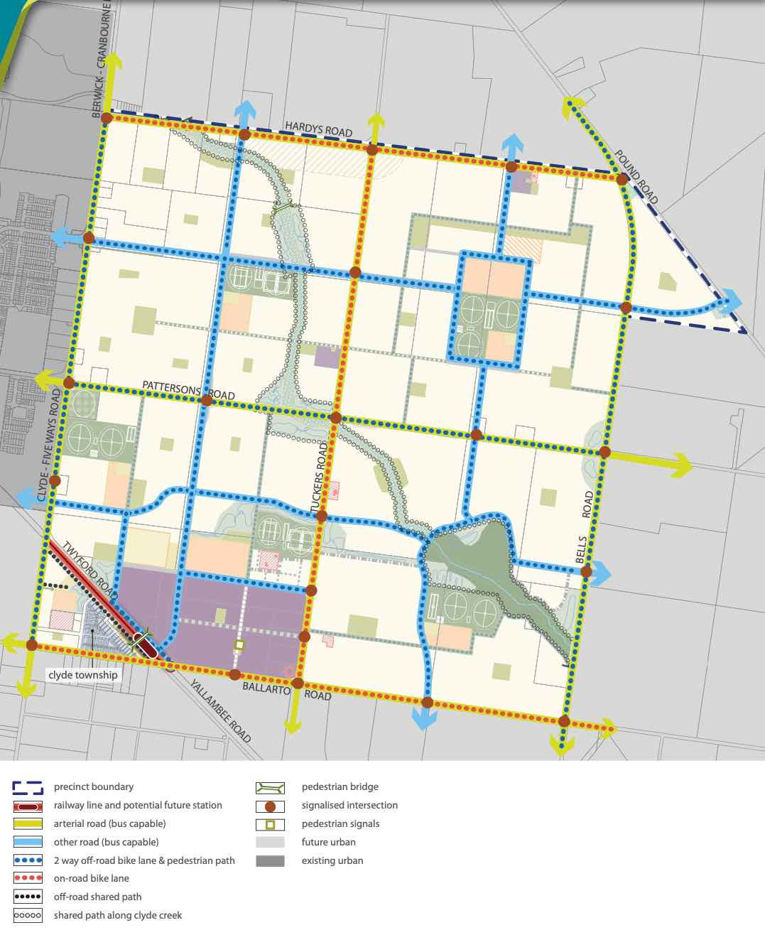
Clyde is with the City of Casey located 48 kilometres South-East of Melbourne, which contains a rural-residential township that forms part of the Urban Growth Boundary. The Clyde growth area is approximately 1,154 ha, which is located on either side of the Pattersons Road.
The new suburb is bounded by Clyde-Five Ways Road to the west, Pound Road and Bells Road extension to the east, Hardys Road to the north and Ballarto Road to the south.
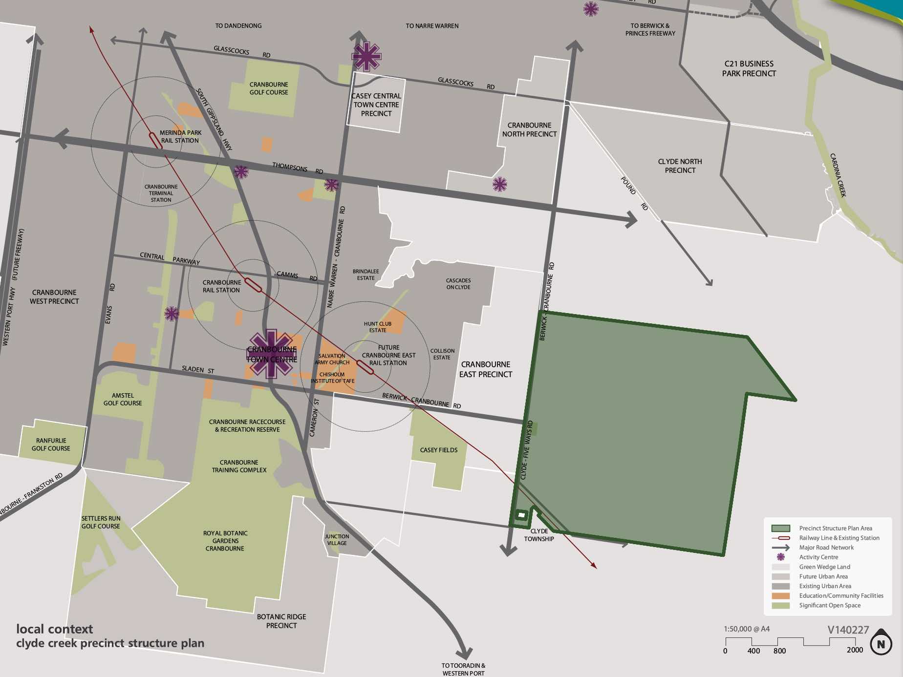
The Clyde Creek Precinct Structure Plan (PSP) was prepared to guide the future community, visitors and workers within the area. The PSP seeks to provide access to services, recreation, employment, shopping and transport infrastructure necessary to support quality of lifestyle and a mix of affordable housing.
The conservation and enhancement of the significant biodiversity area of the Clyde Creek corridor have been recognised, which integrates the stormwater design and open space. A protected species of the Growling Grass Frog has been provided ponds and foraging areas along the Clyde Creek corridor and cultural heritage sites.
Clyde also has other Precinct Structure Plan areas to the north of the existing township. The Victorian Planning Authority (VPA) has prepared a Clyde North PSP that was approved by Minister for Planning in November 2011 through Amendment C186 to the Casey Planning Scheme.

The Clyde Creek Precinct Structure Plan PSP was prepared by Victorian Planning Authority (VPA) in consultation with the Casey City Council and was approved by the Minister for Planning in November 2014. The decision was officially gazetted in October 2014 under Amendment C186 to the Casey Planning Scheme, then further amended in October 2015.
The Vision of Clyde Creek
“Clyde Creek is planned to be a community where a distinct urban form, characterised by a grid of high quality streets, is complemented by an extensive natural creek environment and park network. The Clyde Major Town Centre, planned immediate to the north of the potential future Clyde railway station, will deliver extensive services and facilities to the surrounding residential area.”
“Clyde Creek will be a place that residents and businesses are proud to call home, a place of significant housing choice, catering for a diversity of people, and a connected community through public transport, road-trail networks and integrated community hubs.”
“Significant biodiversity within the Clyde Creek corridor has been recognised through the conservation and enhancement of the Growing Grass Frog Category 1 habitat area. The prominent landform of the precinct, Clyde Creek, will form the key environmental, recreational and community spine of the future suburb. The topography of the precinct provides for attractive views and vistas.”
“Heritage values - both aboriginal and cultural heritage and post-contact heritage sites - have been identified and incorporated into the future urban structure of Clyde Creek Precinct.”
Benefits of Clyde Creek
The existing zoning will be amended to provide for Urban Growth Zones, that will provide for a future urban structure and future development. The Clyde Creek Precinct Structure Plan provides for a diversity of streetscape, open space, local character and protection of the Clyde Creek Conservation Area that traverses the precinct.
Existing and proposed sports fields and parks are strategically located within the new residential areas. The major and minor town centre areas provide for social, retail and community infrastructure, with the largest located to the south west corner of the Precinct Structure Plan.
The Precinct Structure Plan provides the planning framework to facilitate the new mixed use community, new schools, sports and recreation areas and protect Clyde Creek.
Transportation in Clyde Creek
Clyde Creek will be connected to public passenger transport, with a future train station to be built in proximity to the south west of the Clyde Township and the passenger train service will connect to Melbourne CBD.
The suburb will include a network of shared paths, linking the local parks and a new road network. A road network including a 6 lane (primary arterial) road along Pattersons Road and 4 lane (second arterial) road along Tuckers Road to facilitate vehicle access to the surrounding growth areas and Clyde North. Access to Berwick – Cranbourne Road to the west will provide a direct connection to the Princes Freeway, access to Melbourne CBD or eastern Victoria.
Clyde Creek Suburb Summary
References
Victoria Planning Authority – Planning Schemes
Victoria Planning Authority – Clyde Creek PSP
Reviews & Comments on Riverfield Estate - Clyde
Estate Brochure, Masterplan, Engineering Plan, Plan of Subdivision (POS), Design Guidelines
FAQs about Riverfield Estate - Clyde
View all estates from Brown Property Group
- Clyde Secondary College - 1.7km west
- Clyde Creek Primary School - 2.5km north-west
- Ramlegh Park Primary School - 2.5km north-west
- Clyde Primary School - 2.7km west
- Clyde Grammar - 3.6km north-east
- St Thomas the Apostle Catholic Primary School - 4.0km north-west
Popular Estates near Riverfield Estate - Clyde
Latest New Home Articles for You

13/Mar/2025 | OpenLot.com.au
Home Building Hub Offers Expert Tips for Visiting Display Homes
The latest episode of "Home Building Hub," hosted by industry experts Col...
12/Mar/2025 | OpenLot.com.au
Display Homes at Botania Estate: A Charming New Boutique Community in Fraser Rise
Welcome to Botania Estate in Fraser Rise, where the charm of a boutique c...

11/Mar/2025 | OpenLot.com.au
4 Steps to Getting the Best Building Quotes
In the latest episode of the Home Building Hub podcast, hosts Colin Bisch...
10/Mar/2025 | OpenLot.com.au
Display Homes at Atherstone Estate: A Thriving Community in Melbourne’s Booming West
Welcome to Atherstone, a vibrant and flourishing masterplanned community ...
07/Mar/2025 | OpenLot.com.au
Kaduna Park: A New Chapter in Officer South's Real Estate Story
Nestled in the scenic beauty of Officer South, Kaduna Park is a testament...
![[Feb/2025] Top Most Searched Housing Developments in Australia](https://files.openlot.com.au/p/styles/500h/s3/article/Thumbnail%20-%20Top%2030%20Most%20Searched%20Housing%20Developments%20%281%29.png.webp?itok=wtjvzwHK)
06/Mar/2025 | OpenLot.com.au
[Feb/2025] Top Most Searched Housing Developments in Australia
OpenLot provides a comprehensive overview of leading housing developments...

05/Mar/2025 | OpenLot.com.au
Display Homes at Alfredton Grove Estate: A Premier Community in Alfredton's Growing West
Alfredton Grove has become one of the most desirable residential communit...
04/Mar/2025 | OpenLot.com.au
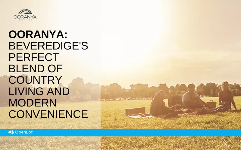
Display Homes at Ooranya: Beveredige's Perfect Blend of Country Living and Modern Convenience
Nestled in the charming town of Beveridge, Ooranya is a community designe...

03/Mar/2025 | OpenLot.com.au
The Rise of Regional Living: Why More Australians are Moving Beyond Major Cities
In recent years, Australia has witnessed a significant shift in populatio...