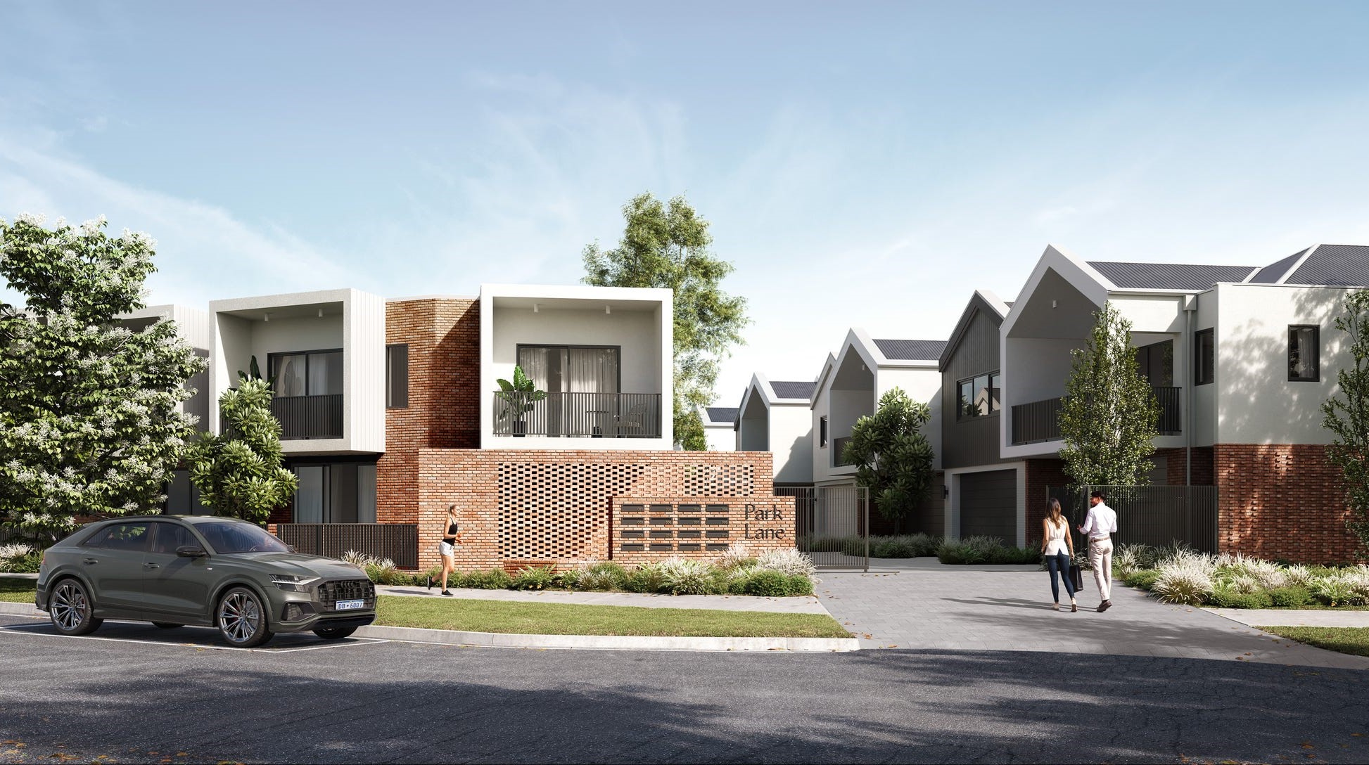
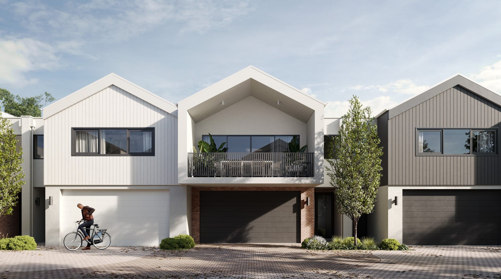
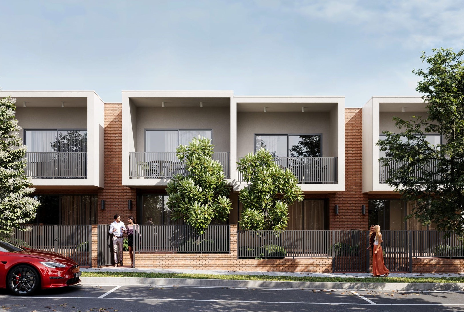
Park Lane Townhomes - Stirling
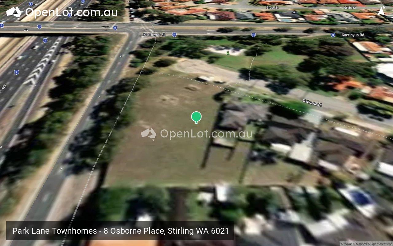
 8 Osborne Place, Stirling WA 6021
This information is estimated by the OpenLot research team. Let us know here to provide up-to-date information about this development.
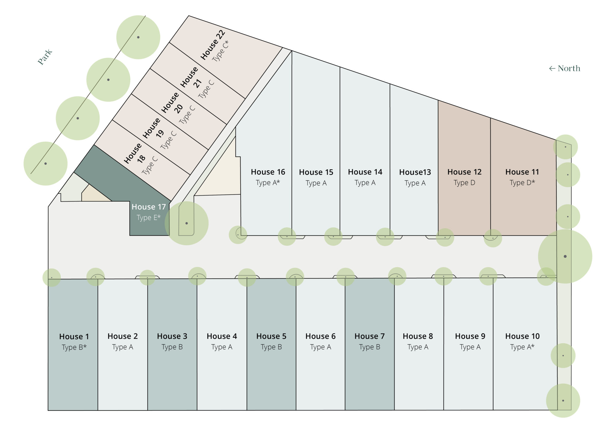
| Total new homes | 22 |
| Area size | 0.37 hectares |
| Growth Region | Perth North West Growth Areas |
| City council | City of Stirling |
| Developer | Locus Development Group |
| Project marketer | Mouve |
| Creative agency | Brandform |
| Distance to | Perth CBD - 9 km north-west Perth Airport - 17 km west |
Townhomes:
Popular Estates near Park Lane Townhomes - Stirling


Updates for Park Lane Townhomes - Stirling
Facebook updates:
Submit the Facebook page for Park Lane Townhomes - Stirling.
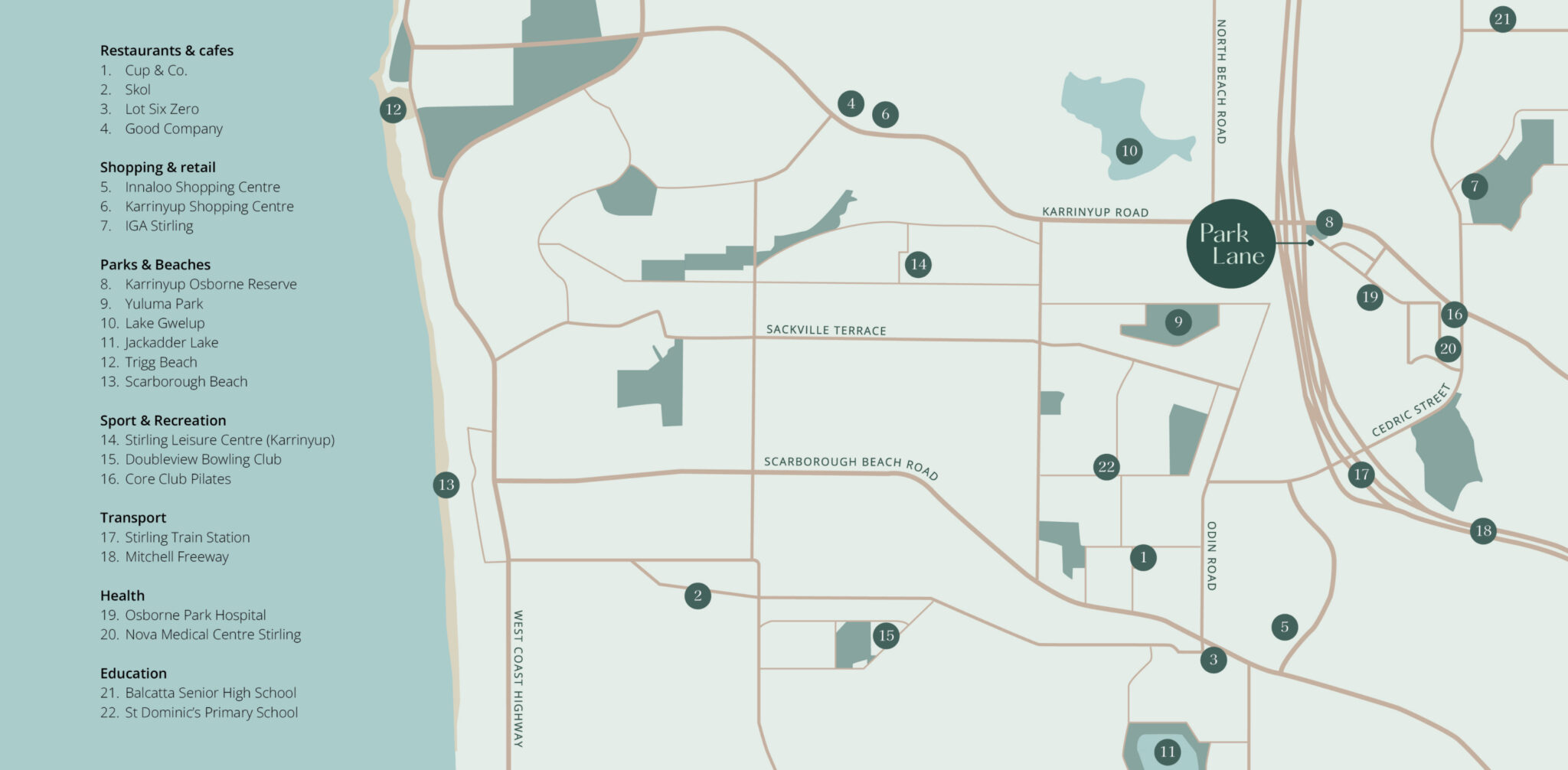
Location & Map for Park Lane Townhomes - Stirling
Display Homes near Park Lane Townhomes - Stirling


Vacancy Rate in Stirling WA 6021
View full vacancy rate history in Stirling WA 6021 via SQM Research.
Schools near Park Lane Townhomes - Stirling
Here are 6 schools near Park Lane Townhomes - Stirling:
7-12 Government Secondary School
K-6 Government Primary School
K-6 Government Primary School
K-6 Government Primary School
PP-6 Catholic Primary School
K-6 Government Primary School
Reviews & Comments on Park Lane Townhomes - Stirling
Estate Brochure, Masterplan, Engineering Plan, Plan of Subdivision (POS), Design Guidelines
FAQs about Park Lane Townhomes - Stirling
View all estates from Locus Development Group
View all estates marketed by Mouve
- Balcatta Senior High School - 1.3km north-east
- West Balcatta Primary School - 1.4km north-east
- Lake Gwelup Primary School - 1.4km north
- Yuluma Primary School - 1.5km south-west
- St Dominic's School - 1.6km south-west
- Newborough Primary School - 2.0km west
Popular Estates near Park Lane Townhomes - Stirling
Latest New Home Articles for You

13/Dec/2024
The Aussie Dream Is Alive: Despite Worry That New Homebuyers Must Settle for Apartments, New Data Reveals Australians Buy Twice as Many New Houses as Units
MELBOURNE (15 October 2024) — The Australian Dream of owning a detached h...

10/Dec/2024
Data Reveals It Costs 57% More to Build a New House than Before Covid
MELBOURNE (10 September 2024) — Australians are spending as much as 57% m...

21/Nov/2024
Decoding Terms Found In Drawings & Plans
In the latest episode of "The Home Building Hub" podcast, hosts Colin Bis...

12/Nov/2024
Victoria: Top 30 Most Searched Housing Developments (October 2024)
We’re excited to present the top 30 most popular housing developments in ...

12/Nov/2024
Western Australia: Top 30 Most Searched Housing Developments (October 2024)
If you've ever envisioned calling Western Australia home, now is an excel...

12/Nov/2024
South Australia: Top 30 Most Searched Housing Developments (October 2024)
South Australia, celebrated for its breathtaking landscapes and vibrant c...

12/Nov/2024
New South Wales: Top 30 Most Searched Housing Developments (October 2024)
If you've considered making New South Wales your home, now is an ideal ti...

12/Nov/2024
Queensland: Top 30 Most Searched Housing Developments (October 2024)
Spanning the sunlit shores of Australia’s eastern coast, Queensland—affec...
![[Oct/2024] Top Most Searched Housing Developments in Australia](https://files.openlot.com.au/p/styles/500h/s3/article/Thumbnail%20-%20Top%2030%20Most%20Searched%20Housing%20Developments_0.png.webp?itok=YtDmCKiT)
06/Nov/2024
[Oct/2024] Top Most Searched Housing Developments in Australia
OpenLot offers an in-depth look at top housing developments making an imp...