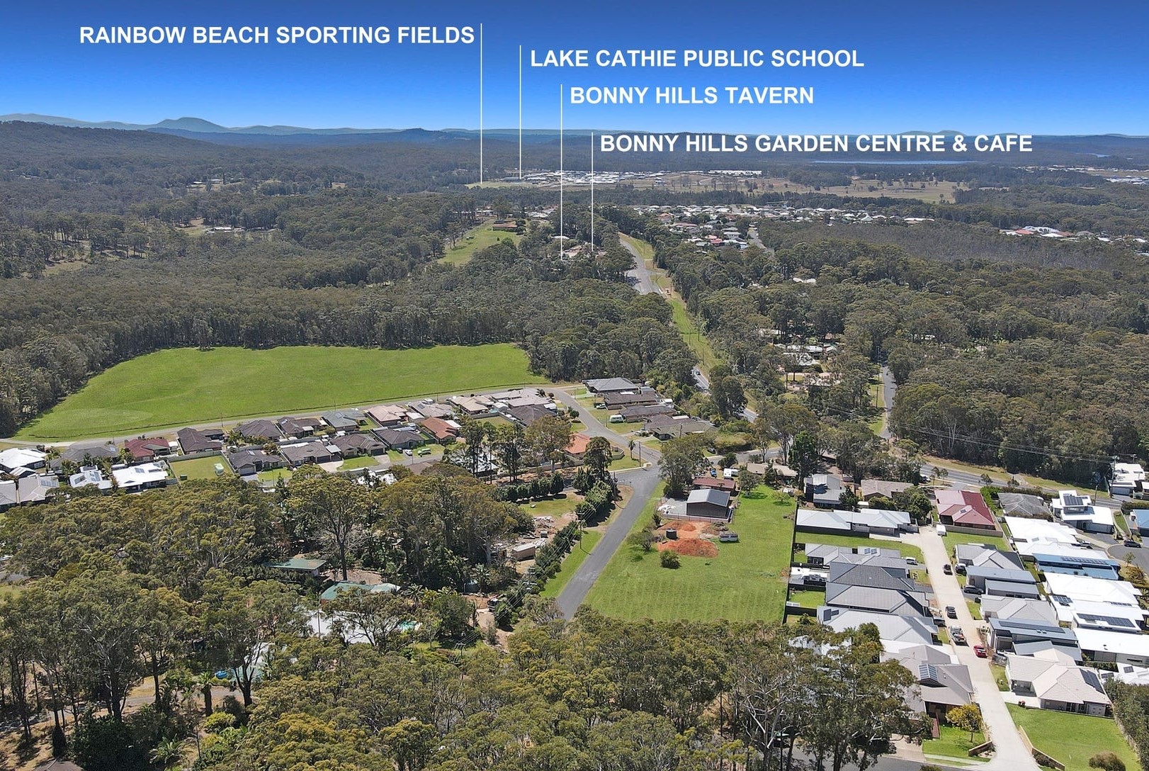
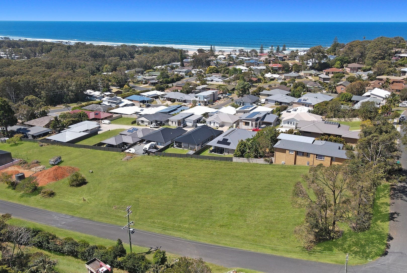
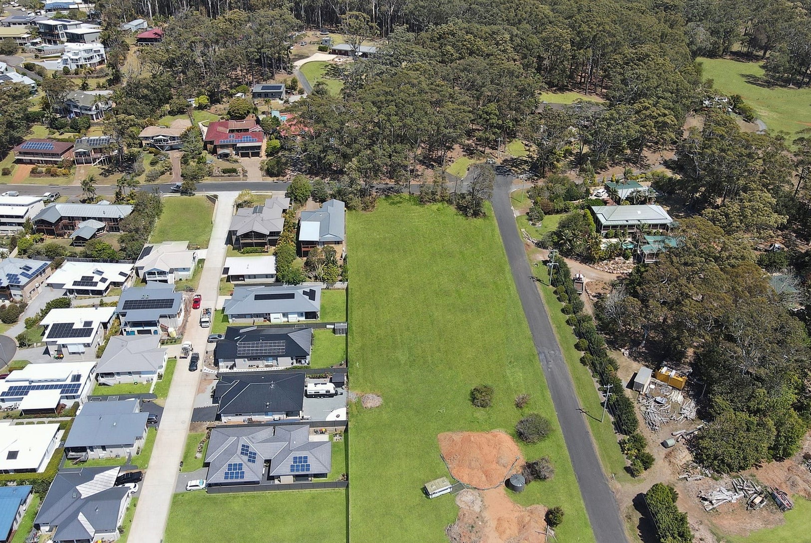
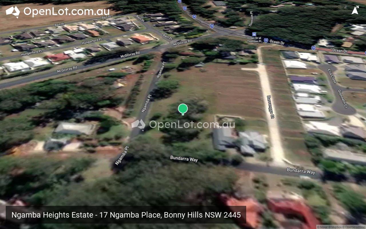
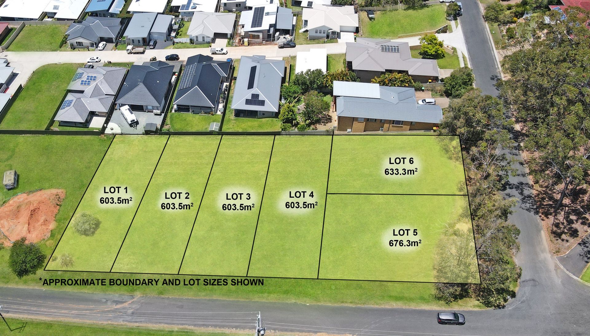
Ngamba Heights Estate - Bonny Hills IN PLANNING
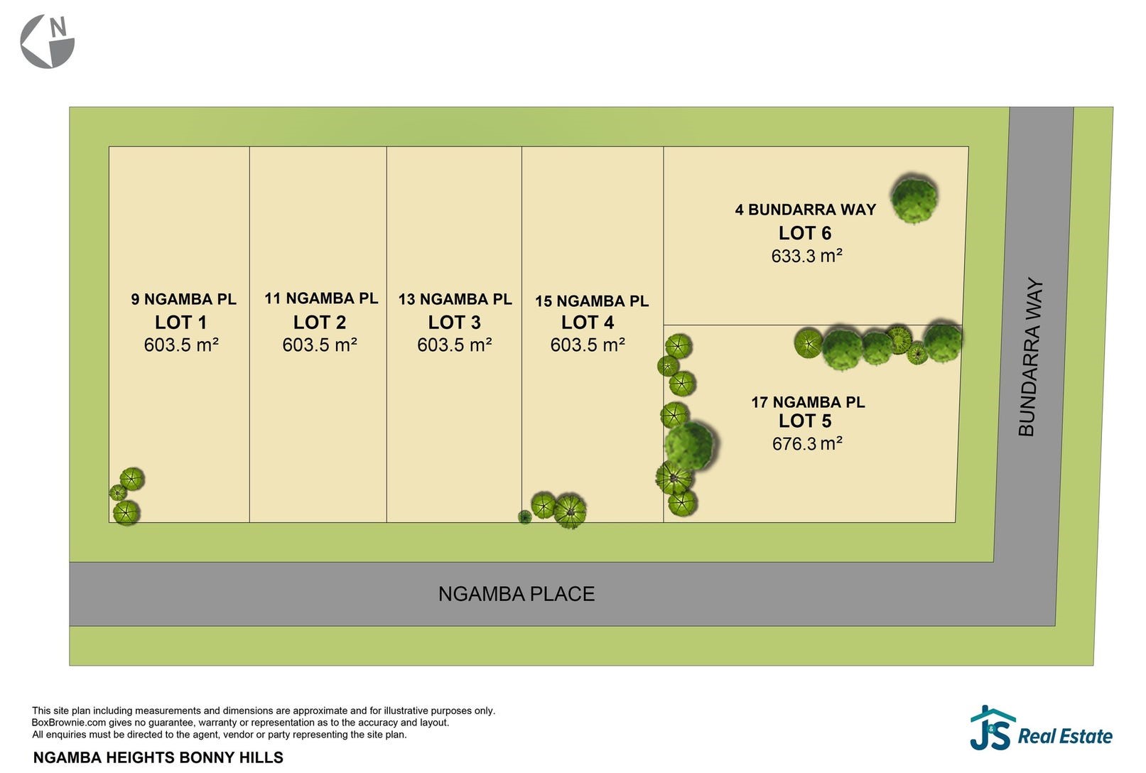
 17 Ngamba Place, Bonny Hills NSW 2445
This information is estimated by the OpenLot research team. Let us know here to provide up-to-date information about this development.
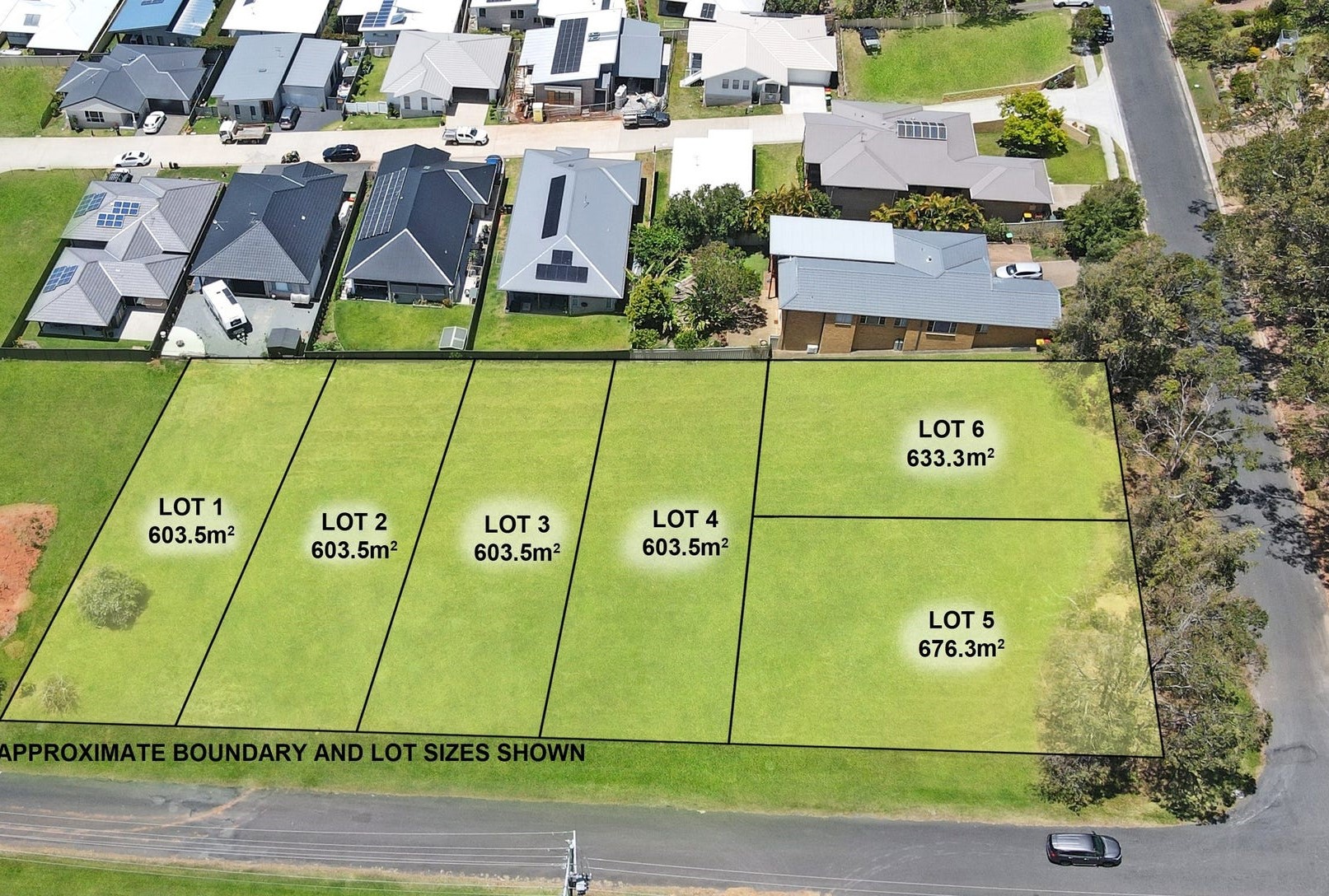
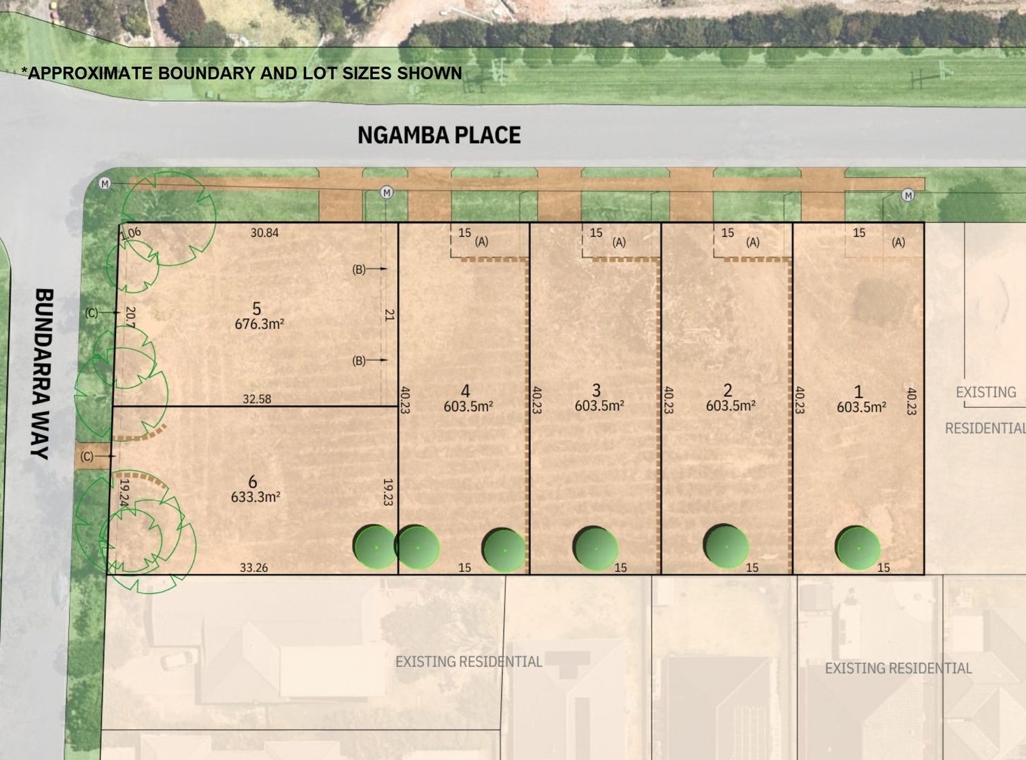
| Total new homes | 6 |
| Area size | 0.37 hectares |
| City council | Port Macquarie-Hastings Council |
| Developer | N/A |
| Project marketer | J & S Real Estate |
Land for Sale, House and Land Packages:
Popular Estates near Ngamba Heights Estate - Bonny Hills


 4
4  2
2  2
2


Updates for Ngamba Heights Estate - Bonny Hills
Facebook updates:
Submit the Facebook page for Ngamba Heights Estate - Bonny Hills.
Related news:
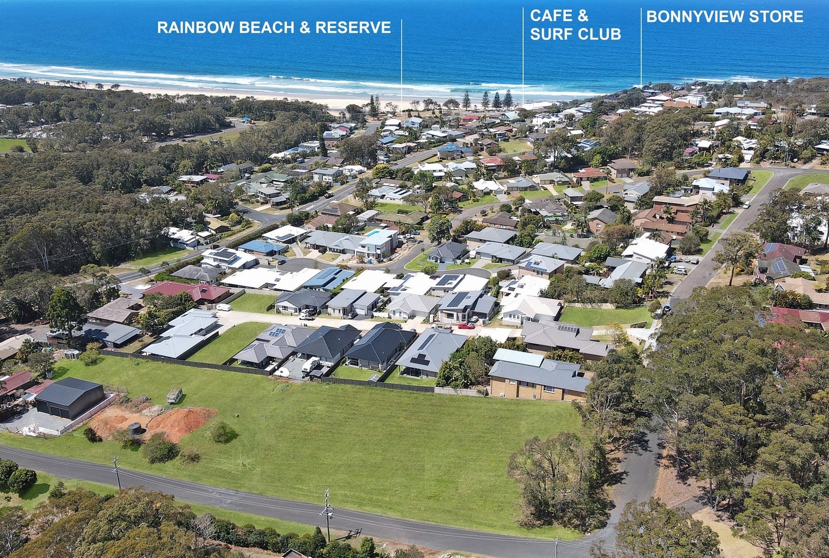
Introducing Ngamba Heights, Bonny Hills. Discover the epitome of coastal living with our limited offering of 6 exclusive blocks of land for sale. Seize the opportunity to build your dream home in this sought-after location where opportunities are becoming increasingly limited. Nestled in the heart of Bonny Hills, our exclusive land parcels offer the perfect…
The official Port Macquarie Council Application Tracker
Missing articles? Send us a link here.
Location & Map for Ngamba Heights Estate - Bonny Hills
Display Homes near Ngamba Heights Estate - Bonny Hills

Vacancy Rate in Bonny Hills NSW 2445
View full vacancy rate history in Bonny Hills NSW 2445 via SQM Research.
Schools near Ngamba Heights Estate - Bonny Hills
Here are 6 schools near Ngamba Heights Estate - Bonny Hills:
K-6 Government Primary School
K-6 Government Primary School
K-6 Catholic Primary School
K-6 Government Primary School
K-6 Government Primary School
7-12 Government Secondary School
Reviews & Comments on Ngamba Heights Estate - Bonny Hills
Estate Brochure, Masterplan, Engineering Plan, Plan of Subdivision (POS), Design Guidelines
FAQs about Ngamba Heights Estate - Bonny Hills
View all estates marketed by J & S Real Estate
- Lake Cathie Public School - 2.4km north
- North Haven Public School - 5.1km south
- St Joseph's Primary School - 6.9km south-west
- Laurieton Public School - 7.7km south-west
- Herons Creek Public School - 9.8km west
- Camden Haven High School - 10.7km south-west
Popular Estates near Ngamba Heights Estate - Bonny Hills
Latest New Home Articles for You

13/Dec/2024
The Aussie Dream Is Alive: Despite Worry That New Homebuyers Must Settle for Apartments, New Data Reveals Australians Buy Twice as Many New Houses as Units
MELBOURNE (15 October 2024) — The Australian Dream of owning a detached h...

10/Dec/2024
Data Reveals It Costs 57% More to Build a New House than Before Covid
MELBOURNE (10 September 2024) — Australians are spending as much as 57% m...

21/Nov/2024
Decoding Terms Found In Drawings & Plans
In the latest episode of "The Home Building Hub" podcast, hosts Colin Bis...

12/Nov/2024
Victoria: Top 30 Most Searched Housing Developments (October 2024)
We’re excited to present the top 30 most popular housing developments in ...

12/Nov/2024
Western Australia: Top 30 Most Searched Housing Developments (October 2024)
If you've ever envisioned calling Western Australia home, now is an excel...

12/Nov/2024
South Australia: Top 30 Most Searched Housing Developments (October 2024)
South Australia, celebrated for its breathtaking landscapes and vibrant c...

12/Nov/2024
New South Wales: Top 30 Most Searched Housing Developments (October 2024)
If you've considered making New South Wales your home, now is an ideal ti...

12/Nov/2024
Queensland: Top 30 Most Searched Housing Developments (October 2024)
Spanning the sunlit shores of Australia’s eastern coast, Queensland—affec...
![[Oct/2024] Top Most Searched Housing Developments in Australia](https://files.openlot.com.au/p/styles/500h/s3/article/Thumbnail%20-%20Top%2030%20Most%20Searched%20Housing%20Developments_0.png.webp?itok=YtDmCKiT)
06/Nov/2024
[Oct/2024] Top Most Searched Housing Developments in Australia
OpenLot offers an in-depth look at top housing developments making an imp...