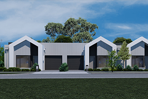
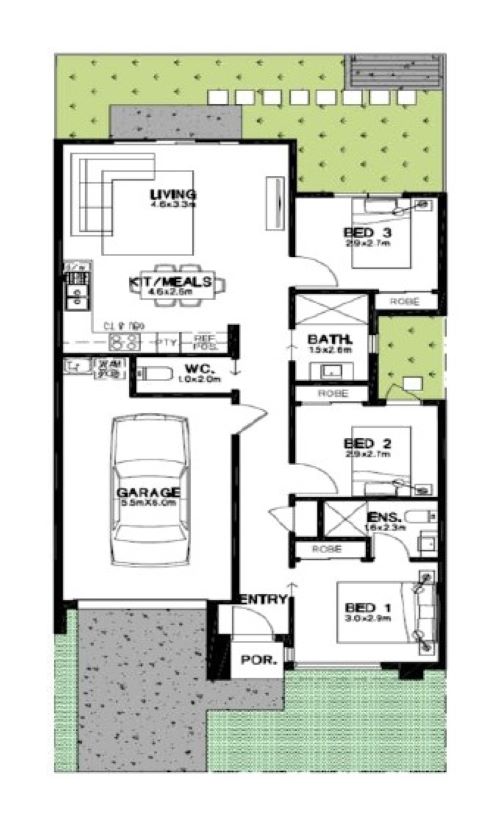
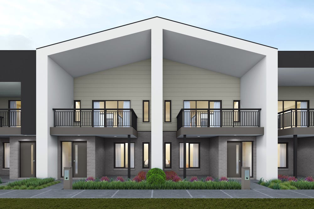
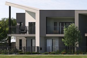
Lot 237: Euroa End @ Maple Grove Estate - Pakenham East
 Annual Avenue, Pakenham East VIC 3810
that perfectly suits your lifestyle, providing the ideal setting for every moment and embrace the joy of outdoor living with a spacious backyard, where you can relax and unwind in your private oasis.
 3
3  1
1  1
1Development Info of Maple Grove Estate - Pakenham East

This information is estimated by the OpenLot research team. Let us know here to provide up-to-date information about this development.
| Total new homes | 1,160 |
| Area size | 29.89 hectares |
| Growth Region | Melbourne South East Growth Corridor |
| City council | Cardinia Shire Council |
| Developer | Satterley Property Group |
| Distance to | Melbourne CBD - 57 km south-east |
Location & Map for Maple Grove Estate - Pakenham East
Display Homes near Maple Grove Estate - Pakenham East


More Townhouses by Metricon Homes (Home Builder)


Vacancy Rate in Pakenham East VIC 3810
View full vacancy rate history in Pakenham East VIC 3810 via SQM Research.
Schools near Maple Grove Estate - Pakenham East
Here are 6 schools near Maple Grove Estate - Pakenham East:
Prep-6 Government Primary School
Prep-6 Government Primary School
Prep-6 Catholic Primary School
7-12 Government Secondary School
Prep-6 Government Primary School
Prep-6 Catholic Primary School
Suburb Planning Review in Pakenham East VIC 3810
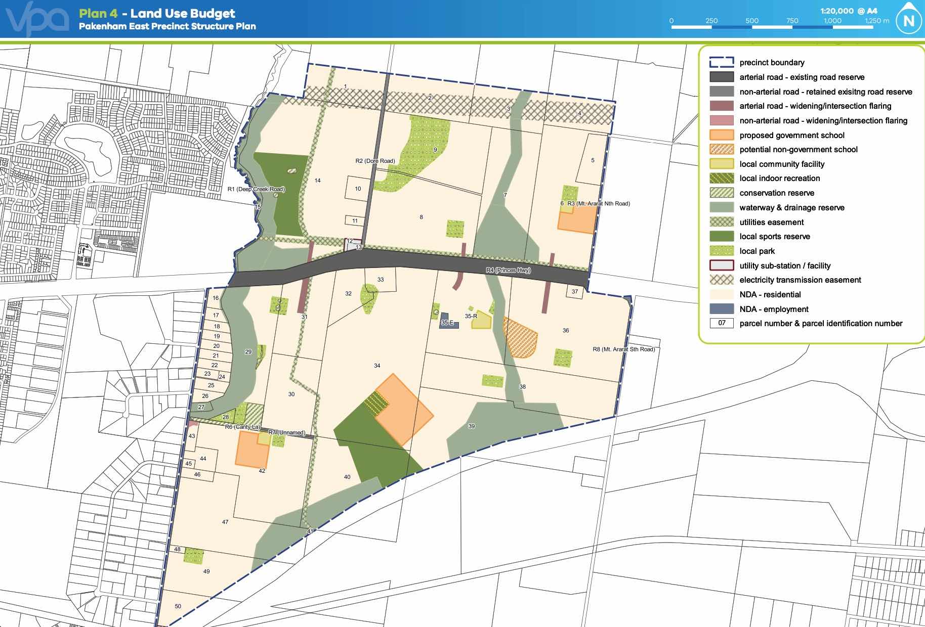
Pakenham East is located in the Shire of Cardinia, the fringe of Melbourne’s Urban Growth Boundary and logical expansion of the existing Pakenham township. The new 630ha suburb area is located on either side of the Princes Highway and is bounded by natural features, existing urban community, infrastructure and farmland.
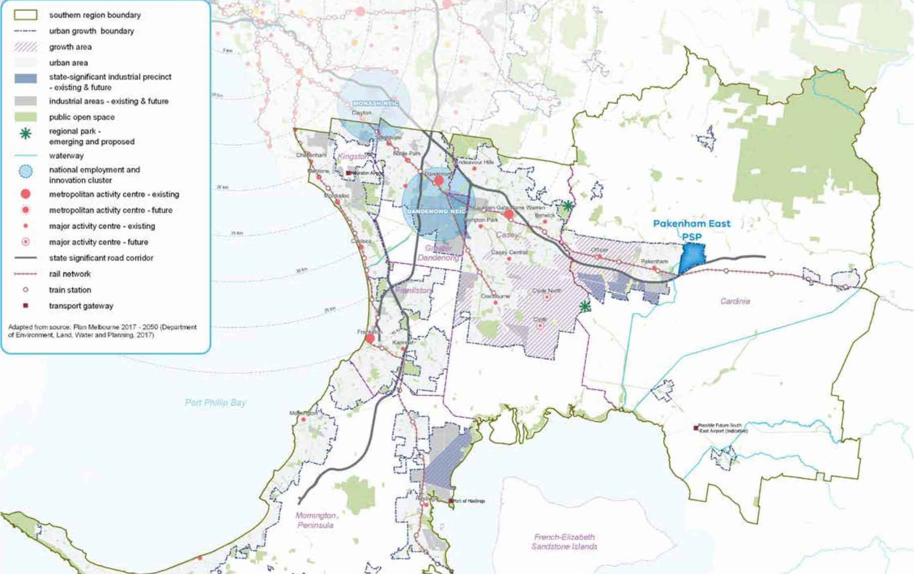
The Pakenham East Precinct Structure Plan (PSP) and Native Vegetation Precinct Plan (NVPP) were prepared to guide the redevelopment of the released land, protection of natural assets and where services are planned to support the suburb growth. This includes local heritage, landscape and environmental values of the area while delivering a variety of housing options and community and recreational facilities as a logical extension of the Pakenham township.
Both the Pakenham East PSP and NVPP were prepared by Victorian Planning Authority (VPA) in consultation with the Cardinia Shire Council and was approved on 2 January 2021 by the Minister for Planning in December 2020. The decision was officially gazetted on 21 January 2021 under Amendment C234 of the Cardinia Planning Scheme.
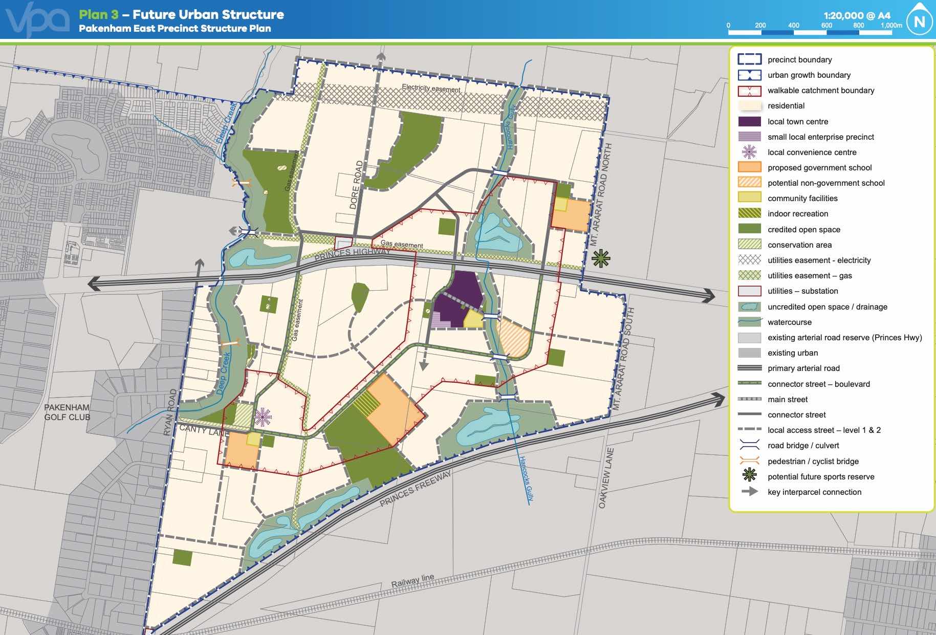
The Vision
“for a sustainable and resilient community with plenty of housing choices, open space, well-connected streets, future schools and a local town centre and convenience centre. It will complement Pakenham, with an extensive network of cycling paths, public transport and pedestrian links to central Pakenham”.
Benefits
The amendments allow the rezoning of Farming and Low Density Residential Zones to Urban Growth Zone. This allows the new greenfield sites to provide for a new residential community, protect natural features and sports and recreation areas. A series of new schools, local community hubs, a town centre and a convenience centre will provide local employment.
Transportation
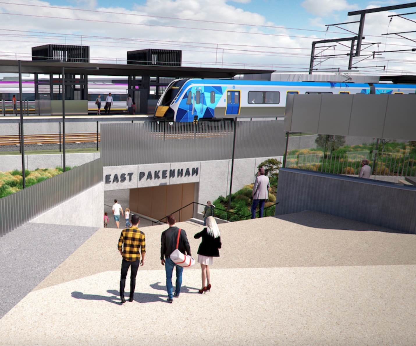
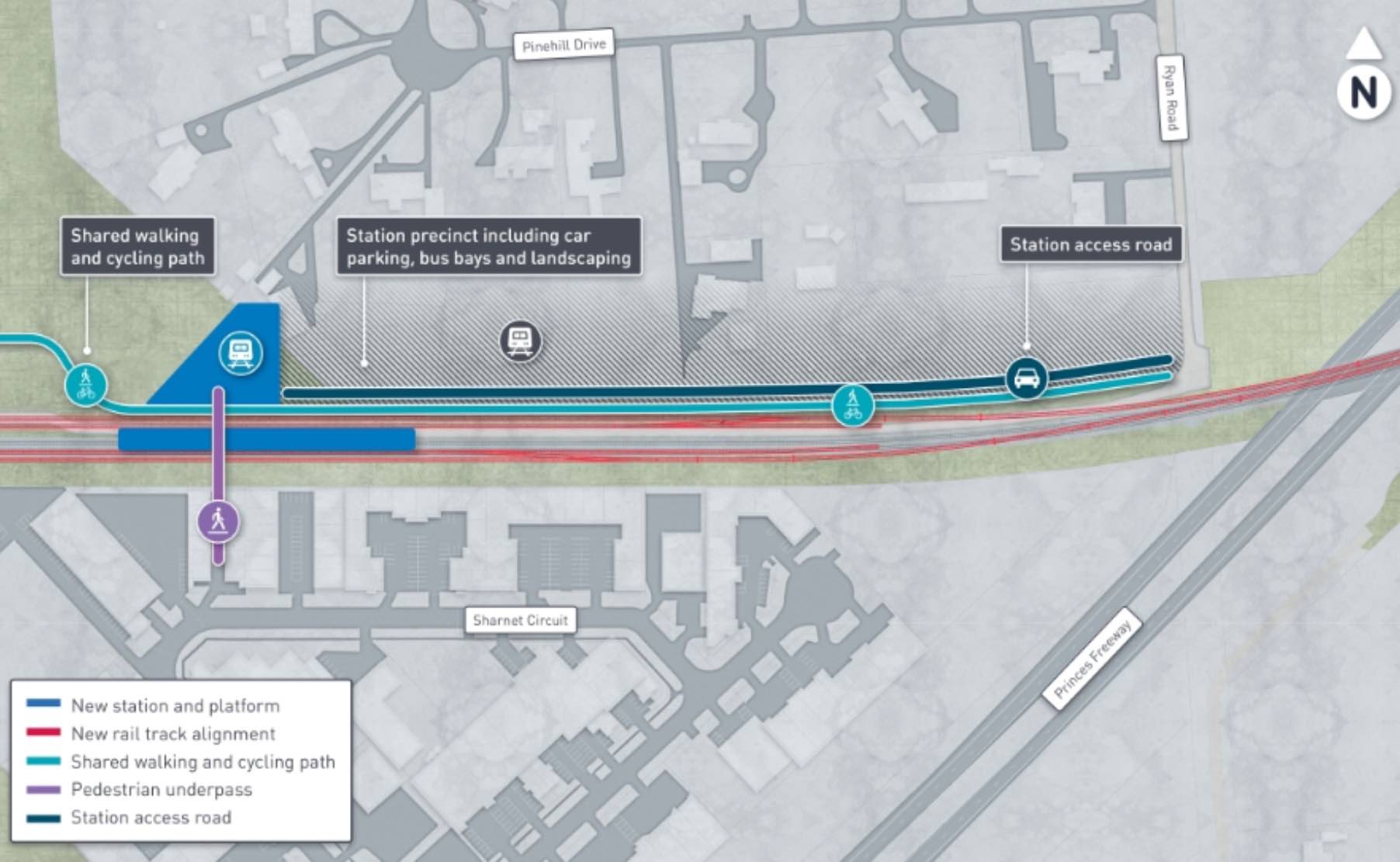
Pakenham East is well connected to public passenger transport, with the Pakenham rail line set to be extended to a new station to be built adjacent to Deep Creek Reserve within the Pakenham community fringe and car parking access from Ryan Road. The passenger train service on the Orbost mainline will connect Flinders Street and the new Pakenham East train station.
While located just outside the new suburb boundary the train station will be well connected to a network of shared paths including cycle links and the local road network. The Princes Highway will provide vehicle access to the Princes Freeway and a direct connection to Melbourne CBD or the east coastline of Victoria.
Suburb Summary
References
- Cardinia Shire Council
- Victoria Planning Authority
- Premier of Victoria – New Station
- Premier of Victoria – New Suburb
- Level Crossing Removal Project
Latest New Home Articles for You

13/Dec/2024
The Aussie Dream Is Alive: Despite Worry That New Homebuyers Must Settle for Apartments, New Data Reveals Australians Buy Twice as Many New Houses as Units
MELBOURNE (15 October 2024) — The Australian Dream of owning a detached h...

10/Dec/2024
Data Reveals It Costs 57% More to Build a New House than Before Covid
MELBOURNE (10 September 2024) — Australians are spending as much as 57% m...

21/Nov/2024
Decoding Terms Found In Drawings & Plans
In the latest episode of "The Home Building Hub" podcast, hosts Colin Bis...

12/Nov/2024
Victoria: Top 30 Most Searched Housing Developments (October 2024)
We’re excited to present the top 30 most popular housing developments in ...

12/Nov/2024
Western Australia: Top 30 Most Searched Housing Developments (October 2024)
If you've ever envisioned calling Western Australia home, now is an excel...

12/Nov/2024
South Australia: Top 30 Most Searched Housing Developments (October 2024)
South Australia, celebrated for its breathtaking landscapes and vibrant c...

12/Nov/2024
New South Wales: Top 30 Most Searched Housing Developments (October 2024)
If you've considered making New South Wales your home, now is an ideal ti...

12/Nov/2024
Queensland: Top 30 Most Searched Housing Developments (October 2024)
Spanning the sunlit shores of Australia’s eastern coast, Queensland—affec...
![[Oct/2024] Top Most Searched Housing Developments in Australia](https://files.openlot.com.au/p/styles/500h/s3/article/Thumbnail%20-%20Top%2030%20Most%20Searched%20Housing%20Developments_0.png.webp?itok=YtDmCKiT)
06/Nov/2024
[Oct/2024] Top Most Searched Housing Developments in Australia
OpenLot offers an in-depth look at top housing developments making an imp...