
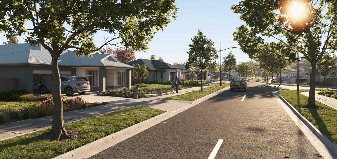

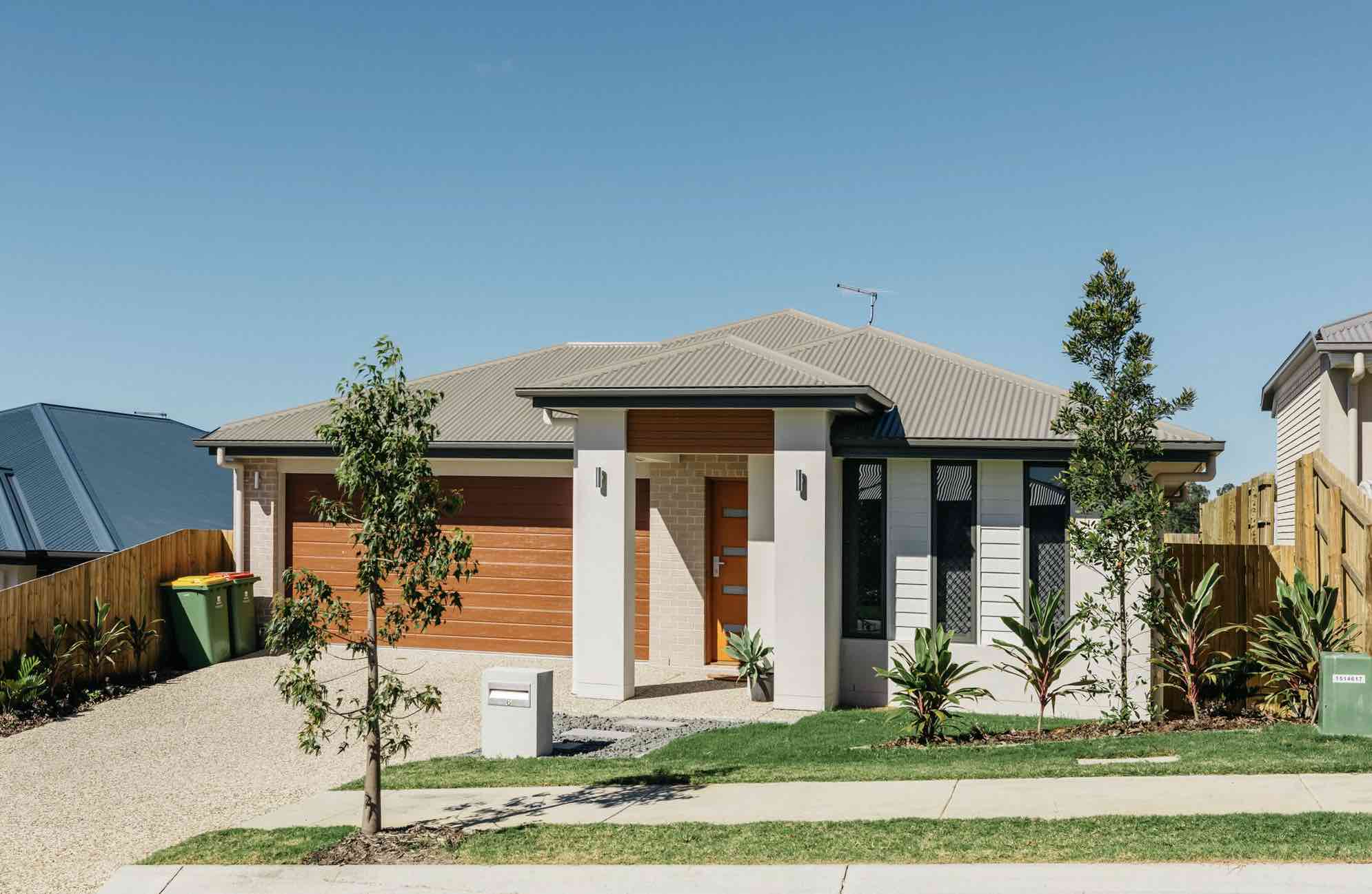
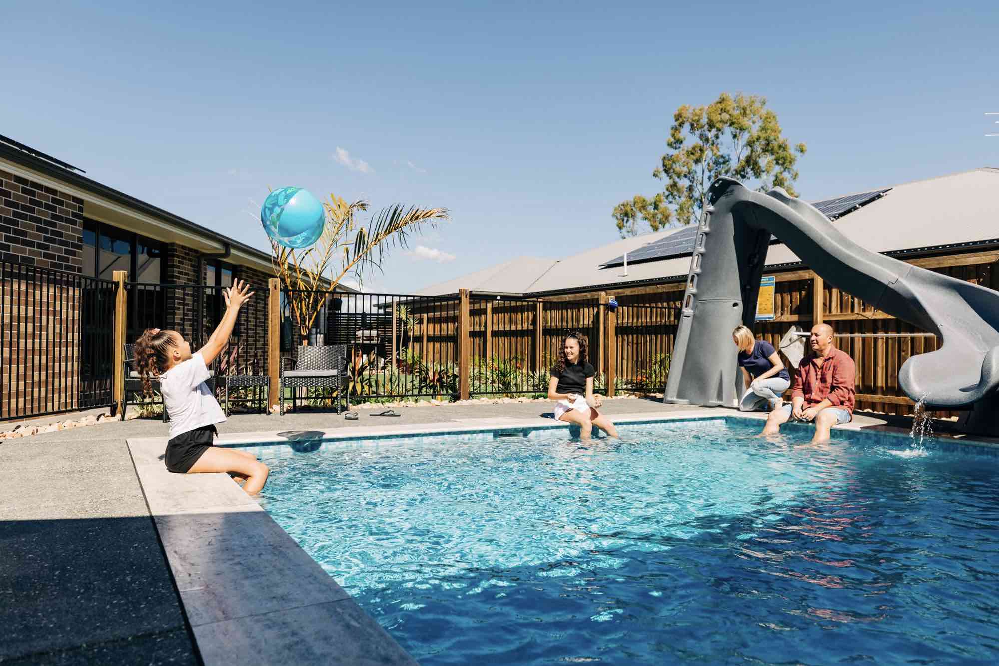
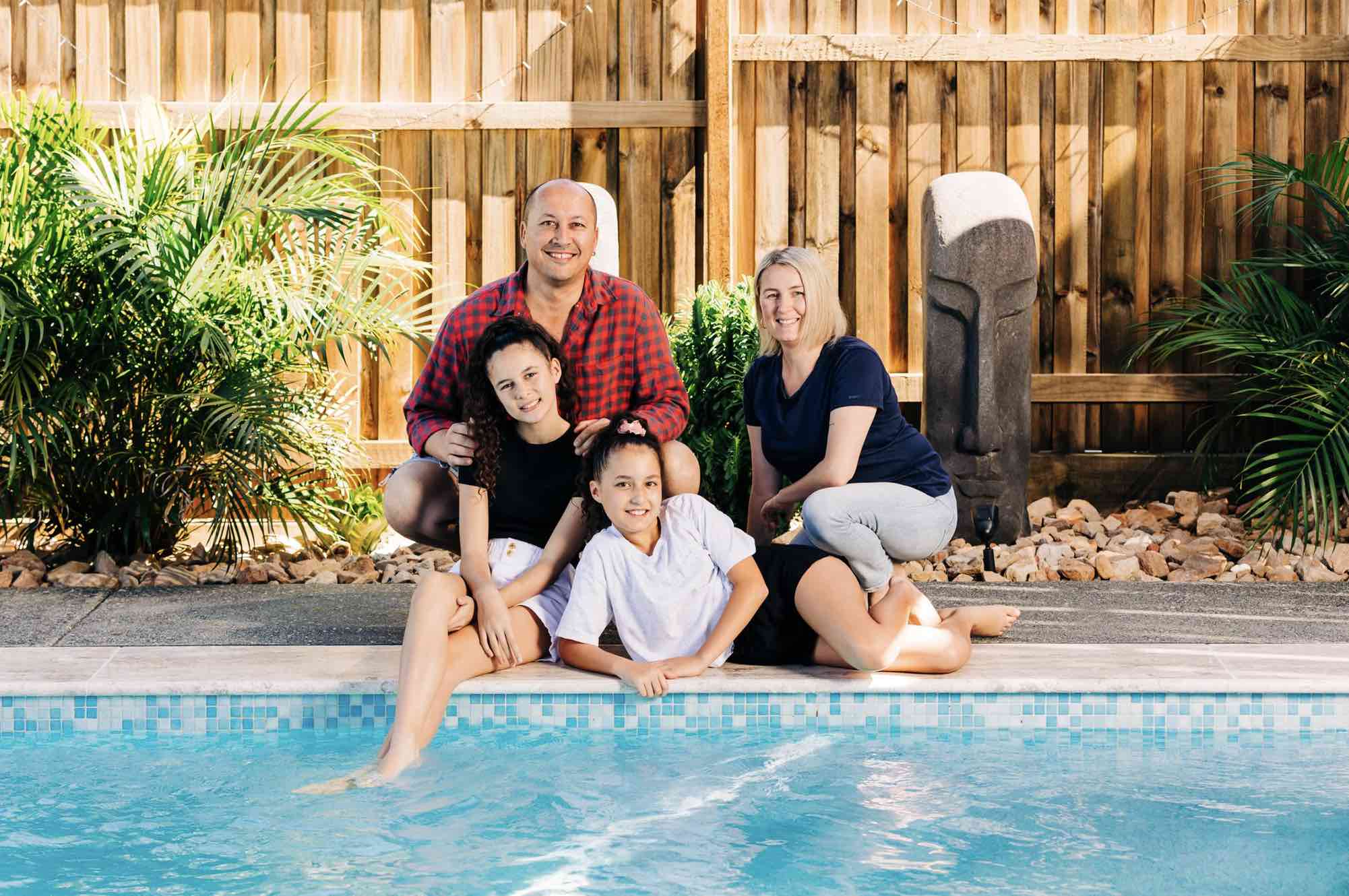
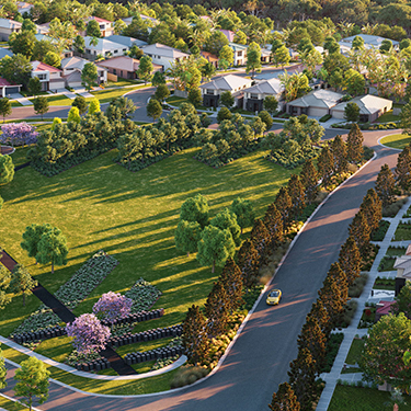
Hayfield Estate - Ripley 6 AVAILABLE
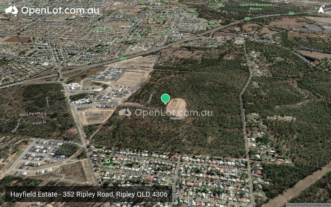
 352 Ripley Road, Ripley QLD 4306
[LIMITED OFFER] New Park Front Land Now Selling.
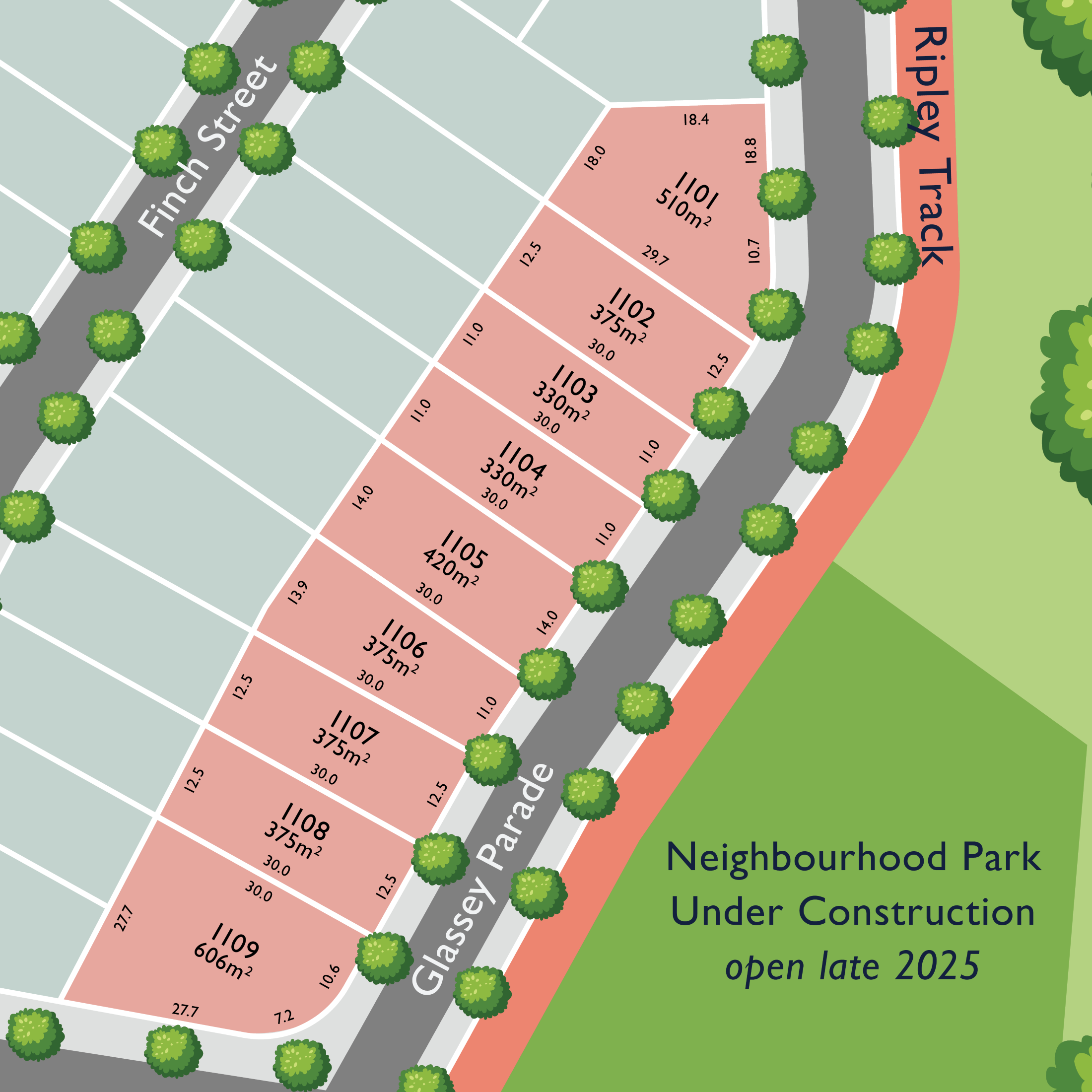
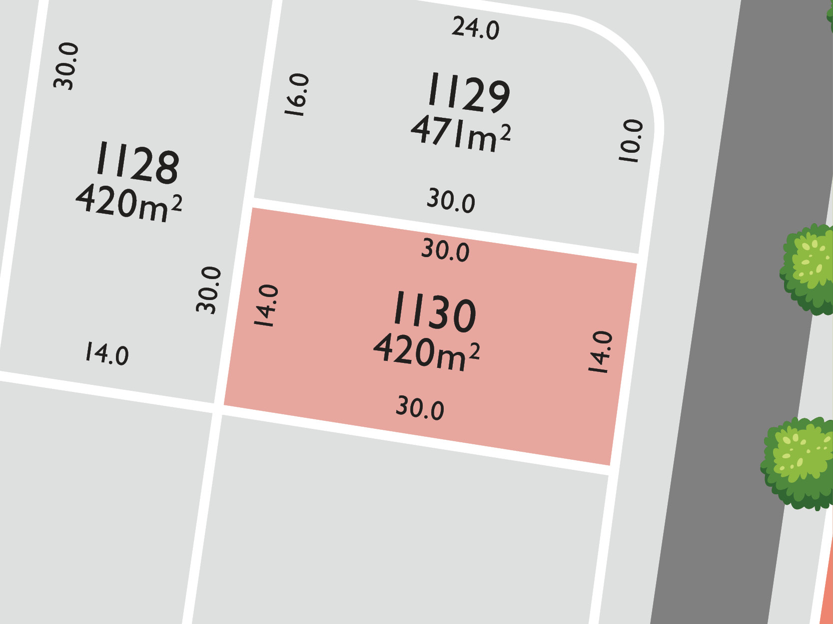
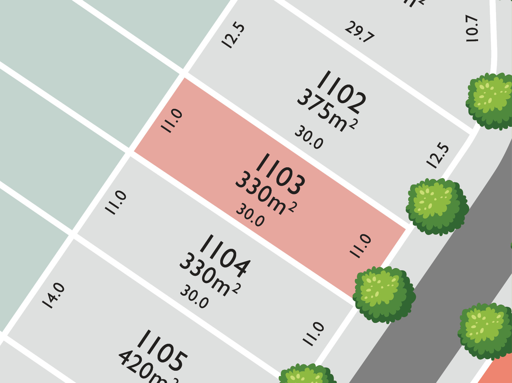
- Stage 11 Release now selling featuring premium home sites from 330sqm to over 600sqm with many overlooking The Greenwood & positioned in a quiet elevate cul-de-sac, perfect for family living.
- Join a thriving community with over 300 families calling Hayfield home.
- Choose from blocks that enjoy mountain views or parkland frontages
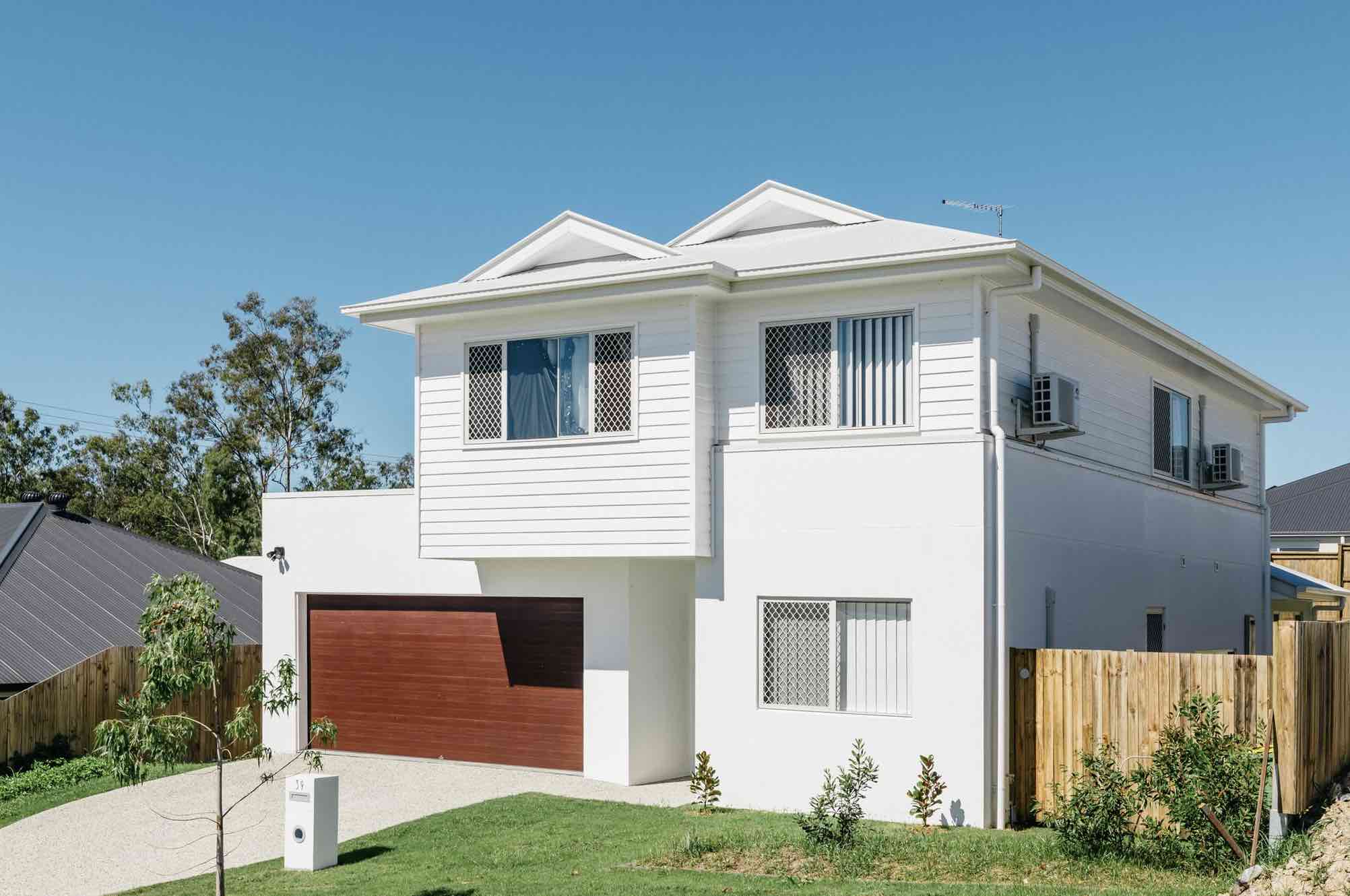
- FREE front garden with every home.
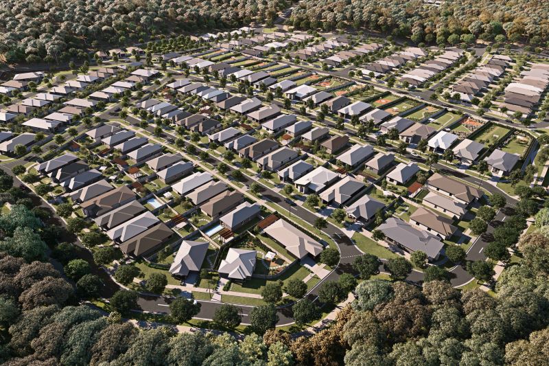
- Established quality new homes set amongst a beautiful natural backdrop.
- Hayfield is the only masterplan of its size with over 26 hectares of native forest meandering through the entire community – The Greenwood.
- Winding through Hayfield is The Ripley Track, 4km of dedicated walking, running & cycling tracks.
- 1 park already established and another 2 parks on the way!
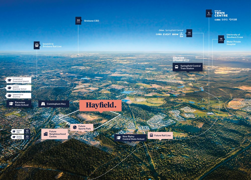
- Only 5 mins drive to Ripley Town Centre including Coles, pharmacy and 18 specialty stores.
- Only 10 minutes to Ipswich & 35 min to Brisbane CBD.
- Close to a number of primary and secondary schools including Ipswich Girls' Grammar and West Moreton Anglican College.
- Proposed future childcare, primary and secondary schools onsite.
This information is estimated by the OpenLot research team. Let us know here to provide up-to-date information about this development.
| Total new homes | 900 |
| Area size | N/A |
| Growth Region | Greater Brisbane Growth Areas |
| City council | Ipswich City Council |
| Developer | Goldfields Group |
| Project marketer | Colliers |
| Creative agency | Hello Mellow |
| Distance to | Brisbane CBD - 32 km south-west Brisbane Airport - 44 km south-west Gold Coast CBD - 72 km north-west |
Land for Sale, House and Land Packages:
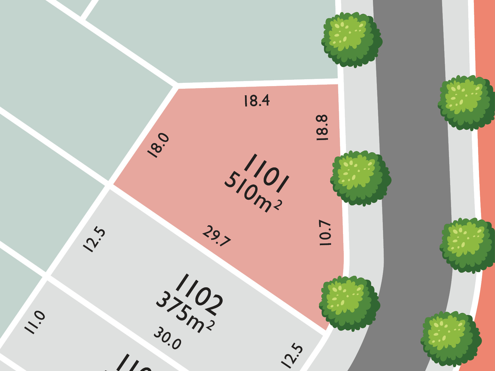
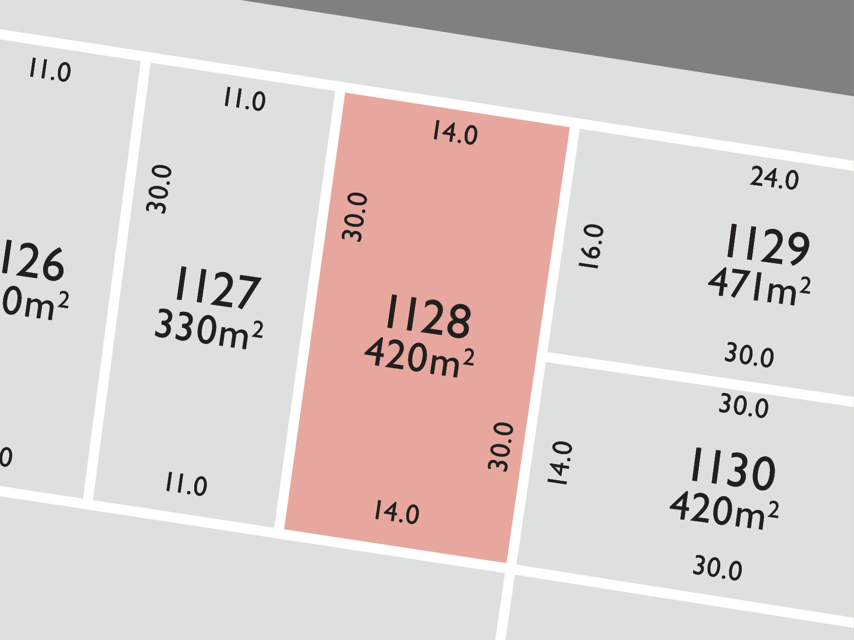
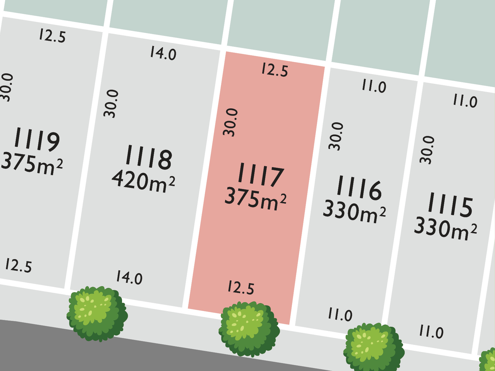
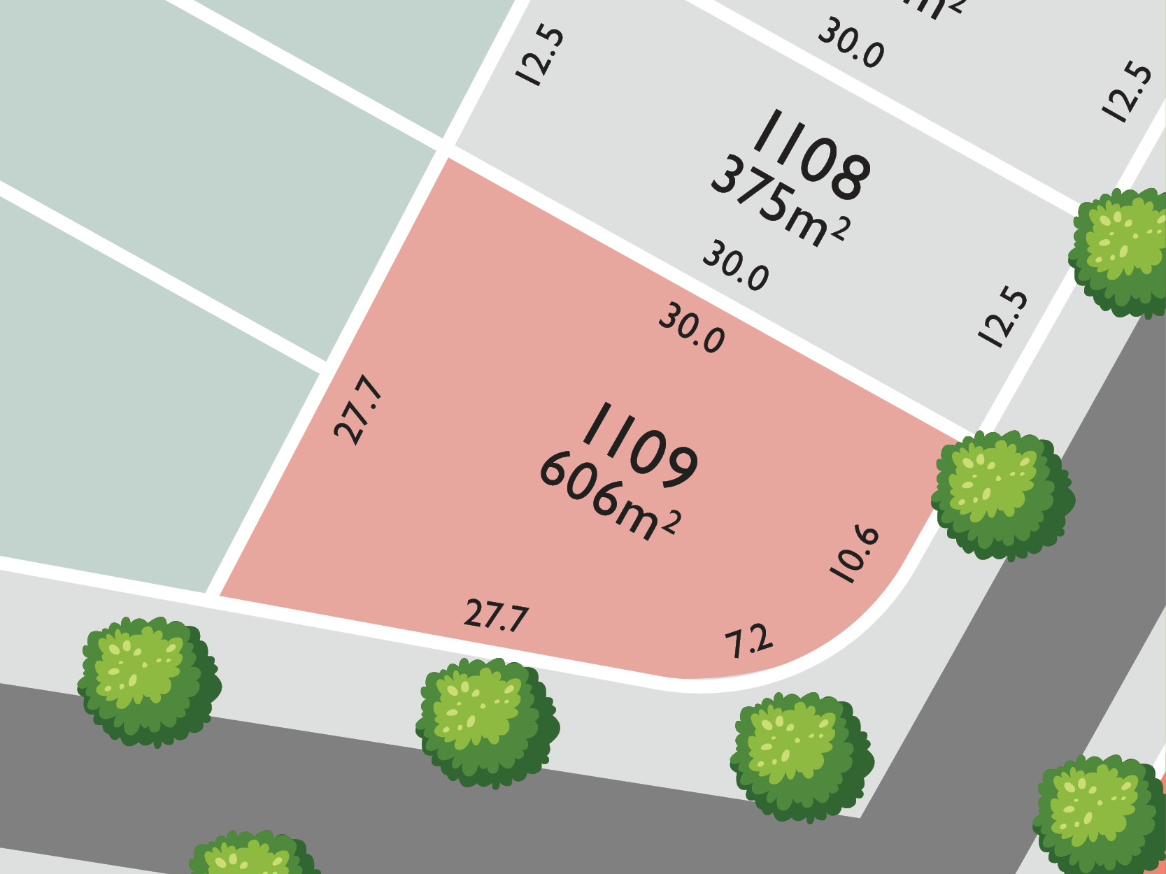
8 Land Lots in Hayfield Estate - Ripley
Updates for Hayfield Estate - Ripley
Facebook updates:
Related news:
Welcome to Hayfield, a new master-planned community that combines natural beauty with urban convenience in the heart of Ripley Valley.Hayfield is designed to encourage a true connection between famili

A change to a development application approval has been lodged for a Subdivision, located at 7002 Trigona Drive, Ripley. Designed by Place Deign Group, t

Our Urban Design services identified significant increases in project yield during the project feasibility and due diligence process while providing efficient ongoing design services moving forward.
Missing articles? Send us a link here.
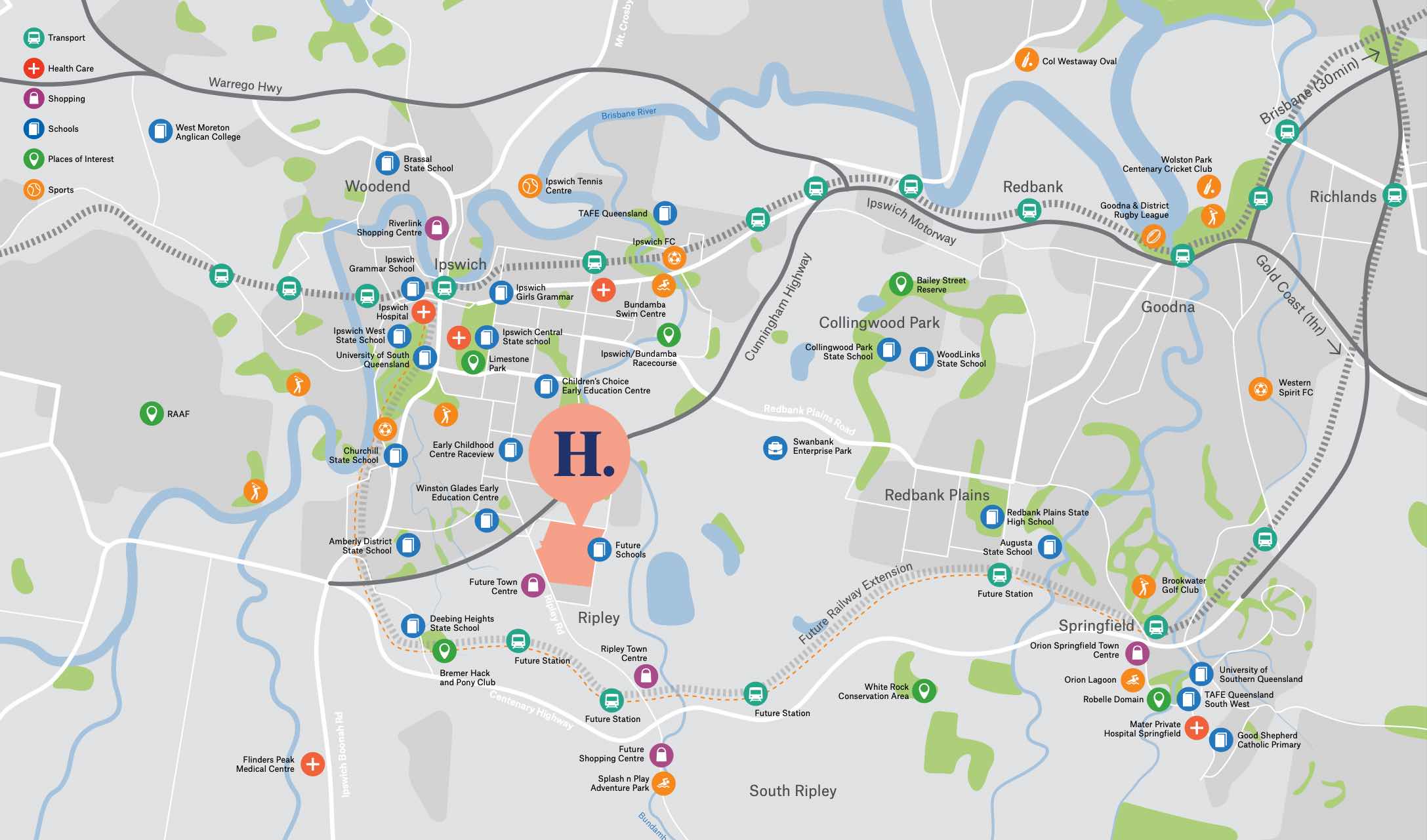
Location & Map for Hayfield Estate - Ripley
Visit Display Homes near Hayfield Estate - Ripley


Schools near Hayfield Estate - Ripley
Here are 6 schools near Hayfield Estate - Ripley:
Prep-6 Government Primary School
Prep-6 Government Primary School
Prep-6 Independent Primary School
Prep-12 Government Special School
Prep-6 Government Primary School
Prep-6 Government Primary School
Suburb Planning Review in Ripley QLD 4306
Ripley is approximately 12,800 ha within the city of Ipswich, located 42 kilometres south-west of Brisbane and 7.5 kilometres from Ipswich CBD. The suburb is located in bounded by the Cunningham Highway and Boyland Way to the north, in proximity to the Centenary Highway in the south, Bundamba Creek to the east and Deebing Creek to the west. Ripley Road passes through the centre of the suburb from Flinders View to Ripley South.
The suburb contains large areas of vegetation with sections of cleared and partially cleared land throughout the suburb, separated from the Swan Bank Power Station area to the east by the Bundamba Creek corridor. The existing Ripley Town Centre is located in the south east corner of the suburb accessed by Ripley Road.

Three areas of recreational zoned land are found within the boundaries of Ripley that accommodate parkland, reserves and waterway corridors, which offer walking trails and vegetated creek networks that flow down through the future residential properties.
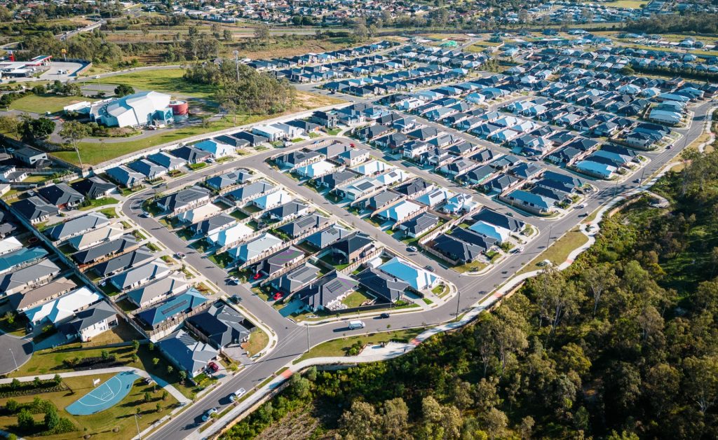
The large rural residential lots are being developed for smaller lots as the population in South East Queensland expands and the demand for new housing stock rises. Eight new developments in Ripley are, Bellevue Estate, Hayfield Estate, Monterea Estate, Miramor Estate, Cadence Estate, Ripley Valley Estate and the largest being Ecco Ripley Estate.

Ripley Valley
The Queensland State Government introduced the Urban Land Development Act 2007 (ULDA Act) in 2007, which created the Urban Land Development Authority (ULDA) as a state-based planning authority given functions and powers to plan, undertake, coordinate and control the development of identified areas, known as UDAs. The Ripley Valley UDA was declared in October 2010, however, now referred to as a Priority Development Area (PDA) with the commencement of the Economic Development Act 2012 which gave the Minister for Economic Development Queensland (MEDQ).
The Ripley Valley PDA is made up of two (2) areas of Ipswich that covers 4,680 hectares of land located south of Flinders View and Yamanto and west of Swan Bank. The Ripley Valley PDA is surrounded by White Rock Conservation Park to the southeast and Mount Perry Conservation Park to the southwest. The area is expected to provide up to 50,000 new dwellings and take approximately 30-40 years to redevelop.
Ipswich City Council’s vision for the region was adopted by the Development Scheme prepared to guide the redevelopment by the ULDA, which contains four new zones, Urban Living, Major Centre, Environmental Protection, Industry and Business. The PDA includes an urban core area called ‘Ripley Central’ that will provide a mix of commercial, business, community, entertainment, retail and higher density development up to 12 storey in height.
It is envisaged that Ripley Valley PDA will provide an urban community (50,000 new dwellings and 120,000 people) with the district, neighbourhood and village centres providing access to employment, services and retail. 13 state primary schools and 5 state high schools are envisaged for the area. A future rail line with several train station stops is envisaged in the long term planning of the area to cater for the new population.

Vision of Ripley
“Ripley Valley 2030 – is a rich and festive community which has developed as a series of distinctive neighbourhoods and smaller villages within the many and varied valley precincts, surrounded both close and afar by hills and views of the iconic Flinders Peak.
Vegetated hills, valleys, lakes, open spaces linkages and trials are a constant reminder of the connection and relationship this community has with its valley home. This natural setting is celebrated by the community in every aspect of design, form and function.
Residents have easy access and connections to employment opportunities both locally and within the wider Ipswich district. Ripley Valley is the heart of one of the State’s employment and economic growth regions, with residents benefiting from employment prospects n neighbouring areas of Swanbank, Ebenezer and Amberley. An integrated public transport system operates within and beyond the Valley to provide convenient travel alternatives. A real ‘sense of place’ is instilled in the Valley, generating community pride in their active involvement in a safe, friendly and green living environment.
The Ripley town centre is stimulating and inspired by its marketplace style and is easily accessible to the community it services. The valley is complimented by a network of smaller neighbourhood mixed use villages offering meeting places, cultural experiences, shopping, recreation, and state of the art transport connections both near and afar. The Ripley Valley has embraced the principles of sustainability and is a model for others to follow – acknowledged both in Australia and overseas”.

Development Themes
The Ripley Valley development scheme follows themes that have been refined to shape the vision statement and prepared in consultation with government, business and the community. The themes guide the development for community living, accessibility, design and function to provide a prosperous and protect valley environment.
Transportation in Ripley
Ripley Valley PDA will provide public passenger transport to Ripley, with bus stops provided to facilitate a bus service through the new community. A potential future rail line and train stations are to be constructed in proximity to the Ripley Town Centre with a passenger train service that connects to Brisbane. The suburb will include a network of shared paths, linking the local parks and conservations parkland to the surrounding and community pathway network.

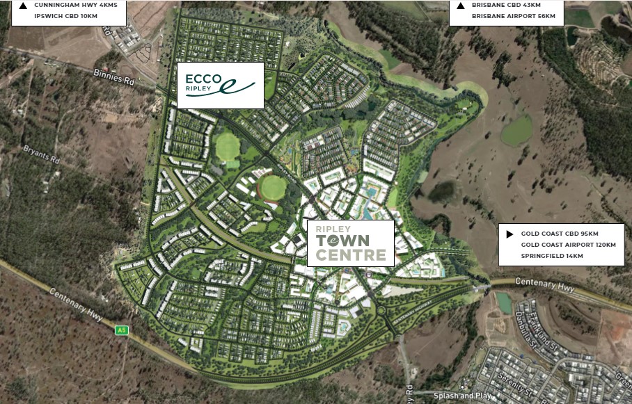
Ecco Ripley Estate
The central portion of the Ripley Valley PDA will be partly redeveloped by Sekisui House which has prepared a $1.5 billion master plan for a substantial parcel of land they have named ‘Ecco’. The master plan includes Ecco Ripley (residential) and Ripley Town Centre (mixed use development) that together provide access to health, commercial, community and retail facilities centred around a future rail station. Located on both sides of the Centenary Highway interchange and future rail station the masterplan provides 40 ha of parkland, local parks and open space in proximity to new residential areas.
The surrounding precincts of the Ripley Valley PDA will provide further social, educational, and community infrastructure, such as South Ripley and surrounding growth areas of Redbank Plains, and Springfield. Local shopping, services and further employment will be found within the Ripley Town Centre and new local centre, including the new Yamanto Town Centre or the Ipswich CBD. The Precinct Structure Plan supports the areas of urban development for higher density residential communities in the Ripley Valley PDA, areas of conservation and rural residential living.
Ripley Suburb Summary
References
ECCO Ripley & Town Centre - Masterplan
Ripley Town Centre
Google Aerial - Ripley
EDQ – Ripley Valley Planning Scheme
Reviews & Comments on Hayfield Estate - Ripley
Estate Brochure, Masterplan, Engineering Plan, Plan of Subdivision (POS), Design Guidelines
FAQs about Hayfield Estate - Ripley
View all estates from Goldfields Group
View all estates marketed by Colliers
- Ripley Central State School - 1.5km south
- Raceview State School - 2.1km north
- Bethany Lutheran Primary School - 2.6km north
- Claremont Special School - 3.4km north
- Amberley District State School - 3.5km west
- Deebing Heights State School - 3.9km south-west
Popular Estates near Hayfield Estate - Ripley


Latest New Home Articles for You

13/Mar/2025 | OpenLot.com.au
Home Building Hub Offers Expert Tips for Visiting Display Homes
The latest episode of "Home Building Hub," hosted by industry experts Col...
12/Mar/2025 | OpenLot.com.au
Display Homes at Botania Estate: A Charming New Boutique Community in Fraser Rise
Welcome to Botania Estate in Fraser Rise, where the charm of a boutique c...

11/Mar/2025 | OpenLot.com.au
4 Steps to Getting the Best Building Quotes
In the latest episode of the Home Building Hub podcast, hosts Colin Bisch...
10/Mar/2025 | OpenLot.com.au
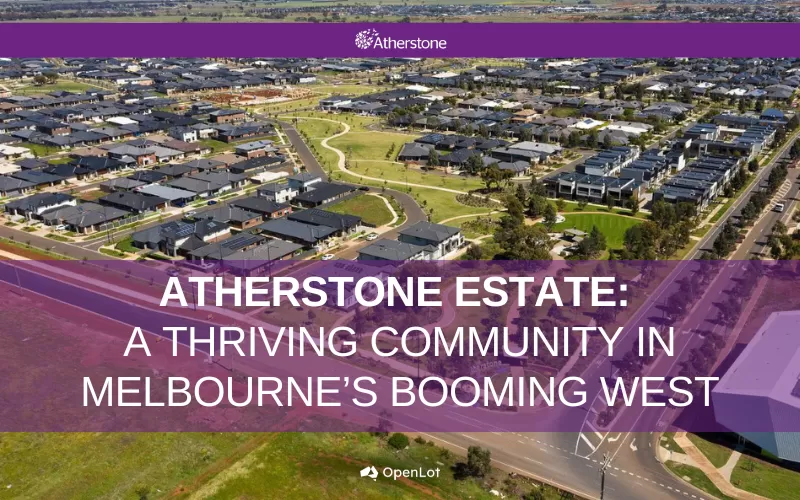
Display Homes at Atherstone Estate: A Thriving Community in Melbourne’s Booming West
Welcome to Atherstone, a vibrant and flourishing masterplanned community ...
07/Mar/2025 | OpenLot.com.au
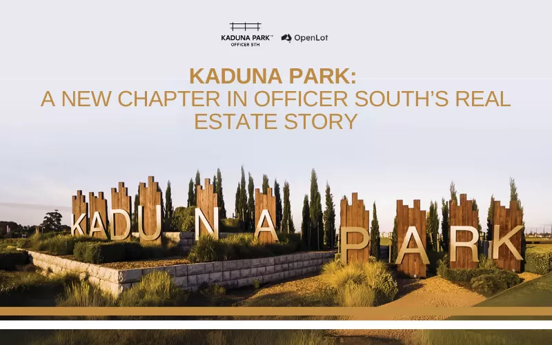
Kaduna Park: A New Chapter in Officer South's Real Estate Story
Nestled in the scenic beauty of Officer South, Kaduna Park is a testament...
![[Feb/2025] Top Most Searched Housing Developments in Australia](https://files.openlot.com.au/p/styles/500h/s3/article/Thumbnail%20-%20Top%2030%20Most%20Searched%20Housing%20Developments%20%281%29.png.webp?itok=wtjvzwHK)
06/Mar/2025 | OpenLot.com.au
[Feb/2025] Top Most Searched Housing Developments in Australia
OpenLot provides a comprehensive overview of leading housing developments...

05/Mar/2025 | OpenLot.com.au
Display Homes at Alfredton Grove Estate: A Premier Community in Alfredton's Growing West
Alfredton Grove has become one of the most desirable residential communit...
04/Mar/2025 | OpenLot.com.au
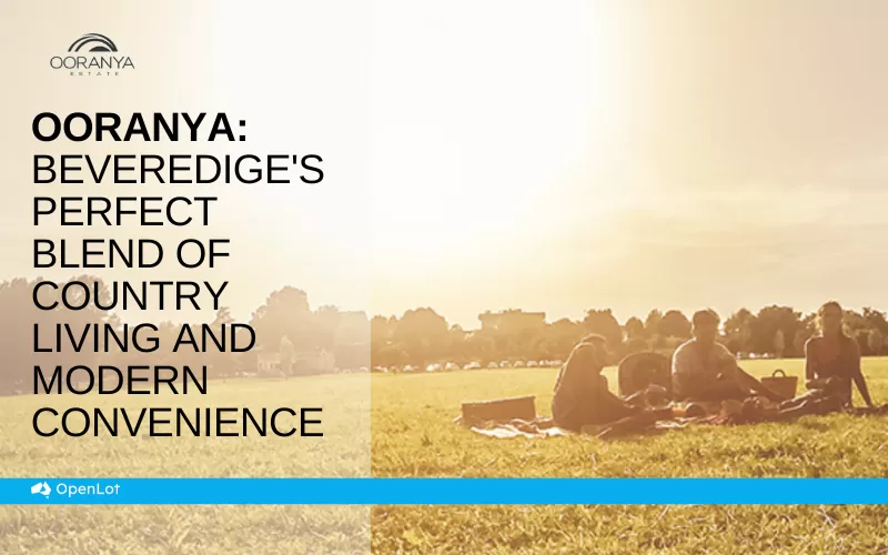
Display Homes at Ooranya: Beveredige's Perfect Blend of Country Living and Modern Convenience
Nestled in the charming town of Beveridge, Ooranya is a community designe...

03/Mar/2025 | OpenLot.com.au
The Rise of Regional Living: Why More Australians are Moving Beyond Major Cities
In recent years, Australia has witnessed a significant shift in populatio...