559 Anambah Road, Gosforth NSW 2320 IN PLANNING
This information is estimated by the OpenLot research team. Let us know here to provide up-to-date information about this development.
| Total new homes | 900 |
| Area size | 125.00 hectares |
| Growth Region | Greater Newcastle Growth Areas (The Hunter Region) |
| City council | Maitland City Council |
| Developer | Thirdi Group |
| Distance to | Newcastle CBD - 40 km north-west |
Land for Sale, House and Land Packages:
Popular Estates near 559 Anambah Road, Gosforth


 4
4  2
2  2
2


Updates for 559 Anambah Road, Gosforth
Facebook updates:
Related news:
The Sydney developer’s expansion into the sector continues with a proposal for a site next to its 900-home scheme in the Hunter Valley…
Three major developments are planned in regional NSW including a precinct at the old gaol and Thirdi’s low density build-to-rent project…

Missing articles? Send us a link here.
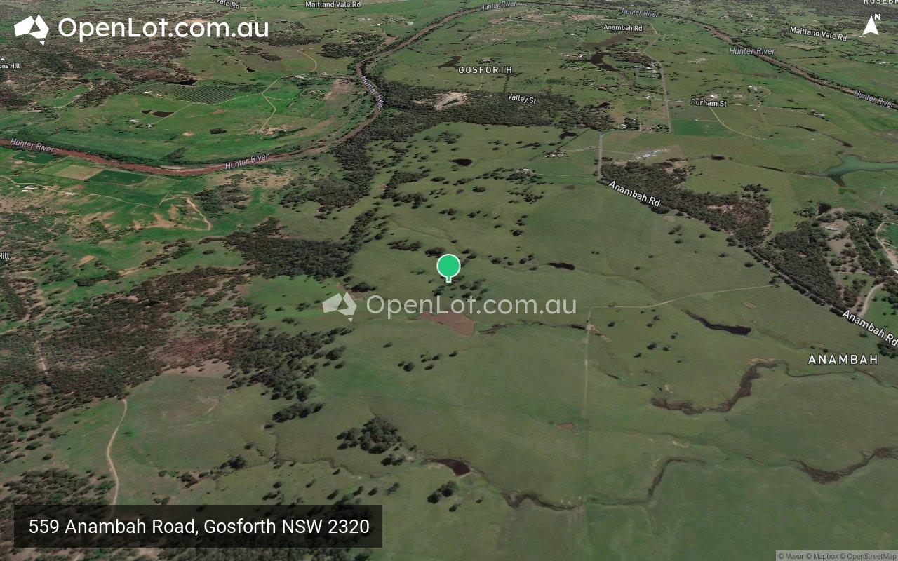
Location & Map for 559 Anambah Road, Gosforth
Visit Display Homes near 559 Anambah Road, Gosforth


Vacancy Rate in Gosforth NSW 2320
View full vacancy rate history in Gosforth NSW 2320 via SQM Research.
Schools near 559 Anambah Road, Gosforth
Here are 6 schools near 559 Anambah Road, Gosforth:
7-12 Catholic Secondary School
K-6 Catholic Primary School
K-6 Government Primary School
K-6 Government Primary School
7-12 Government Secondary School
K-6 Catholic Primary School
Reviews & Comments on 559 Anambah Road, Gosforth
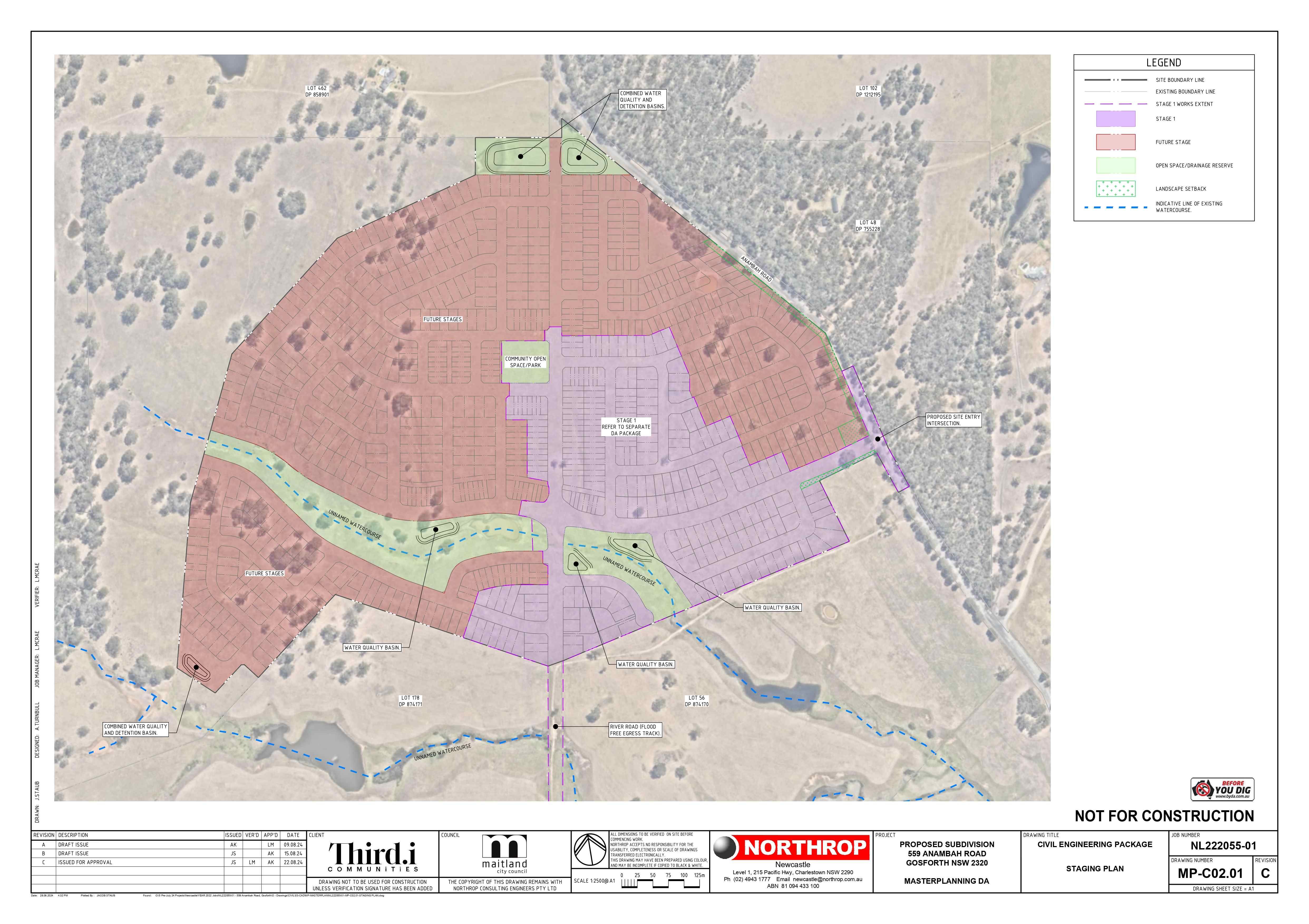
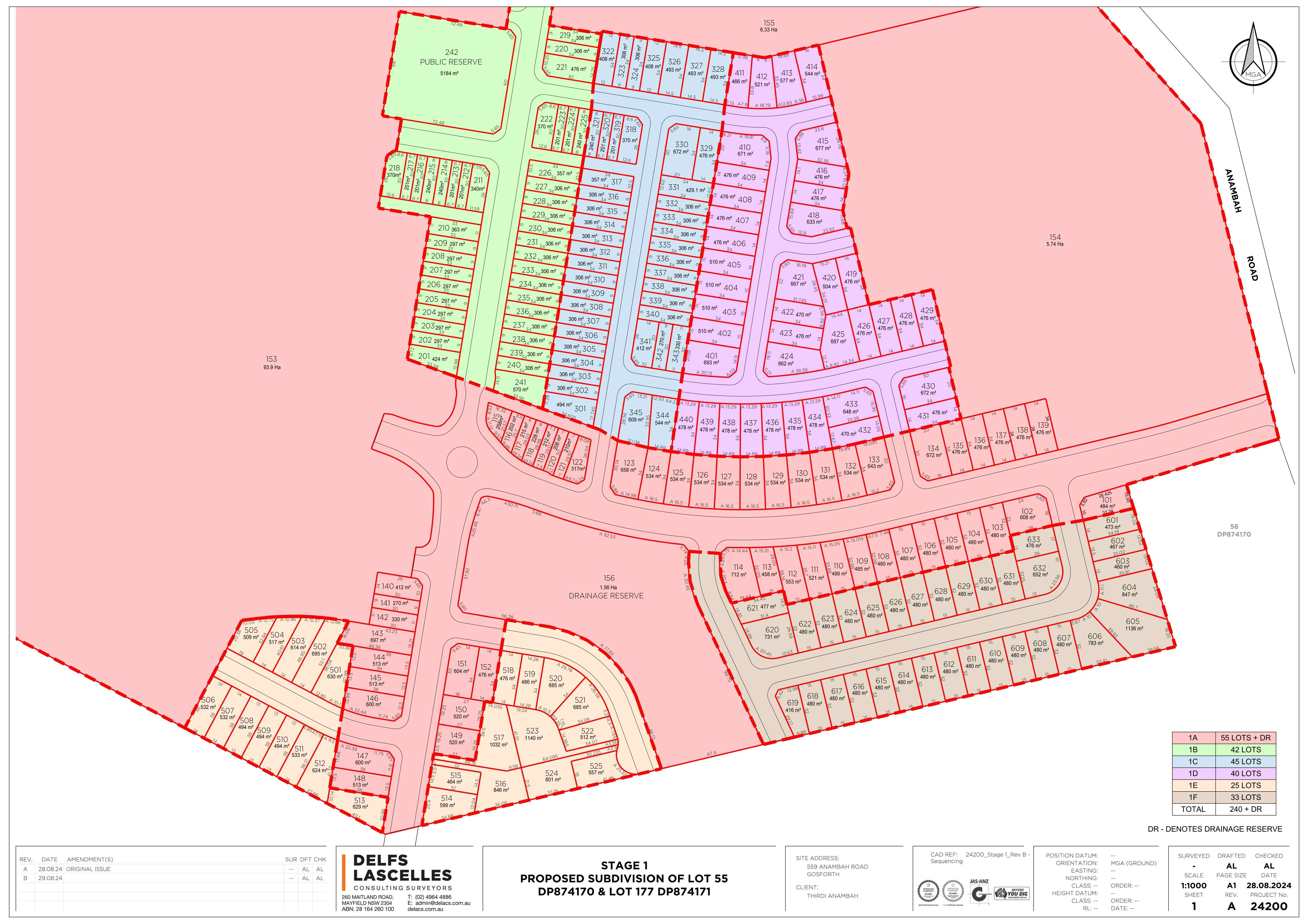
Estate Brochure, Masterplan, Engineering Plan, Plan of Subdivision (POS), Design Guidelines
FAQs about 559 Anambah Road, Gosforth
View all estates from Thirdi Group
- St Joseph's College - 3.9km south-west
- St Patrick's Primary School - 4.1km south-west
- Lochinvar Public School - 4.4km south-west
- Rutherford Public School - 6.3km south-east
- Rutherford Technology High School - 6.5km south-east
- St Paul's Primary School - 7.3km south-east
Popular Estates near 559 Anambah Road, Gosforth
Latest New Home Articles for You

13/Mar/2025 | OpenLot.com.au
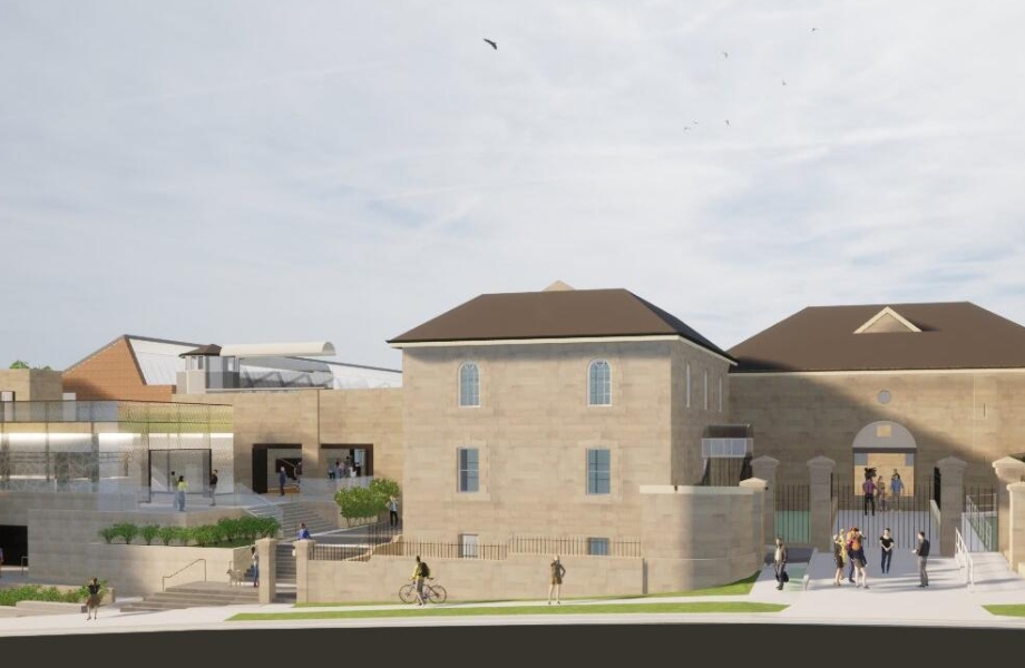
Home Building Hub Offers Expert Tips for Visiting Display Homes
The latest episode of "Home Building Hub," hosted by industry experts Col...
12/Mar/2025 | OpenLot.com.au
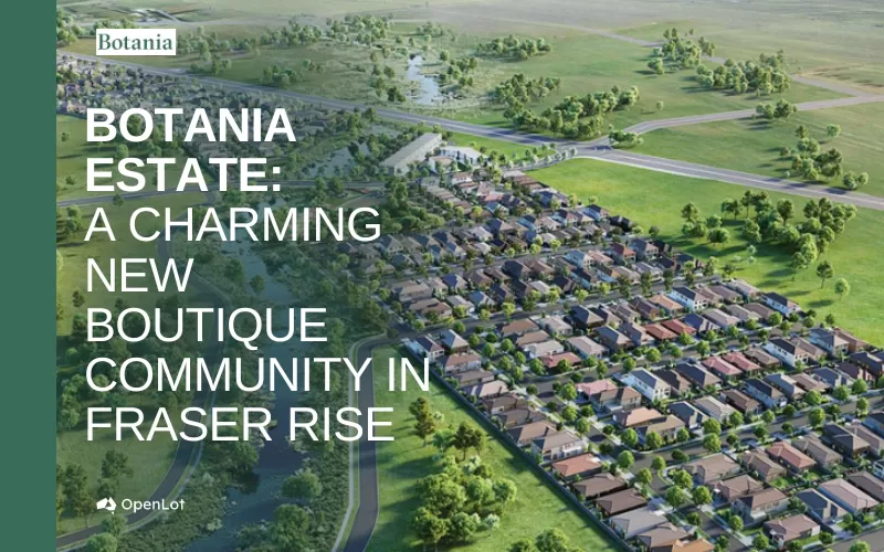
Display Homes at Botania Estate: A Charming New Boutique Community in Fraser Rise
Welcome to Botania Estate in Fraser Rise, where the charm of a boutique c...

11/Mar/2025 | OpenLot.com.au
4 Steps to Getting the Best Building Quotes
In the latest episode of the Home Building Hub podcast, hosts Colin Bisch...
10/Mar/2025 | OpenLot.com.au
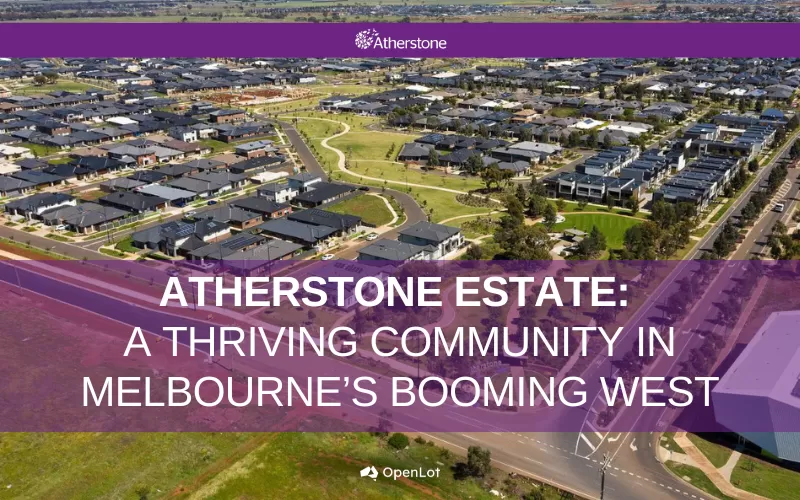
Display Homes at Atherstone Estate: A Thriving Community in Melbourne’s Booming West
Welcome to Atherstone, a vibrant and flourishing masterplanned community ...
07/Mar/2025 | OpenLot.com.au
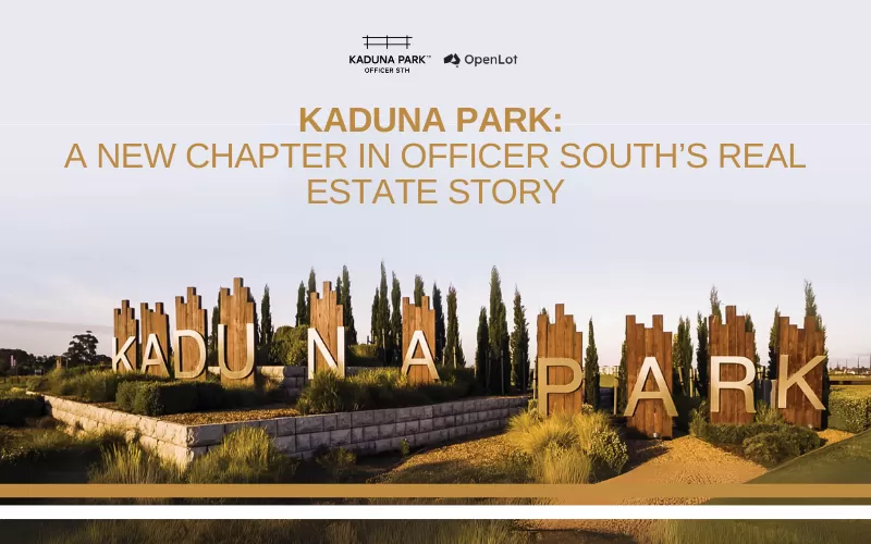
Kaduna Park: A New Chapter in Officer South's Real Estate Story
Nestled in the scenic beauty of Officer South, Kaduna Park is a testament...
![[Feb/2025] Top Most Searched Housing Developments in Australia](https://files.openlot.com.au/p/styles/500h/s3/article/Thumbnail%20-%20Top%2030%20Most%20Searched%20Housing%20Developments%20%281%29.png.webp?itok=wtjvzwHK)
06/Mar/2025 | OpenLot.com.au
[Feb/2025] Top Most Searched Housing Developments in Australia
OpenLot provides a comprehensive overview of leading housing developments...

05/Mar/2025 | OpenLot.com.au
Display Homes at Alfredton Grove Estate: A Premier Community in Alfredton's Growing West
Alfredton Grove has become one of the most desirable residential communit...

04/Mar/2025 | OpenLot.com.au
Display Homes at Ooranya: Beveredige's Perfect Blend of Country Living and Modern Convenience
Nestled in the charming town of Beveridge, Ooranya is a community designe...

03/Mar/2025 | OpenLot.com.au
The Rise of Regional Living: Why More Australians are Moving Beyond Major Cities
In recent years, Australia has witnessed a significant shift in populatio...