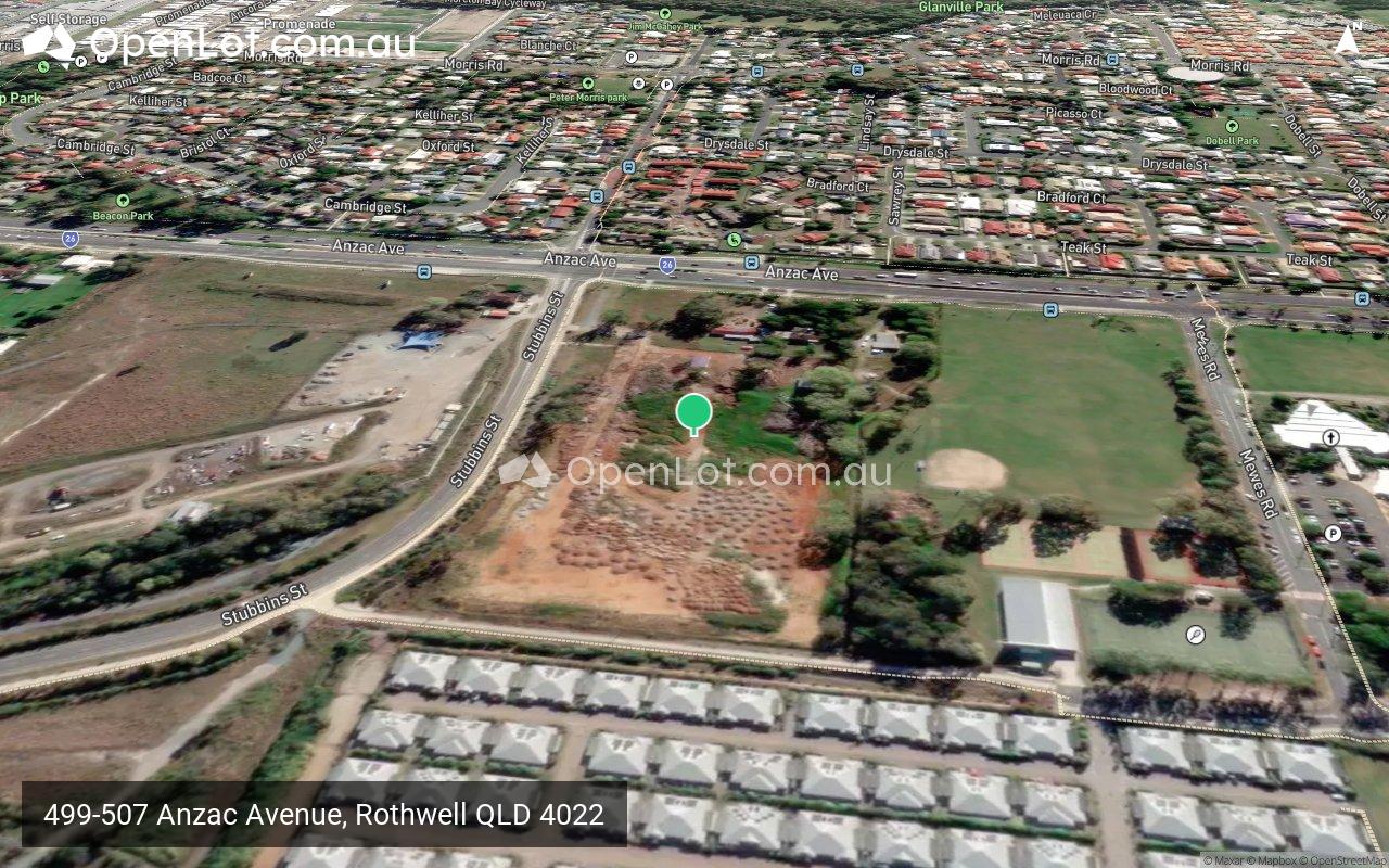
499-507 Anzac Avenue, Rothwell QLD 4022 IN PLANNING
This information is estimated by the OpenLot research team. Let us know here to provide up-to-date information about this development.
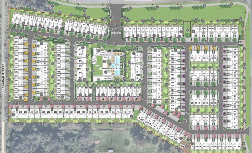
| Total new homes | 240 |
| Area size | 4.55 hectares |
| Growth Region | Greater Brisbane Growth Areas |
| City council | Moreton Bay Regional Council |
| Developer | Azure Development Group, Myers Ellyett |
| Distance to | Brisbane Airport - 21 km north Brisbane CBD - 28 km north Gold Coast CBD - 95 km north |
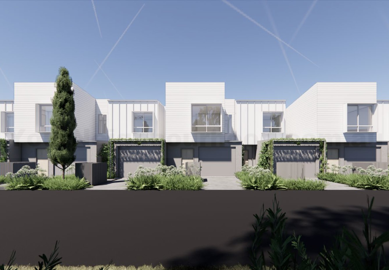
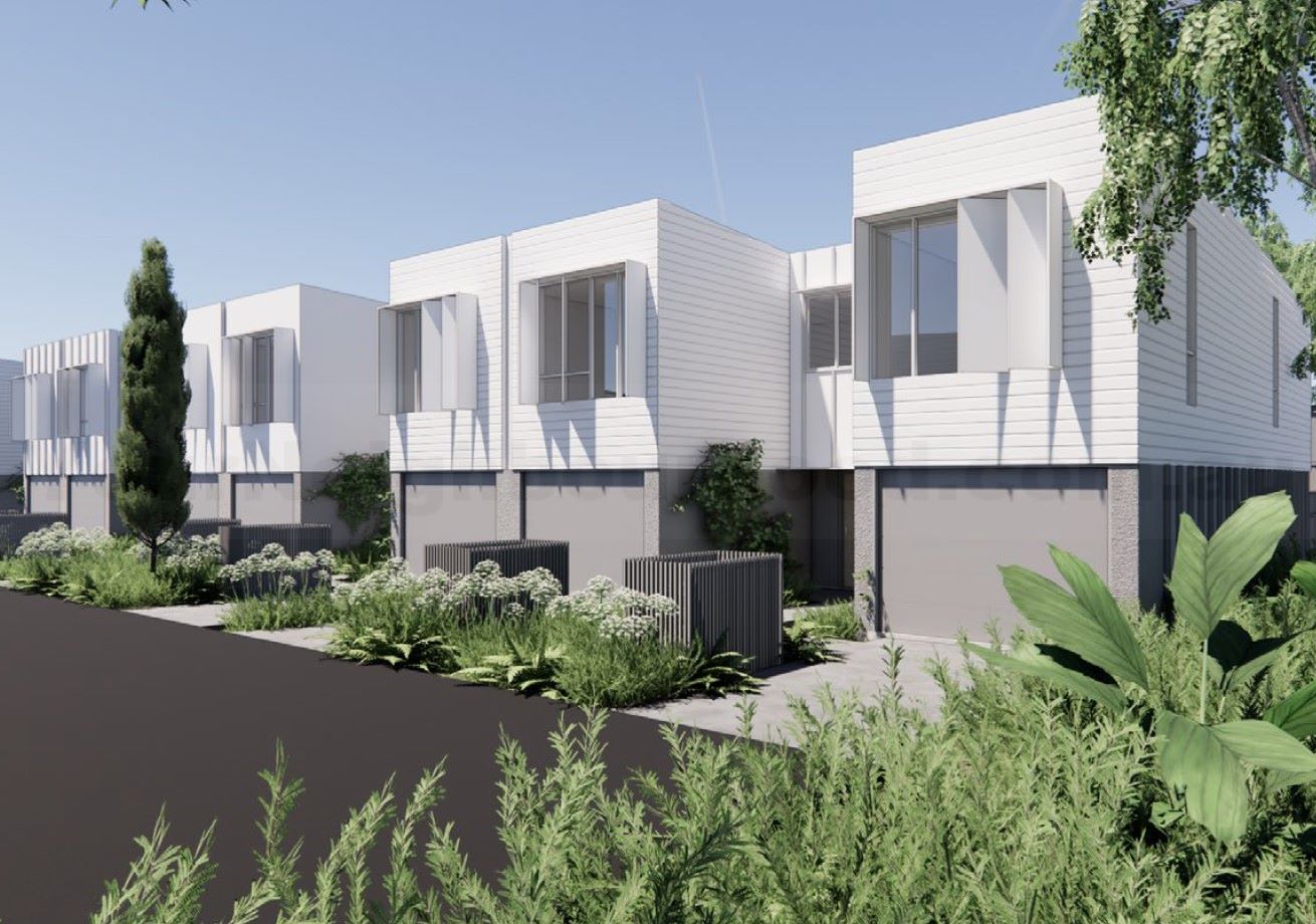
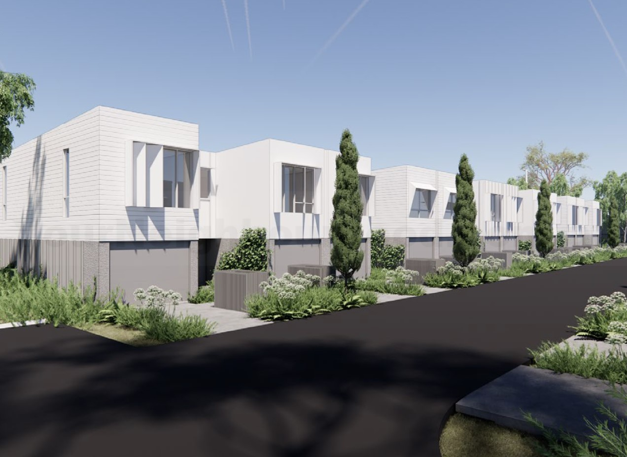
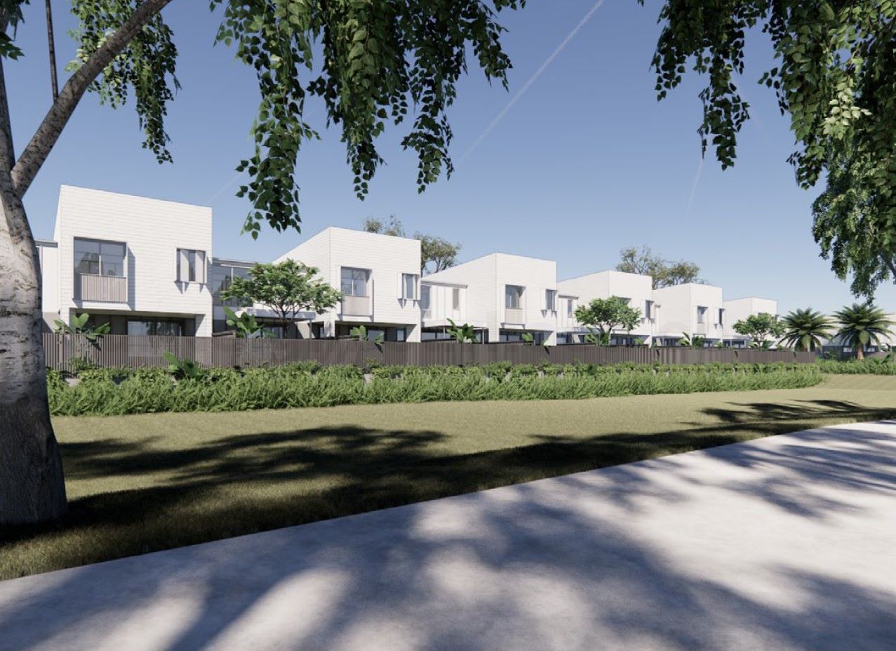
Townhomes:
Popular Estates near 499-507 Anzac Avenue, Rothwell


Updates for 499-507 Anzac Avenue, Rothwell
Facebook updates:
Submit the Facebook page for 499-507 Anzac Avenue, Rothwell.
Related news:
A development application has been lodged for multiple dwellings, located at 499 - 507 Anzac Avenue, Rothwell. Designed by Myers Ellyett, the proposal seeks

Track the progress of development applications from lodgement through to decision.
Missing articles? Send us a link here.
Location & Map for 499-507 Anzac Avenue, Rothwell
Visit Display Homes near 499-507 Anzac Avenue, Rothwell


Vacancy Rate in Rothwell QLD 4022
View full vacancy rate history in Rothwell QLD 4022 via SQM Research.
Schools near 499-507 Anzac Avenue, Rothwell
Here are 6 schools near 499-507 Anzac Avenue, Rothwell:
7-12 Independent Secondary School - School Head Campus
Prep-12 Independent Combined School
Prep-6 Government Primary School
Prep-6 Catholic Primary School
7-11 Government Secondary School
7-12 Government Secondary School
Reviews & Comments on 499-507 Anzac Avenue, Rothwell
Estate Brochure, Masterplan, Engineering Plan, Plan of Subdivision (POS), Design Guidelines
FAQs about 499-507 Anzac Avenue, Rothwell
View all estates from Azure Development Group
View all estates from Myers Ellyett
- Grace Lutheran College - 257m east
- Mueller College - 964m north-east
- Hercules Road State School - 2.5km east
- St Benedict's Primary School - 2.8km south-west
- Mango Hill State Secondary College - 3.0km south
- Deception Bay State High School - 3.0km north-west
Popular Estates near 499-507 Anzac Avenue, Rothwell
Latest New Home Articles for You

05/Mar/2025 | OpenLot.com.au
Display Homes at Alfredton Grove Estate: A Premier Community in Alfredton's Growing West
Alfredton Grove has become one of the most desirable residential communit...

04/Mar/2025 | OpenLot.com.au
Display Homes at Ooranya: Beveredige's Perfect Blend of Country Living and Modern Convenience
Nestled in the charming town of Beveridge, Ooranya is a community designe...

03/Mar/2025 | OpenLot.com.au
The Rise of Regional Living: Why More Australians are Moving Beyond Major Cities
In recent years, Australia has witnessed a significant shift in populatio...

28/Feb/2025 | OpenLot.com.au
2025 Property Investment Strategies: How to Maximise ROI
As Australia’s real estate market evolves, property investors are seeking...

27/Feb/2025 | OpenLot.com.au
Display Homes at Everley: The Heart of Sunbury’s Newest Community
Everley proudly stands at the centre of Sunbury, offering an unparalleled...

25/Feb/2025 | OpenLot.com.au
Western Australia’s Most Popular Land Estates for January 2025: Top Picks Across Growth Areas
Western Australia’s property market continues to show robust growth, with...

24/Feb/2025 | OpenLot.com.au
South Australia’s Most Popular Land Estates for January 2025: Top Picks Across Growth Areas
South Australia’s property market is gaining momentum, with growth areas ...

23/Feb/2025 | OpenLot.com.au
Exploring the Impact of Technology on Home Buying: A Comprehensive Overview
The latest episode of the "Home Building Hub" podcast delved into this to...

22/Feb/2025 | OpenLot.com.au
Display Homes at Cloverton: Kalkallo Perfect Balance of City and Nature
If you're seeking a harmonious balance between vibrant city life and sere...