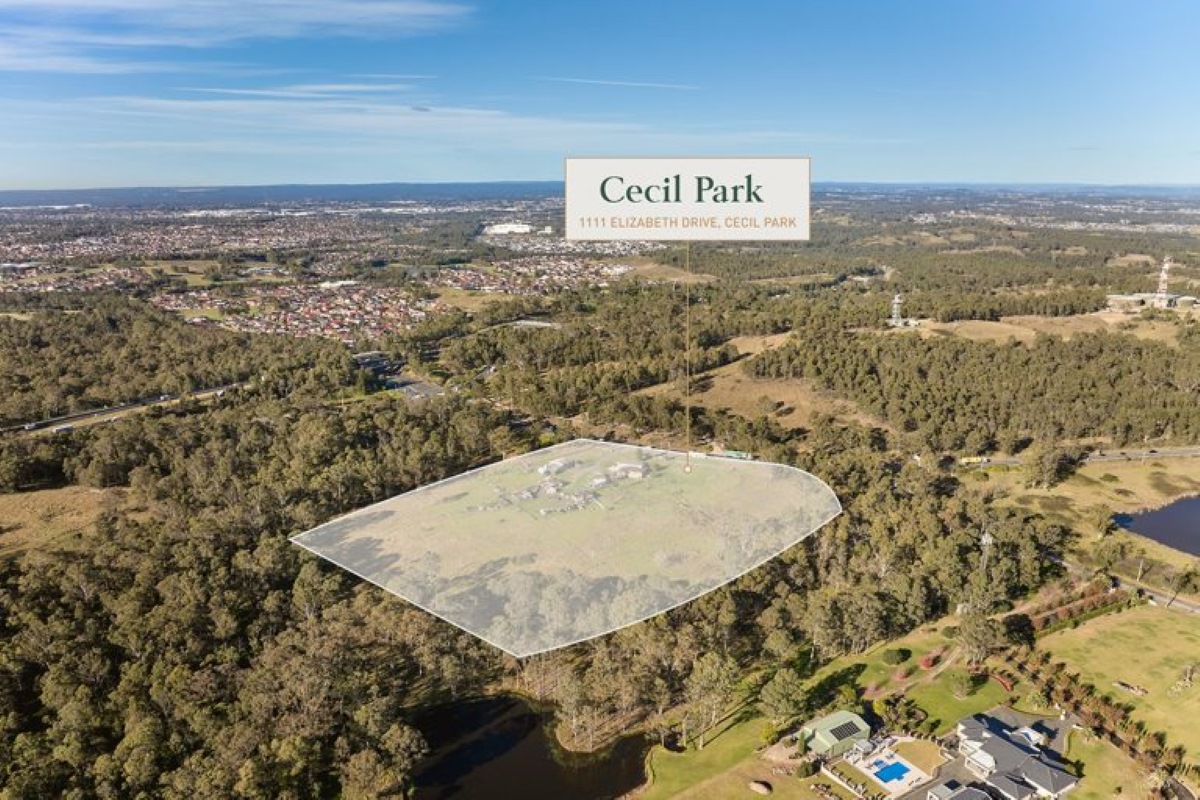
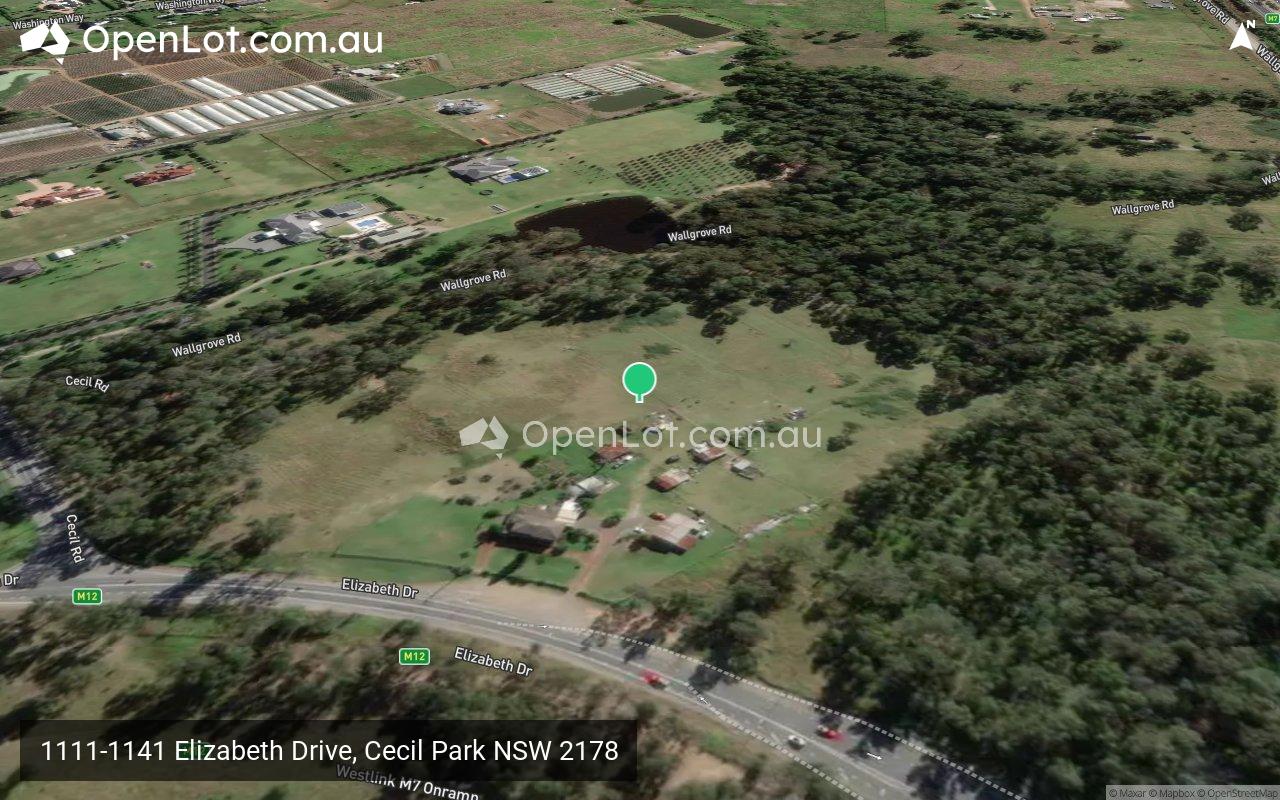
1111-1141 Elizabeth Drive, Cecil Park NSW 2178 IN PLANNING
This information is estimated by the OpenLot research team. Let us know here to provide up-to-date information about this development.
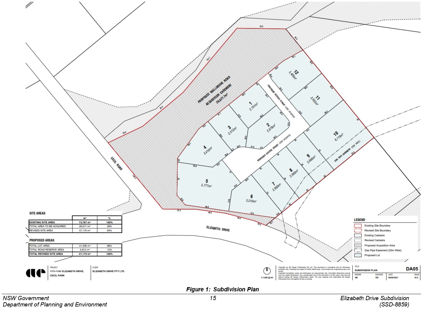
| Total new homes | 12 |
| Area size | 4.71 hectares |
| Growth Region | Sydney South West Growth Areas |
| City council | Fairfield City Council |
| Developer | Landen |
| Distance to | Sydney CBD - 32 km west Sydney Airport - 32 km west |
Land for Sale, House and Land Packages:
Popular Estates near 1111-1141 Elizabeth Drive, Cecil Park


 5
5  3
3  2
2


Updates for 1111-1141 Elizabeth Drive, Cecil Park
Facebook updates:
Submit the Facebook page for 1111-1141 Elizabeth Drive, Cecil Park.
Related news:
Colliers is pleased to present for sale a prime commercial development opportunity that can be developed as one site or subdivide into several lots si


Missing articles? Send us a link here.
Location & Map for 1111-1141 Elizabeth Drive, Cecil Park
Visit Display Homes near 1111-1141 Elizabeth Drive, Cecil Park


Vacancy Rate in Cecil Park NSW 2178
View full vacancy rate history in Cecil Park NSW 2178 via SQM Research.
Schools near 1111-1141 Elizabeth Drive, Cecil Park
Here are 6 schools near 1111-1141 Elizabeth Drive, Cecil Park:
K-12 Independent Combined School
K-6 Government Primary School
7-12 Catholic Secondary School
K-6 Catholic Primary School
7-12 Government Secondary School
K-6 Government Primary School
Reviews & Comments on 1111-1141 Elizabeth Drive, Cecil Park
Estate Brochure, Masterplan, Engineering Plan, Plan of Subdivision (POS), Design Guidelines
FAQs about 1111-1141 Elizabeth Drive, Cecil Park
View all estates from Landen
- Irfan College - 1.4km west
- Cecil Hills Public School - 2.0km south-east
- Freeman Catholic College - 2.5km south-east
- John the Baptist Catholic Primary School - 2.6km south-east
- Cecil Hills High School - 2.7km south-east
- Bonnyrigg Heights Public School - 3.0km south-east
Popular Estates near 1111-1141 Elizabeth Drive, Cecil Park
Latest New Home Articles for You

20/Jan/2025
How to Choose the Perfect Floor Plan for Your Family
Choosing the perfect floor plan is one of the most important decisions yo...

14/Jan/2025
New South Wales: Top 30 Most Searched Housing Developments (December 2024)
If you’re thinking about making New South Wales your home, December is an...

13/Jan/2025
Victoria: Top 30 Most Searched Housing Developments (December 2024)
We’re excited to present the top 30 most popular housing developments in ...

13/Jan/2025
Western Australia: Top 30 Most Searched Housing Developments (December 2024)
If you’ve ever dreamt of making Western Australia your home, now is the p...

13/Jan/2025
South Australia: Top 30 Most Searched Housing Developments (December 2024)
South Australia, celebrated for its breathtaking landscapes and vibrant c...

13/Jan/2025
Queensland: Top 30 Most Searched Housing Developments (December 2024)
Stretching across the sunny eastern coast of Australia, Queensland, affec...
![[Dec/2024] Top Most Searched Housing Developments in Australia](https://files.openlot.com.au/p/styles/500h/s3/article/Thumbnail%20-%20Australia%20Top%20Most%20Searched%20Housing%20Developments%20%284%29.png.webp?itok=x1v7BbSx)
13/Jan/2025
[Dec/2024] Top Most Searched Housing Developments in Australia
OpenLot provides a comprehensive overview of leading housing developments...

13/Jan/2025
Budgeting for a New Build: What You Need to Know
Building a new home is an exciting journey, offering the chance to create...

13/Dec/2024
The Aussie Dream Is Alive: Despite Worry That New Homebuyers Must Settle for Apartments, New Data Reveals Australians Buy Twice as Many New Houses as Units
MELBOURNE (15 October 2024) — The Australian Dream of owning a detached h...